 |
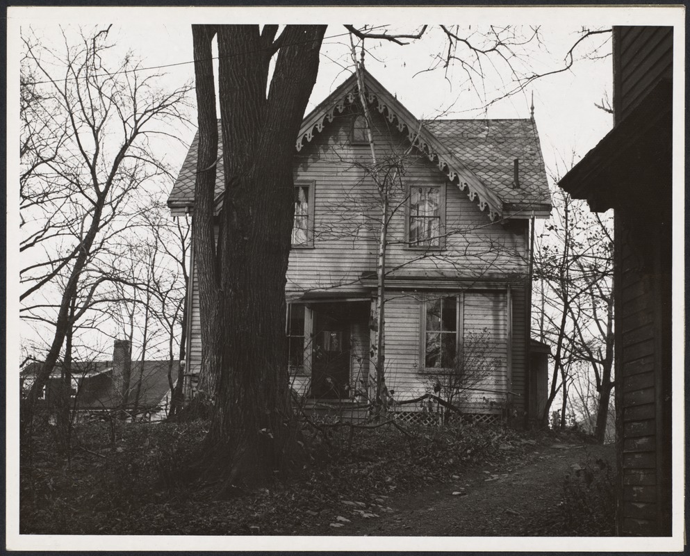
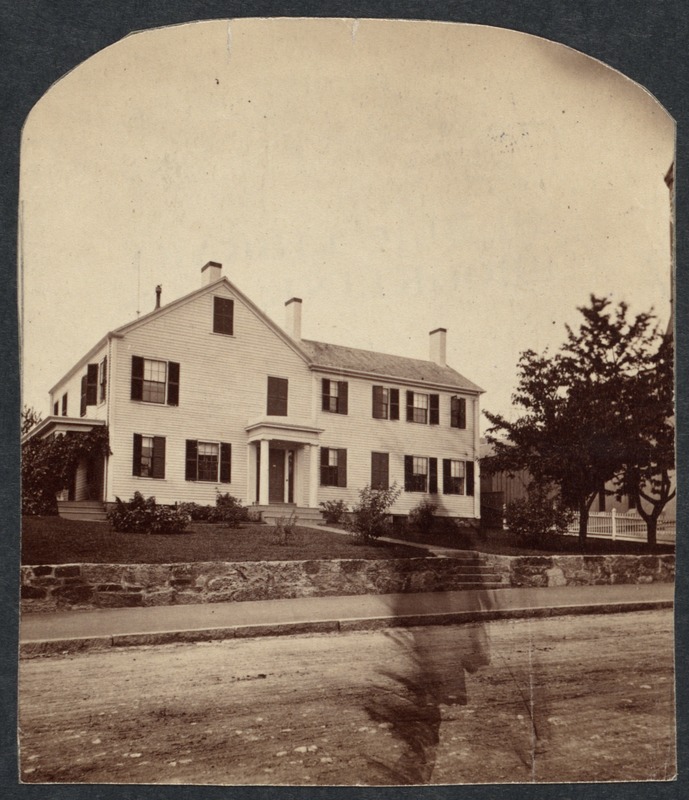
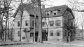
217 Freeman St., 1956
The house was set back from the street. In the distance is 219 Freeman St., still standing.
[Source: Digital Commonwealth]
|
 |
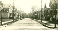
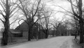
Naples Rd.
Looking northeast from Harvard St. The first house has been replaced with a store but the rest of the street remains largely unchanged.
[Source: Brookline Public Library]
|
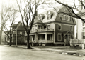 |
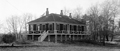
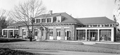
146 Naples Rd.
140 Naples Rd. is to the left.
[Source: Brookline Preservation Department]
|
 |
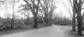
Osborne Rd.
Looking east from Naples Rd.
[Source: Joel Shield]
|
 |
Osborne Rd., 1939
Looking east from Naples Rd. at numbers 1, 5, 9
[Source: Brookline Preservation Department]
|
 |
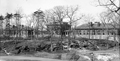
Collision of Fire Trucks, October 18, 1919
This accident occurred during a response to a small fire on Crowninshield Rd. Ladder Truck B was leading Combination AA on Pleasant St. preparing to turn on to Crowninshield Rd. A misunderstanding of the intended movement of Ladder Truck B caused Combination AA to collide with it and spin 180 degrees. Several firefighters were thrown from the truck and hoseman Michael J. Mahon was killed. An émigré from Galway, Ireland, he lived in Brookline Village with his wife and five children with a sixth child on the way. After working as a gardener he began work for the fire department in 1916 and was working at Station A in the Village Square at the time of the accident.
Photo by Leslie Jones who worked for the Boston Herald-Traveler newspaper between the years 1917 and 1956.
[Source: Leslie Jones Collection]
|
 |
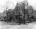
20 Harvard St.
House of the Thomas Shaler Brown family from aproximately 1873 to 1901. He ran the Thomas S. Brown & Co., provisions store located at today's 145 Washington St. in Brookline Village, two blocks from his house. In 1900, it was taken over by his son, Colby, and renamed the Brookline Provision Co.
[Source: Digital Commonwealth]
|
 |
184 Newton St., April 18, 1931
Looking southwest on Newton St. just west of the junction with Clyde St. On the left is the outbuilding of the Joseph Orlinksi house at 184 Newton St.
(ID) 020
(Slide ID) P-110-63
[Source: William Robert Murphy Collection]
|
 |
184 and 209 Newton St., April 18, 1931
Looking southwest on Newton St., Clyde St. enters on the right. On the left is the house of the Joseph Orlinksi house at 184 Newton St. Note the man crouched down on the side and the old hydrant for the street-watering wagons. On the right is the house, still standing, of George A. Lyon at 209 Newton St.
(ID) 021
(Slide ID) P-110-61
[Source: William Robert Murphy Collection]
|
 |
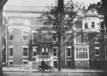
Board of Health Hospital, Newton St.
(ID) 116
(Slide ID) P-24-5
[Source: William Robert Murphy Collection]
|
 |
Alms House, Newton St.
(ID) 093
(Slide ID) P 24-6
[Source: William Robert Murphy Collection]
|
 |
Contagious Hospital, Newton St.
This is probably one of the two wooden buildings built circa 1895 on the hill above the Putterham School to isolate and treat the rising number of cases of diphtheria and scarlet fever. They were replaced by a more substantial complex in 1902.
(ID) 100
(Slide ID) P-24-4
[Source: William Robert Murphy Collection]
|
 |
Contagious Hospital, Newton St.
These two hospital buildings and the administration building in the middle were constructed in 1902 on the hill above the Putterham School to isolate and treat the rising number of cases of diphtheria and scarlet fever.
[ref. The Chronicle, October 25th, 1902]
(ID) 127
(Slide ID) P-24-11
[Source: William Robert Murphy Collection]
|
 |
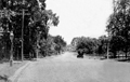
Newton St., April 18, 1931
Looking east, Goddard Ave. curving to the left, Larz Anderson park in the distance.
(ID) 031
(Slide ID) P 10-60
[Source: William Robert Murphy Collection]
|
 |
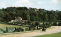
Hancock Village
[Source: Brookline Preservation Department]
|
 |
Chestnut Hill Reservoir Pumping Station, 1908
|
 |
Chestnut Hill Reservoir, 1906
|
 |
25 Park St., 1909
House of Rev. Dillon Bronson, pastor of St. Marks Church. Shown is his Stanley automobile. This photo appeared on page one of the July 21, 1906 issue of The Brookline Chronicle
|
 |
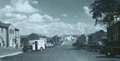
Hammond St.
|
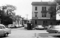 |
84 Pearl St., August 1965
Looking south toward Lower Washington St. From right to left:
- Village Garage, car repair, 11 Pearl St.
- 1-5 Pearl St. at the rear of Brookline Auto Parts
- Brookline Print 10-14 Pearl St.
From a notebook of property-appraisal photos taken in 1965 and early 1966 for The Marsh Urban Renewal Project run by the Brookline Redevelopment Authority. Only a few scattered peripheral structures remain today.
|

