 |
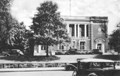
Public Library, 1940
|
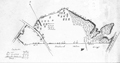 |
Linden Street Development Plan Early Sketch
[Source: Brookline Preservation Department]
|
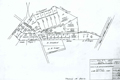 |
Linden Street Development Plan
[Source: Brookline Preservation Department]
|
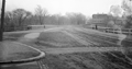 |
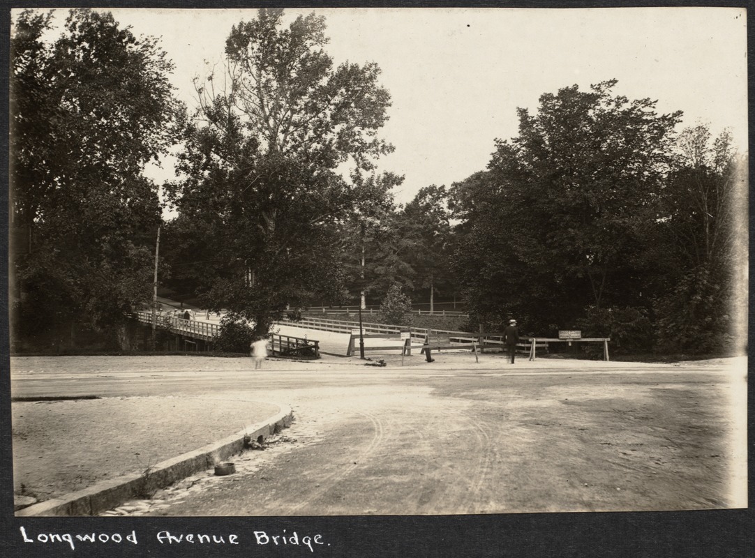
Longwood Ave. Bridge, 1899
Looking toward Boston from Chapel St. The bridge has recently opened and replaced the old wooden bridge there.
(ID) 161
(Slide ID) P-27-11
[Source: William Robert Murphy Collection]
|
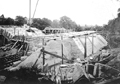 |
Construction of the Longwood Ave. Bridge, July 16, 1898
Looking toward Boston.
(ID) 040
(Slide ID) P 26-25
[Source: William Robert Murphy Collection]
|
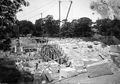 |
Construction of the Longwood Ave. Bridge, July 16, 1898
Looking west. In the background on the right is the carriage house of the Richards estate, location of the present-day Longwood Towers. On the left is 197/199 Longwood Ave., still standing.
(ID) 041
(Slide ID) P 26-24
[Source: William Robert Murphy Collection]
|
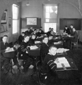 |
Longwood Day School, 1936
The Longwood Day School, also known as Longwood Country Day School, was a private school attended by students from wealthy backgrounds. It was located on the south side of Browne St. just west of St. Paul St. and ran from 1913 to 1940. Note that a potential source of confusion is that there was also the Longwood School on St. Mary’s St.
The stereoview had a partial list of names. From front-to-back and left-to-right:
Row 1: Horatio Harris Alden, Jr.
Row 2: Graham Lester, Jr., Henry Leonard Alden, Julian Bullard Doggett
Row 3: ?, John Davis Sprague
Row 4: Douglas Schuyler Rath, Frank Streeter Gardner, William ?
Row 5, 6: Unlisted
Teacher at desk: Ralph M. Clark
|
 |
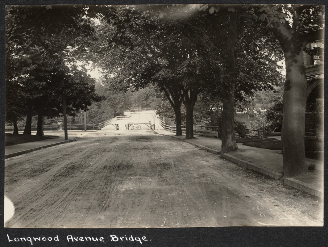
Longwood Ave., circa 1898
Looking east at the old wooden bridge at Chapel St. The bridge is closed which most likely indicates that construction of the new stone bridge is about to commence. .
[Source: Digital Commonwealth]
|
 |
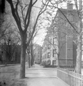
Longwood Ave., circa 1898
Standing at 197/199 Longwood Ave. looking east at the old wooden bridge at Chapel St. The bridge is closed which most likely indicates that construction of the new stone bridge is about to commence. Note two people seated in the hill in the distance on the right.
[Source: Digital Commonwealth]
|
 |
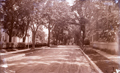
Carlton St. at Monmouth St., circa 1910
Lookng north from Monmouth St. The apartment building at 40 Carlton St. on the northwest corner has not yet been erected (1924).
|
 |
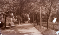
Hawes St., circa 1910
Looking south. Monmouth St. coming in on the left followed by the George Wightman mansion (b. 1904) at 43 Hawes St.. 48 Hawes St. (b. 1913) visible on the right. Both still standing.
|
 |
Kent St., circa 1910
Looking south toward Longwood Ave. In the foreground on the left is 116 Colchester St. followed by 295 Kent St. Far in the distance, the rounded entrance to 269 Kent St. can be detected on the southeast corner of Longwood Ave. The latter two houses remain unchanged.
116 Colchester St. was sold in 1906 and the 1907 atlas indicates that the wooden siding shown in the photo was replaced by stucco. The current configuration is entirely different, it is unknown whether that is the result of a subsequent extensive enlargement or a complete replacement.
|
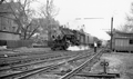 |
Locomotive of the Boston and Albany Railroad, March 21, 1950
Engine no. 316 heading west as it crosses under the Aspinwall Ave. bridge. In the distance is 232 Aspinwall Ave. and in the foreground is 233 Aspinwall Ave., both still standing. On the right is the start of the side track for freight trains that will unload at destinations in Brookine Village.
|
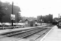 |
Future Site of the Hearthstone Plaza, August 1965
Looking southwest from the Brookline Village “T” stop at what is essentially today’s Hearthstone Plaza. These buildings, save those in the center on the south side of Lower Washington St., were razed in the next 2-3 years for the Plaza project. From left to right:
- Partial view of the rear wall of the movie theater at 105 Washington St.
- Partial view of the rear of the four-story apartment building at 127-131Washington St.
- The fire station and buildings on High St. south of Lower Washington St. which still stand
- The buildings from 137-175 Washington St.
From a notebook of property-appraisal photos taken in 1965 and early 1966 for “The Marsh Urban Renewal Project” run by the Brookline Redevelopment Authority. Only a few scattered peripheral structures remain today.
|
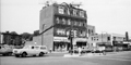 |
Lower Washington St., August 1965
Looking at the north side of Lower Washington St. prior to the start of the urban renewal project for the area known as “The Marsh”. In the center is the building at 127-131 Washington St. housing Sagamore Liquors on the left and The Village restaurant on the right. The large open space on the left had been the site of a wooden building from the 1800s known as “Russell Block”. In August 1962 the town ordered that it be demolished due to its dilapidated condition and no attempt was made to replace it with the urban renewal project pending. On the right is the building built in 1937 housing the entrance to the movie theater.
From a notebook of property-appraisal photos taken in 1965 and early 1966 for “The Marsh Urban Renewal Project” run by the Brookline Redevelopment Authority. Only a few scattered peripheral structures remain today.
[Source: Brookline Preservation Department]
|
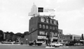 |
127-131 Washington St., August 1965
Looking at the north side of Lower Washington St. prior to the start of the urban renewal project for the area known as “The Marsh”. In the center is the building at 127-131 Washington St. housing Sagamore Liquors on the left and The Village restaurant on the right. The large open space on the left had been the site of a wooden building from the 1800s known as “Russell Block”. In August 1962 the town ordered that it be demolished due to its dilapidated condition and no attempt was made to replace it with the urban renewal project pending. On the right is the building built in 1937 housing the entrance to the movie theater.
From a notebook of property-appraisal photos taken in 1965 and early 1966 for “The Marsh Urban Renewal Project” run by the Brookline Redevelopment Authority. Only a few scattered peripheral structures remain today.
|
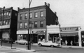 |
157-171 Washington St., July 1965
Looking at the north side of Lower Washington St. where the roadway becomes Boylston St. and Washington St. curves northward to the left in the photo. In one year, the Brookline Redevelopment Authority would begin the process of eminent domain to demolish all these buildings for the Hearthstone Plaza, the first phase of “The Marsh Urban Renewal Project”. From right to left:
- Jim’s Shoe Store, 157 Washington St. In the Village for three decades, the shop moved here in 1941 from its location at 139 Washington St.
- Village Barber Shop, 159 Washington St.
- Kenmore Valet, dry cleaning, 165 Washington St. They relocated to 39 Harvard St.
- Brookline Bulk Candy Co, 167 Washington St. They relocated to 216 Washington St. as “Village Candies”
- Ames Supply Co., 171 Washington St., (partial view) was one of thirteen businesses, out of 49 total in The Marsh, deemed not essential to village life and therefore not eligible for relocation by the Brookline Redevelopment Authority
From a notebook of property-appraisal photos taken in 1965 and early 1966 for “The Marsh Urban Renewal Project” run by the Brookline Redevelopment Authority. Only a few scattered peripheral structures remain today.
|
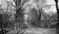 |
Unidentified Longwood area, "Lover's Walk", 1889
|
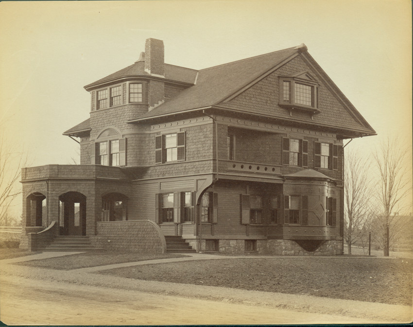 |
76 Sewall Ave.
Still standing.
[Source: Historic New England]
|
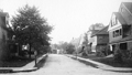 |
Sewall Ave.
Looking west on Sewall Ave. from St Paul St. None of the houses on the left side remain. On the right, from right to left, all on Sewall Ave:
- #82, no longer standing
- #76 with the unique entrance, still standing
- #70 is barely differentiated from #76, it is still standing
- #64, no longer standing
- Charles St. enters, not visible
- White house
- Second Unitarian Society Parish House
[Source: Brookline Public Library]
|

 The Society
 Program Archives