 |
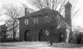
Station E (Future Station 5) Devotion St. Fire Station
The station was opened in 1893 on Devotion St. to serve the North Brookline area where farm land was being rapidly transformed into housing developments. The front façade and doors were virtually identical to those of Hose Company #3 which had just opened in 1891. The station was later replaced by the current Fire Station 5 at 49 Babcock St.
(ID) 044
(Slide ID) P 24-27
[Source: William Robert Murphy Collection]
|
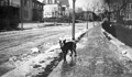 |
Downing Rd., January 19, 1915
Looking northeast on Downing Rd. toward Washington St. From left to right:
- 9 Downing Rd.
- Orchard Rd. intersection
- 25 Downing Rd.
- 797 Washington St. opposite Downing Rd.
From the photo album of Edith Draper Steinmetz, 31 Evans Rd.
[Source: Daniel Coston Collection]
|
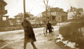 |
Downing Rd., January 19, 1915
Looking north from the rotary at the intersection of Williston, Evans, and Downing roads. In the foreground is Penny, unidentified. From left to right:
- 14 Orchard Rd., rear
- 9 Downing Rd.
- Orchard Rd. intersection
- 25 Downing Rd.
From the photo album of Edith Draper Steinmetz, 31 Evans Rd.
[Source: Daniel Coston Collection]
|
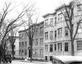 |
Dwight St., 1933
Looking east from Babcock St.
(ID) 136
(Slide ID) P-195-199
[Source: William Robert Murphy Collection]
|
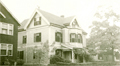 |
13 Elm St., 1910
[Source: Brookline Preservation Department]
|
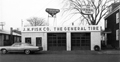 |
19 Emerald St., January 1966
Looking north from Emerald St. which was renamed to become an extension of today’s of Pearl St. This building at 19 Emerald St. was constructed circa 1960 for the Fisk company which had previously been located at 20 Walnut St. It had been razed by the early 1970s.
From a notebook of property-appraisal photos taken in 1965 and early 1966 for “The Marsh Urban Renewal Project” run by the Brookline Redevelopment Authority. Only a few scattered peripheral structures remain today.
|
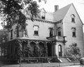 |
74 Davis Ave.
Moved in 1907 from its original location across the street to make way for Emerson Park. The buried culvert for the Village Brook runs through the back yard.
[Source: Brookline Preservation Department]
|
 |
Emerson House, 81 Davis Ave.
Looking south from the rear of the house. Davis Ave. is behind the large tree.
[Source: Brookline Preservation Department]
|
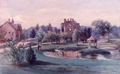 |
Emerson House, 81 Davis Ave.
Looking south toward Davis Ave .at the rear of the house. On the left are the stables.
[Source: Brookline Preservation Department]
|
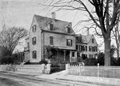 |
Emerson House, 81 Davis Ave.
[Source: Brookline Preservation Department]
|
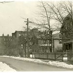 |
Davis Ave., Looking East, March, 1921
30 Davis Ave., foreground right, and distant brick apartment buildings are still standing.
[Source: Olmsted]
|
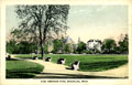 |
Emerson Park
|
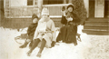 |
31 Evans Rd., January 19, 1915
Emma Roland Gilliams Steinmetz holding Pete the dog outside her home at 31 Evans Rd.
From the photo album of Edith Draper Steinmetz, 31 Evans Rd.
[Source: Daniel Coston Collection]
|
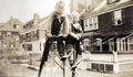 |
Rear of Houses on Evans Rd., January 19, 1915
Viewed are Terry, unidentified, and Spencer Steinmetz who lived at 31 Evans Rd. just off screen to the right. Looking from right to left are the rears of 25, 15, and 11 Evans Rd.
From the photo album of Edith Draper Steinmetz, 31 Evans Rd.
[Source: Daniel Coston Collection]
|
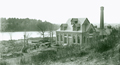 |
Cow Island Pumping Station
By the 1870s, a growing Brookline needed to increase the water supply to the town. After failing to gain access to the supply of Lake Cochituate or adjoining municipalities, an authorization was obtained to tap the Charles River. This pumping station was constructed on Cow Island along side the Charles in West Roxbury, not far from the Brookline border, the send water to Brookine.
[Source: Brookline Preservation Department]
|
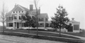 |
150 Fisher Ave.
[Source: Brookline Preservation Department]
|
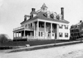 |
Residence of A. J. Wilkinson, 219 Fisher Ave. Corner of Dean Rd. Early 1900s
House stands largely the same today. Photographer: Wm. T. Clark, 338 Washington St. Boston
|
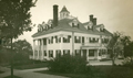 |
219 Fisher Ave.
[Source: Brookline Preservation Department]
|
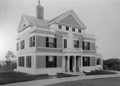 |
150 Fisher Ave.
[Source: Brookline Preservation Department]
|
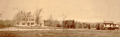 |
150 Fisher Ave.
No longer standing. Looking west.
[Source: Brookline Preservation Department]
|

 The Society
 Program Archives