 |
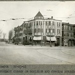
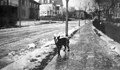
Northeast Corner of Boylston St. & Cypress Ave., December, 1915
Looking north on Cypress St. from Boylston. The building, partially visible, at 353-359 Boylston St. still stands. Otherwise, only the one-story building, barely visible in the distance at 122 Cypress St., still stands. On the corner is Bentley Bros. Grocers at 351 Boylston St. On the right is the apartment building at 343/345 Boylston St.
[Source: Olmsted]
|
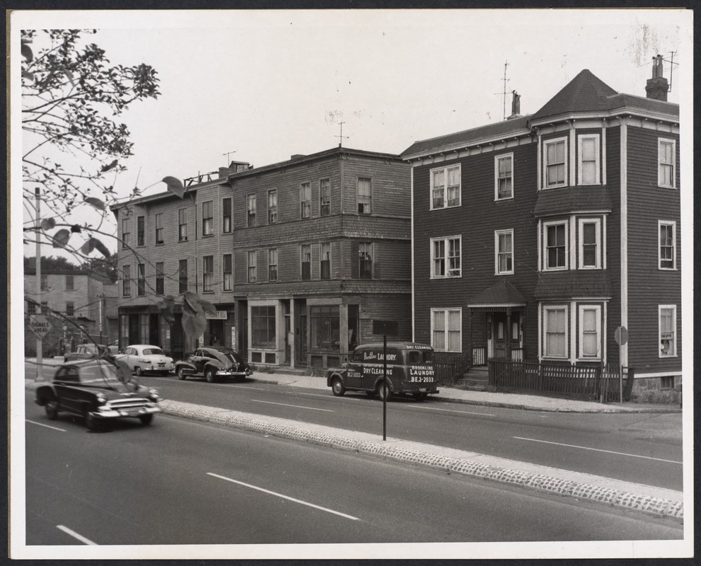 |
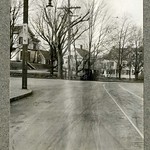
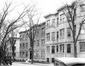
Boylston St., 1956
From right to left:
- 253 Boylston St. on the corner of Smyth St.
- 261-263 Boylston St.
- 265-269 Boylston St.
- Gas station at the corner of Cameron St..
[Source: Digital Commonwealth]
|
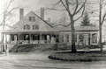 |
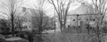
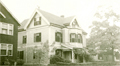
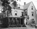
Shurtleff House, Boylston St.
Roughly located at 269 Boylston St. near the NE cprner with Cypress St. In a 1903 publication of the Historical Society entitled Recollections of Brookline, Mary W. Poor (daughter of Rev. John Pierce) wrote:
Some of the more public-spirited of Brookline's citizens aspired to have an elegant and attractive school in which their sons could be fitted for college. I believe Mr. Richard Sullivan was one of the most active in carrying out this scheme. A structure worthy of beautiful Brookline was the result. It was built in 1820 and was modeled from a Greek temple, with Doric pillars, and was considered perfect as a work of art. It was commonly called the Classical School. Well do I remember going to an exhibition in that school when a very young child
The surroundings of this classic hall were lovely. Just behind it was the sweet spot since called Brignal Banks on the shore of the brook already described as the New Lane brook. Some time after, a Mr. Hubbard bought this schoolhouse and built directly behind it a boarding house and in front of it a wooden gymnasium, the first ever heard of in these regions. Years after, Dr. Shurtleff bought the house and used the gymnasium, which had been moved to the south of the house, for a stable. The dear old classical school became his drawing room. The change greatly detracted from the beauty of this gem of architecture as viewed from the street, but it was a fine drawing room.
[Source: Brookline Preservation Department]
|
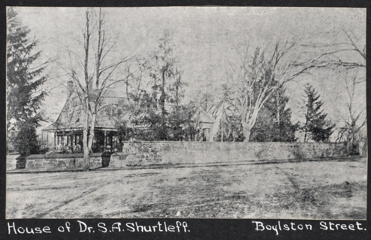 |
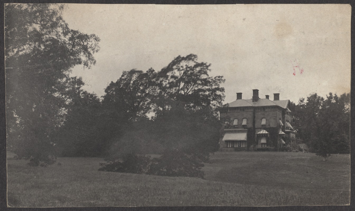
Shurtleff House, Boylston St.
Roughly located at 269 Boylston St. near the NE corner with Cypress St. It was originally built as a school in 1820 and modeled from a Greek temple, with Doric pillars. A Boston physician, Dr. Samuel Atwood Shurtleff purchased it circa 1844 and converted it for use as his home.
[Source: Brookline Preservation Department]
|
 |
House of George Dawes, 298 Boylston St.
[Source: Brookline Public Library]
|
 |
Cypress St. Looking North By Walnut St., December, 1915
Trolley tracks are on Cypress, Walnut St. feeds in from the left. On the left is the house of the Francis family at 295 Walnut. On the right is 161 Cypress. Center rear are the back of houses on E. Milton Rd.
[Source: Olmsted]
|
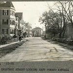 |
Chestnut St., November 1915
Looking southeast toward Kendall St. #60, foreground left, is still standing along with the others on that side.Only the stone fence remains on the right side.
[Source: Olmsted]
|
 |
74/82 Davis Ave., April 26, 1931
74 Davis Ave. is on the left and 82 Davis Ave. is on the right. In the distance, looking south, is the faint image of the Boylston School.
(ID) 065
(Slide ID) P 106-C
[Source: William Robert Murphy Collection]
|
 |
Runkle School, 50 Druce St.
(ID) 055
(Slide ID) P 25-15
[Source: William Robert Murphy Collection]
|
 |
300 Dudley St.
This house was built in the late 1840s by John E. Thayer and was accessed from Warren St. - both Lee St. and the extension of Dudley St. did not yet exist. A slightly confusing jumble of ownership names followed after his death. His widow married Robert C. Winthrop, her new husband moved into the house, and, for reasons unknown, that is how the house is now referenced. The Thayers daughter, Adele Granger Thayer, retained her name and later inherited the house. In 1900, it was acquired by Moses Williams. The 1900 footprint of the house is noticeably changed in the atlases as of 1907 but there is currently no record of any alterations. Two more owners ensued until the house was torn down in 1950 after a massive fire.
[Source: Digital Commonwealth]
|
 |
Station E (Future Station 5) Devotion St. Fire Station
The station was opened in 1893 on Devotion St. to serve the North Brookline area where farm land was being rapidly transformed into housing developments. The front façade and doors were virtually identical to those of Hose Company #3 which had just opened in 1891. The station was later replaced by the current Fire Station 5 at 49 Babcock St.
(ID) 044
(Slide ID) P 24-27
[Source: William Robert Murphy Collection]
|
 |
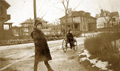
Downing Rd., January 19, 1915
Looking northeast on Downing Rd. toward Washington St. From left to right:
- 9 Downing Rd.
- Orchard Rd. intersection
- 25 Downing Rd.
- 797 Washington St. opposite Downing Rd.
From the photo album of Edith Draper Steinmetz, 31 Evans Rd.
[Source: Daniel Coston Collection]
|
 |
Downing Rd., January 19, 1915
Looking north from the rotary at the intersection of Williston, Evans, and Downing roads. In the foreground is Penny, unidentified. From left to right:
- 14 Orchard Rd., rear
- 9 Downing Rd.
- Orchard Rd. intersection
- 25 Downing Rd.
From the photo album of Edith Draper Steinmetz, 31 Evans Rd.
[Source: Daniel Coston Collection]
|
 |
Dwight St., 1933
Looking east from Babcock St.
(ID) 136
(Slide ID) P-195-199
[Source: William Robert Murphy Collection]
|
 |
13 Elm St., 1910
[Source: Brookline Preservation Department]
|
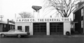 |
19 Emerald St., January 1966
Looking north from Emerald St. which was renamed to become an extension of todays of Pearl St. This building at 19 Emerald St. was constructed circa 1960 for the Fisk company which had previously been located at 20 Walnut St. It had been razed by the early 1970s.
From a notebook of property-appraisal photos taken in 1965 and early 1966 for The Marsh Urban Renewal Project run by the Brookline Redevelopment Authority. Only a few scattered peripheral structures remain today.
|
 |
74 Davis Ave.
Moved in 1907 from its original location across the street to make way for Emerson Park. The buried culvert for the Village Brook runs through the back yard.
[Source: Brookline Preservation Department]
|
 |
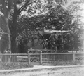
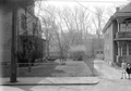
Emerson House, 81 Davis Ave.
Looking south from the rear of the house. Davis Ave. is behind the large tree.
[Source: Brookline Preservation Department]
|
 |
Emerson House, 81 Davis Ave.
Looking south toward Davis Ave .at the rear of the house. On the left are the stables.
[Source: Brookline Preservation Department]
|

