|
The Society
Historical Information
Photo & Map Collections
Exploring Brookline
Links
Program Archives
|
Photo Collection
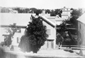 |
135-137 Boylston St., circa 1875
Looking north from the north side of Boylston St. On the left is 135/137 Boylston St. and squeezed right up next to it is #133. On the far right is a partial view of #115. Behind them the railroad tracks can be glimpsed. The large mansard house in the distance is the rear of 50-52 Davis Avenue, still standing.
[Source: Brookline Public Library]
|
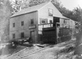 |
Burton W. Neal, Carperter and Builder, 244 Boylston St.
This is the business of Burton W. Neal Sr., carpenter and builder, just west of the Lincoln School, He was succeeded in the business by his namesake son who became a prominent builder and citizen in Brookline.
[Source: Brookline Public Library]
|
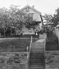 |
244 Boylston St., circa 1876
House of Burton W. Neal Sr., carpenter and builder, just west of the Lincoln School, He was succeeded in the business by his namesake son who became a prominent builder and citizen in Brookline. There remains today a similar stone wall just west of the Lincoln School.
From Photographs of Brookline: taken about 1876 / Richard Hills. Call No.: BROOKLINE/Special (CAGE B.R. 974 H6), Brookline Public Library.
[Source: Brookline Preservation Department]
|
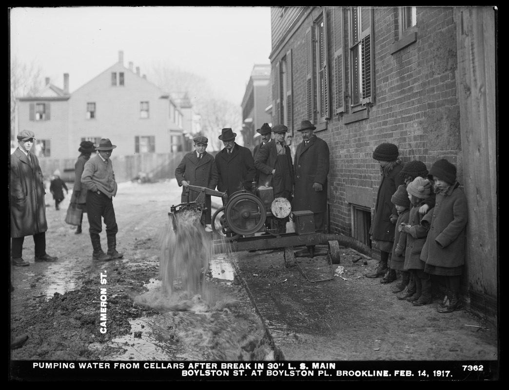 |
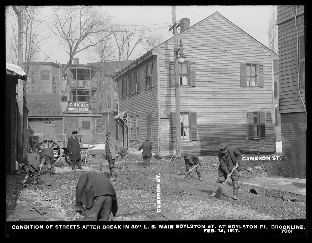
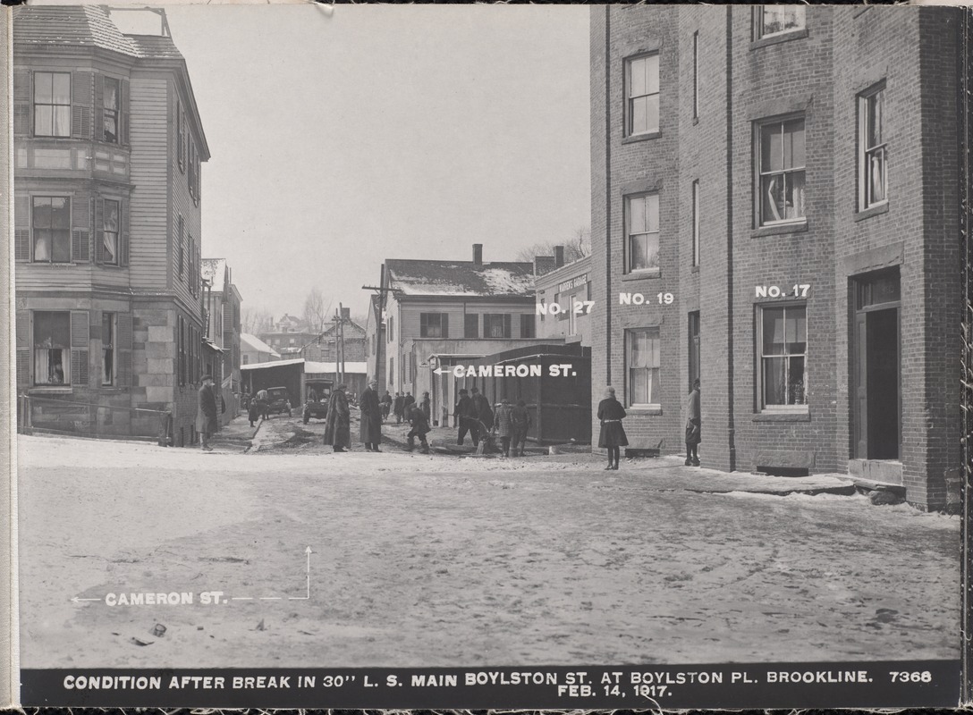
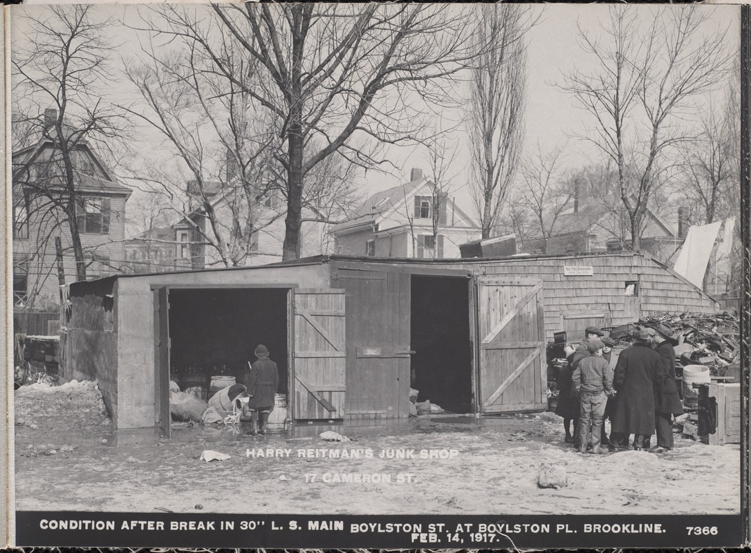
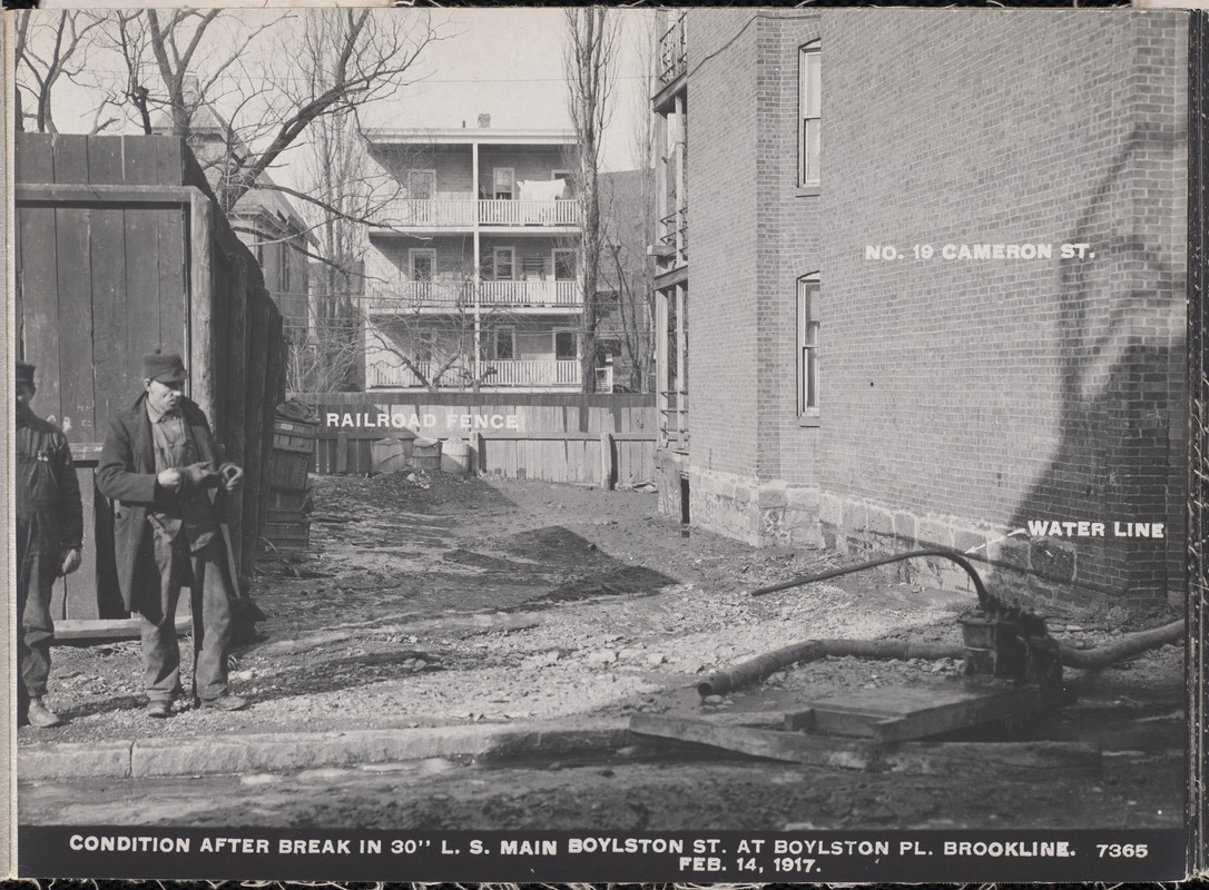
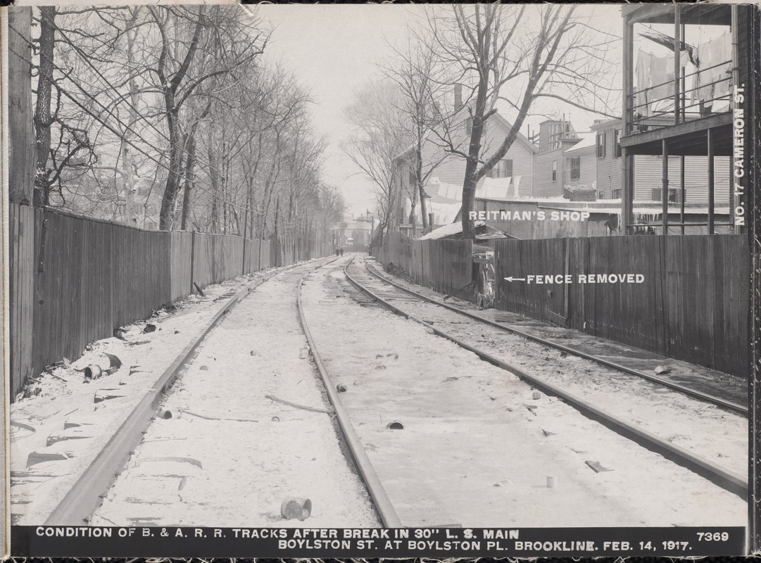
Cameron St., 1917
Cameron St. circumscribed three sides of a square with the fourth side being Boylston St. This view is on the north segment looking east. All buildings are still standing. On the right they are pumping water out of the basement of 14 Smythe St. In the distance on the left is the building at 48 and 50 Cameron St. and, on the right, the apartment building spanning 47 51 Cameron St.
[Source: Digital Commonwealth]
|
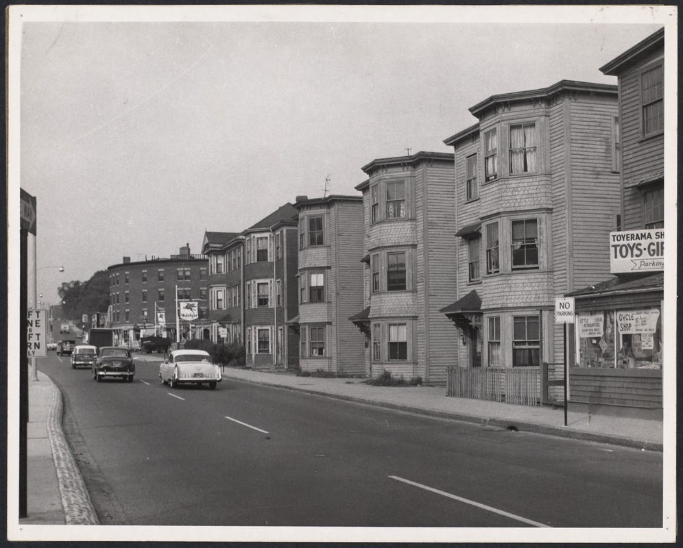 |
Boylston Street Between Cypress & Cameron Sts., 1956
[Source: Digital Commonwealth]
|
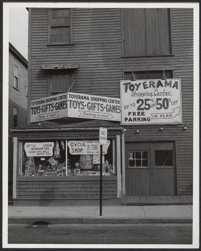 |
Toyerama, 293 Boylston St.
[Source: Digital Commonwealth]
|
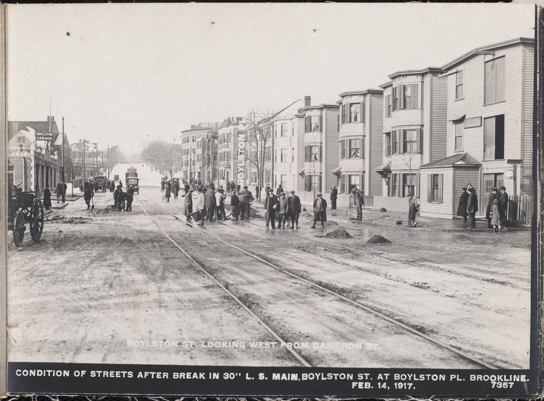 |
Boylston St., 1917
Looking west on Boylston St. toward Cypress St.
On the south side of Boylston from left to right:
- 316 Boylston St., the Boylston Garage, corner partially visible
- Southeast corner of Boylston and Cypress St., the large house of Annie C. Crocker
- Southwest corner of Boylston and Cypress St., store fronts, still standing
- 402 Boylston St., house
On the north side of Boylston from left to right:
- Northwest corner of Boylston and Cypress St., the large curved building of storefronts and apartments, still standing, barely visible
- Northeast side of Boylston and Cypress St., apartment buildings 351 to 299 Boylston St. A man and a woman are viewed in the second-floor window of #305.
- #293 Boylston St., business of B. W. Neal, builder
The couple in the window of #305 are Elizabeth (Ryan) Grennan, 37, and her husband, fireman Thomas Grennan, 40. They raised five children three boys and two girls. In 1917, the children ranged in age from 1 to 13. Two of the boys became doctors one a podiatrist and the other a veterinarian and one of the daughters became a nurse. The other daughter became a teacher and the other son a corrections officer, eventually rising to superintendent of the state prison in Concord.
At the time of this photo, Thomas Grennan was the driver and a hose man on one the engines stationed at the Washington Square firehouse. Six years later, he was promoted to lieutenant and transferred to the Monmouth Street station (now the Brookline Arts Center). His picture appeared in the Boston Globe at that time. He died in 1961 at the age of 84. Elizabeth died in 1967 at the age of 88.
[Source: Digital Commonwealth]
|
 |
Cameron St., 1917
Cameron St. circumscribed three sides of a square with the fourth side being Boylston St. This view is on the west segment looking north. On the right are number 11 and 15 Cameron St. which are still standing and in the distant rear are houses on Elm St. and Davis Ave. which are still standing.
[Source: Digital Commonwealth]
|
 |
Cameron St., 1917
Looking north on Cameron St. On the far right the corner of 15 Cameron St. is visible, still standing. In the distance across the railroad tracks the rear of 5 Elm St. is visible, still standing.
[Source: Digital Commonwealth]
|
 |
Boylston St.,Near Cypress St., January 22, 1913
Looking west toward Cypress St. It appears that sidewalks are about to be laid. From left to right:
- 316 Boylston St. The tall brick building on the far left was constructed circa 1906 and housed the Elizabeth B. Hall Stables, for horses and carriages. The addition to the right was added a few years later for cars. Known as the Boylston Garage, it extended behind the existing house and had a separate entrance road on the other side of the house. The main brick stable is still in use as a car barn at an auto dealership.
- The house of George S. Cushing, also at 316 Boylston St., torn down in 1914 by the owner of the garage.
- The house of Alex Strain, in the rear, at 144 Cypress St.
- The house of Annie C. Crocker at 136 Cypress St.
- Cypress St.
[Source: Digital Commonwealth]
|
 |
Cameron St., 1917
Cameron St. circumscribed three sides of a square with the fourth side being Boylston St. This view is on the north segment looking west. On the right is the apartment building at todays 40/42 Cameron St. On the left is todays 14 Smythe St.
[Source: Digital Commonwealth]
|
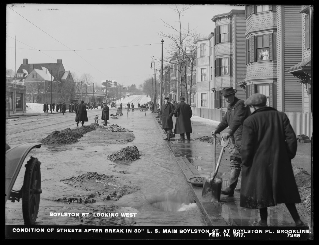 |
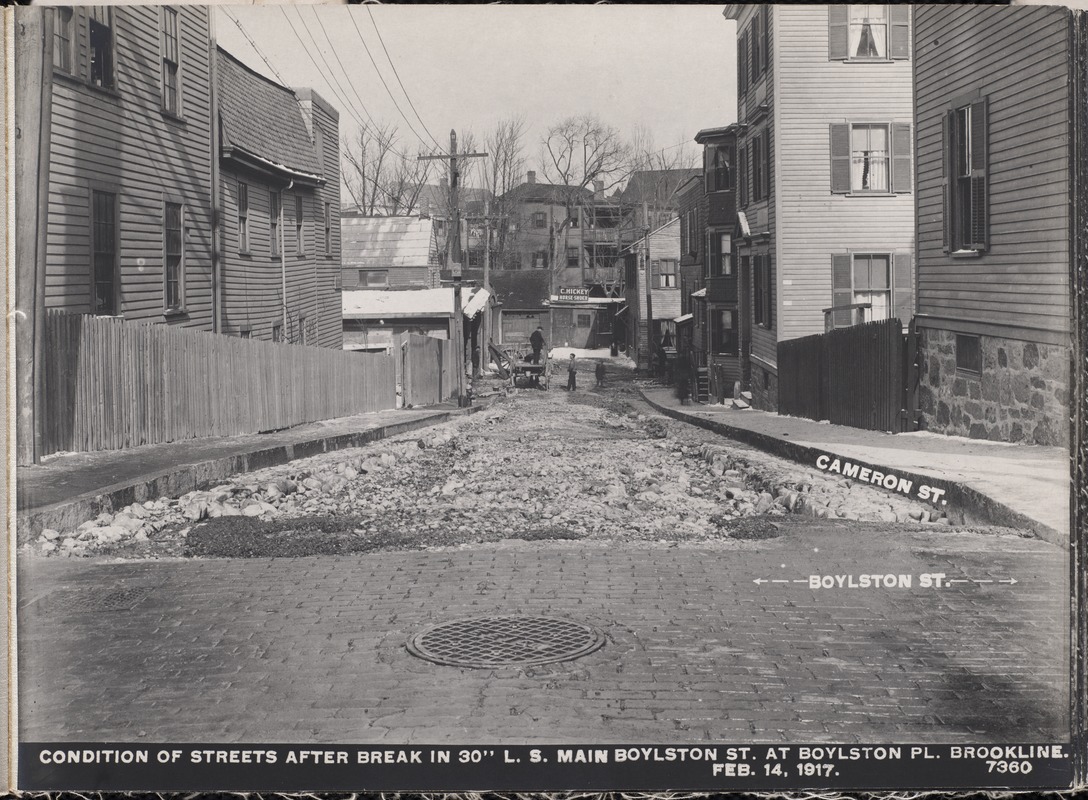
Boylston St., 1917
Looking west on Boylston St. toward Cypress St. after the break of a 70 in. water main on February 14, 1917.
On the south side of Boylston from left to right:
- 316 Boylston St., the Boylston Garage
- Southeast corner of Boylston and Cypress St., the large house of Annie C. Crocker
- Southwest corner of Boylston and Cypress St., store fronts, still standing
On the north side of Boylston from left to right:
- Northwest corner of Boylston and Cypress St., the large curved building of storefronts and apartments, still standing
- Northeast corner of Boylston and Cypress St., apartment buildings 351 to 315 Boylston St.
- Three identical apartment buildings, 311, 305, 299 Boylston St. A woman is viewed in the second-floor window of #305.
- 293 Boylston St., workshop of B. W. Neal
The woman in the window of #305 is Elizabeth Grennan (nee Ryan), wife of fireman Thomas Grennan (viewed in another photo). She and her husband raised five children three boys and two girls. In 1917, the children ranged in age from 1 to 13. Two of the boys became doctors one a podiatrist and the other a veterinarian and one of the daughters became a nurse. The other daughter became a teacher and the other son a corrections officer, eventually rising to superintendent of the state prison in Concord. Elizabeth died in 1967 at the age of 88.
[Source: Digital Commonwealth]
|
 |
Cameron St., 1917
Standing to the right of todays 40/42 Cameron St. looking north at the rears of 110, 106, 102, 100 Davis Ave., all still standing.
[Source: Digital Commonwealth]
|
 |
Cameron St., 1917
Cameron St. circumscribed three sides of a square with the fourth side being Boylston St. This view is on the north segment looking north over the railroad tracks at the rear of 114 Davis Ave.
[Source: Digital Commonwealth]
|
 |
Cameron St., 1917
Looking east from the rear of 17 Cameron St. with the rear of houses on Winthrop Place on the right.
[Source: Digital Commonwealth]
|
 |
Boylston St., January 22, 1913
Looking east from the south side of Boylston St. one block east of Cypress St. On the left is the apartment building at 300 Boylston St. On the right, at 316 Boylston St., is the house of George S. Cushing which was torn down in 1914 by the owner of the garage behind it.
[Source: Digital Commonwealth]
|
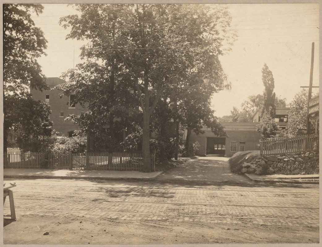 |
Boylston St., circa 1914
Looking at the south side of Boylston St. Cypress St. is to the right. On the left are the Elizabeth B. Hall Stables, the building is still in use as a car barn at an auto dealership. On the right, extending behind the house (barely visible behind the trees) is the Boylston Garage for cars. Its sign is visible on the far right. In the rear is a partial view of 20 E. Milton Rd., still standing.
[Source: Digital Commonwealth]
|
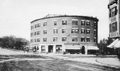 |
Boylston St. at Cypress Ave.
On the left side of the building are 353-359 Boylston St. The pharmacy of John L. McGown is on the right side, at 135 Cypress St. He lived upstairs in the Hotel Madris. His business was first listed there in 1899, at or near the opening of the building, and remained there until 1914 when he joined the Beaconsfield Pharmacy in Washington Square.
|
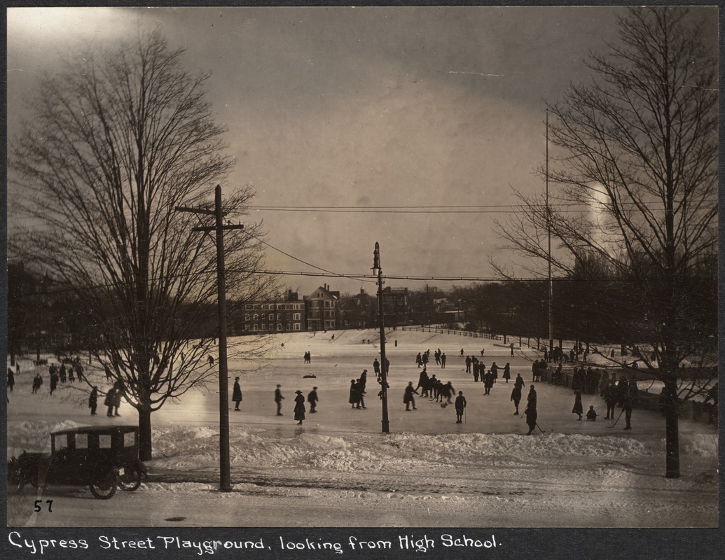 |
Cypress St. Playground
Standing in front of the high school looking east at Cypress St. Numbers 90, 96/98, 102 all still standing.
[Source: Digital Commonwealth]
|
 |
Boylston St. at Cypress St, December, 1915
Looking from Cypress St. north across Boylston St. At 133 Cypress St. is the Hotel Madris. Underneath the hotel on the far left at 361 Boylston St. Is the grocery store of Lucius N. Danforth who was forced to move his newly-acquired store in the Village when the building was knocked down for the widening of Harvard St. in 1905.
[Source: Olmsted]
|
|

