|
The Society
Historical Information
Photo & Map Collections
Exploring Brookline
Links
Program Archives
|
Photo Collection
 |
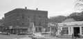
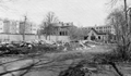
Vernon St., February 1921
Looking east toward Harvard St. House at #21 is no longer standing.
[Source: Olmsted]
|
 |
William Sundell, Painting & Glazing, 84 Harvard St., 1908
The bakery of Annie L. Driscoll & Winifred N. Hayes, cousins who also lived together at 175 Washington St., is partially viewed to the left. The buildings are no longer standing.
|
 |
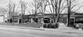
Harvard St. at School St., circa 1963
Looking south on Harvard. Harvard Hall at 6 School St. was a large area upstairs used for parties and meetings. None of the buildings in the foreground are still standing.
[Source: Brookline Preservation Department]
|
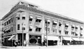 |
Bowker's Block, 79-87 Harvard St.
On the corner with Aspinwall Ave.is the pharmacy of Arthur W. Bowker
[Source: Brookline Preservation Department]
|
 |
87 and 91 Harvard St., 1903
The intersection with Aspinwall Ave. is between the two buildings. On the right is the pharmacy of A. W. Bowker at 87 Harvard St.., building still standing. On the left is the hairdressing shop of J. C. Barthelmes at 91 Harvard St., building no longer standing.
[Source: Digital Commonwealth]
|
 |
Auburn Court
Auburn St., near Harvard St.
|
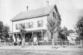 |
99 and 101 Harvard St., circa 1876
On the left side of the duplex, 101 Harvard St., is the house of Thomas S. Pettengill, a Brookline undertaker. The four women shown roughly match the ages of his wife (52) and daughters.
The family on the right, at 99 Harvard St., is unidentified.
[Source: Brookline Public Library]
|
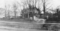 |
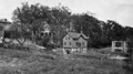
161 Harvard St., 1921
January 21, 1921. The apartment buildings and the row of garages on the left are still standing.
From the photo album of the family of Donald Finley Macleod, caretaker of 161 Harvard St.
|
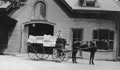 |
Bee Hives Loaded at 161 Harvard St.
Donald Finley Macleod was the long-time caretaker for the Wilson family at 161 Harvard St. His son, (Walter) Ernest, likely pictured here, maintained bee hives on the property. The hives appear to be loaded on the carriage which sits in front of the carriage house of number 161. Ernest Macleod briefly advertised honey and honey products for sale in February 1923 issues of the Brookline Chronicle. From the sign on the carriage, it appears that he was in partnership with Arthur Wales, the husband of his older sister, Alexana. The Wales lived at 6 Elm St., Brookline, the address shown on the carriage sign. After 35 year as a Brookline firefighter, Walter Ernest Gunn Macleod retired to Maine where he continued to raise bees.
From the photo album of the family of Donald Finley Macleod, caretaker of 161 Harvard St.
|
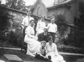 |
The Macleod Family at 161 Harvard St.
Circa 1919, photographed by the carriage house, now the site of a large supermarket. Donald Finley Macleod was the long-time caretaker for the Wilson family at 161 Harvard St. A speculative identification of the people is (front to back, left to right):
- [Row 1] Robert Macleod (son)
- [Row 1] Christena M. Macleod (daughter)
- [Row 2] Christena Donalda (MacIver) Macleod (mother)
- [Row 2] Donald Finley Macleod (father)
- [Row 3] Ernest Macleod (son)
- [Row 3] Christena Macleod (daughter)
- [Row 3] Almon Macleod (son)
From the photo album of the family of Donald Finley Macleod, caretaker of 161 Harvard St.
|
 |
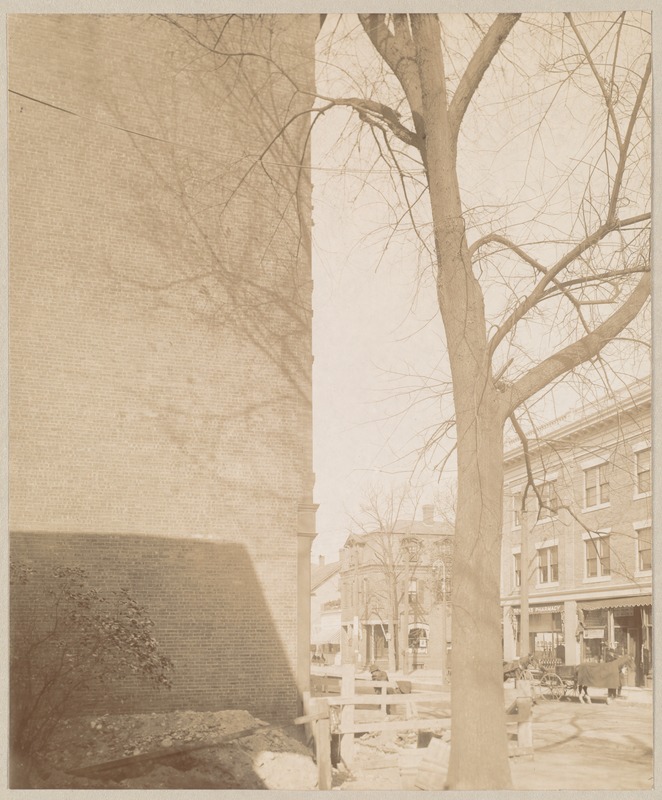
Demolition of 161 Harvard St., March, 1924
Standing on Harvard St. where the Wilson house at #161 has just been demolished. Viewed from left to right:
- The rear of the apartment buildings on Alton Place and the rear wall of their garages, all still standing
- The mansion at 33 Alton Place, no longer standing
- Oin the rear, the apartment complex at Alton Court, then under construction, still standing
- The carriage house of 161 Harvard St. now the site of a large super market
From the photo album of the family of Donald Finley Macleod, caretaker of 161 Harvard St.
|
 |
37 Harvard Ct. - May, 1924
The caretaker's house of Donald Finley Macleod has just been moved from the now-demolished estate of 161 Harvard St. onto a new foundation at 37 Harvard Ct. New siding and a porch will soon be added. On the far left, the rear of 33 Alton Place can be viewed. The rear of the large apartment complex on Alton Ct., then under construction and still standing, can be viewed behind the trees. The rear of The Henry C. Bell auto garage at 2 St. Paul St., no longer standing, is on the right.
From the photo album of the family of Donald Finley Macleod, caretaker of 161 Harvard St.
|
 |
37 Harvard Ct. - July, 1924
House of Donald Finley Macleod. He was the long-time caretaker for the Wilson family at 161 Harvard St. In 1924, Anna and Lydia Wilson, aging sisters who never married and still lived in the family house, sold the property. The caretakers house in the rear was moved down the hill to this location at the end of Harvard Court. The rear of the apartment building on Alton Ct., still standing, is viewed on the left. The rear of The Henry C. Bell auto garage at 2 St. Paul St., no longer standing, is on the right. In the distance is the steeple of St. Pauls Episcopal Church.
From the photo album of the family of Donald Finley Macleod, caretaker of 161 Harvard St.
|
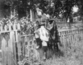 |
Katherine Macleod, 1919
Katherine Macleod (1892 1994) was the daughter of Donald Finley Macleod, caretaker for the Wilson family at 161 Harvard St. She is seen here wearing a traditional Scottish outfit reflective of her Scottish heritage. She married John Cleveland Dick, originally from Scotland, in 1920 and the couple moved to Canada where they had three children. After the early death of her husband in 1935, she returned to Brookline - first to her familys caretaker house which had been moved down the hill to 37 Harvard Ct. and later to 122 Davis Ave.
From the photo album of the family of Donald Finley Macleod, caretaker of 161 Harvard St.
|
 |
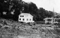
161 Harvard St.
House of Edward C. Wilson
[Source: Digital Commonwealth]
|
 |
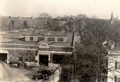
Garage at 161 Harvard St, November, 1924
The Wilson family house and carriage house have just been demolished and replaced with this large auto garage that still stands today, housing a supermarket.
From the photo album of the family of Donald Finley Macleod, caretaker of 161 Harvard St.
|
 |
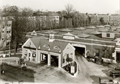
161 Harvard St., October, 1934
Coolidge Corner Chevrolet Co. The building remains in use today as a supermarket. In the rear are apartment buildings on Alton Ct.
[Source: Brookline Preservation Department]
|
 |
161 Harvard St., October, 1934
Coolidge Corner Chevrolet Co. The building remains in use today as a supermarket.
[Source: Brookline Preservation Department]
|
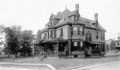 |
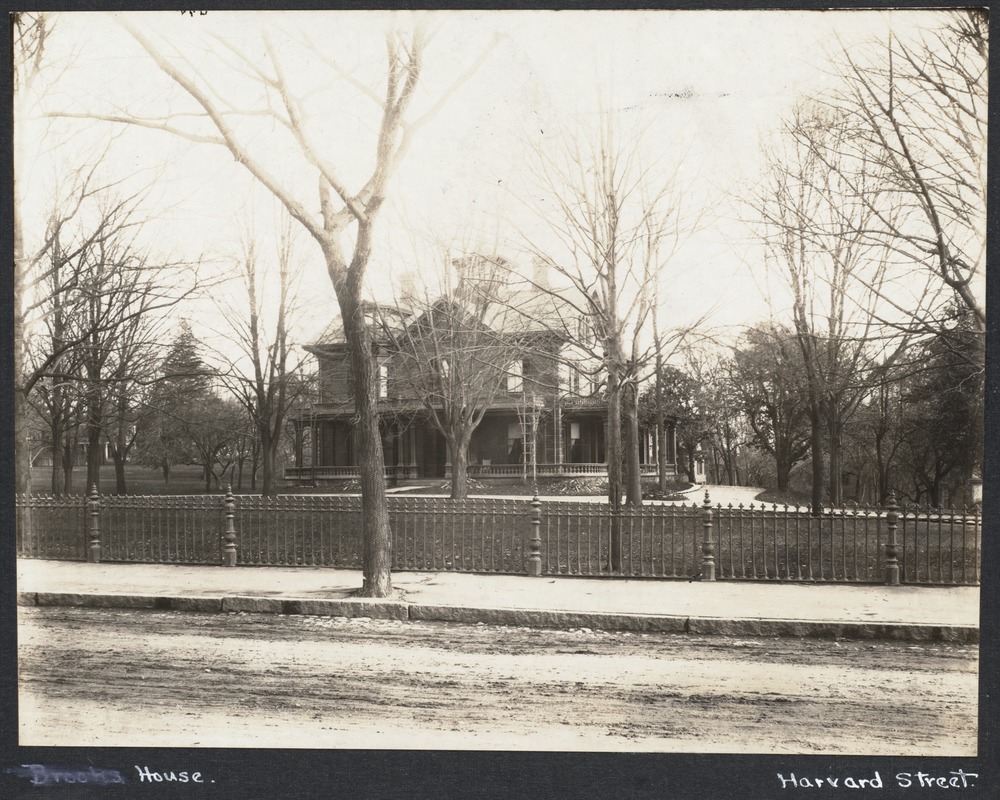
164 Harvard St., 1888.
Residence of H. Edward Abbott, no longer standing. Vernon St. to the right.
|
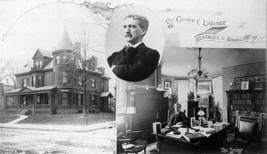 |
164 Harvard St.
Residence of Rev. George Lorimer, no longer standing. Vernon St. to the right.
[Source: Historic New England]
|
|

