|
The Society
Historical Information
Photo & Map Collections
Exploring Brookline
Links
Program Archives
|
Photo Collection
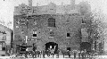 |
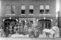
Goodspeed Livery Stable, 316 Washington St., circa 1895
Just north of Harvard Square, opposite Holden St. Originally run in a wooden structure in partnership with Grafton Stone, Goodspeeds stable remained a business here until the early 1930s, later run by Goodspeeds son, Carl and other owners.
The stable provided multiple services for both businesses and individuals. The S.S. Pierce Company boarded its horses and delivery wagons there, horse-drawn taxis could be called, horses were available for rent. The wagon of a boarder is seen out front: Villa Grocery, a business on nearby Harvard St. from approximately 1892 1902. On the left is a partial view of the carpentry business of Macrae and Smyth at 312 Washington St.
[Source: Brookline Preservation Department]
|
 |
Washington St., North of Harvard Square, circa 1876
This is one of a pair of rare wide-angle photos of early Washington St. The view is looking north just past Davis Ave. On the left side, home to a number of carpenters and painters, from left to right are:
- Partial view of 302 Washington St.
- I. Shannon Davis, carpenter, 306 Washington St.
- Sign for Bowker & Lyon, carpenters and builders, whose buildings were behind 306 Washington St.
- The small two-story building with the angled roof at 314 Washington St. It housed the carpentry business of Willard Goodwin, from roughly 1870 to 1899.
- Goodspeeds livery stable at 316 Washington St. (not visible) with the carriages out front
- Two houses, unidentified
- The house of Martin Kingman at 338 Washington St. (front porch visible) on the northwest corner of Thayer St. He had a dry and fancy goods store close by in Harvard Square.
- George H. Stone Hook and Ladder Company
[Source: Brookline Public Library]
|
 |
Washington St., North of Harvard Square, circa 1876
This is one of a pair of rare wide-angle photos of early Washington St. The view is looking south from the area of the library. The first structure on the right is Goodspeeds livery stable at 316 Washington St. followed by the small two-story building with the angled roof at 314 Washington St. that housed the carpentry business of Willard Goodwin from roughly 1870 to 1899. The other buildings housed a collection of carpenters and painters.
[Source: Brookline Public Library]
|
 |
Washington St., Brookline Village
West side of Washington St., just north of Harvard Square, opposite Holden St. Munroe Goodspeeds livery stable, a building that still stands, is on the right at 316 Washington. To the left is 314 Washington St., housing the carpentry business of William Goodwin which was there from roughly 1870 1899.
[Source: Digital Commonwealth]
|
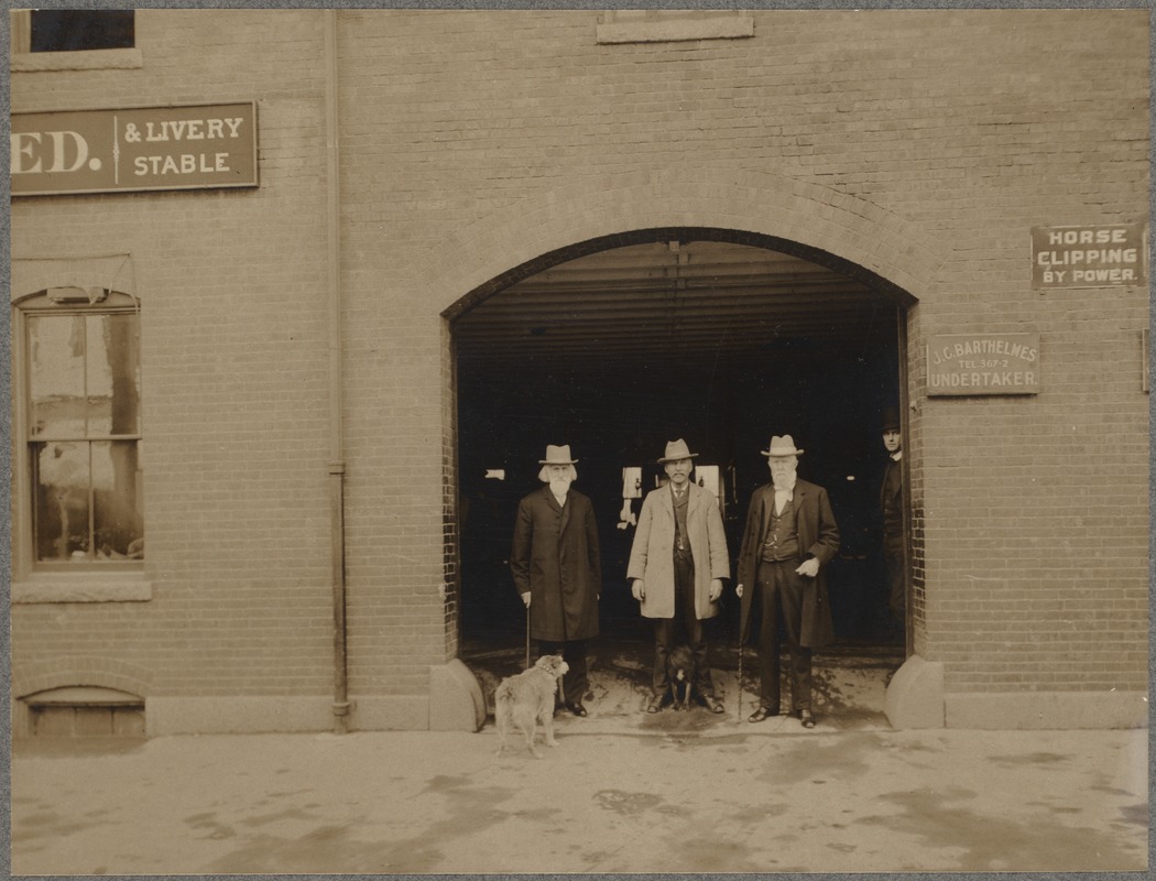 |
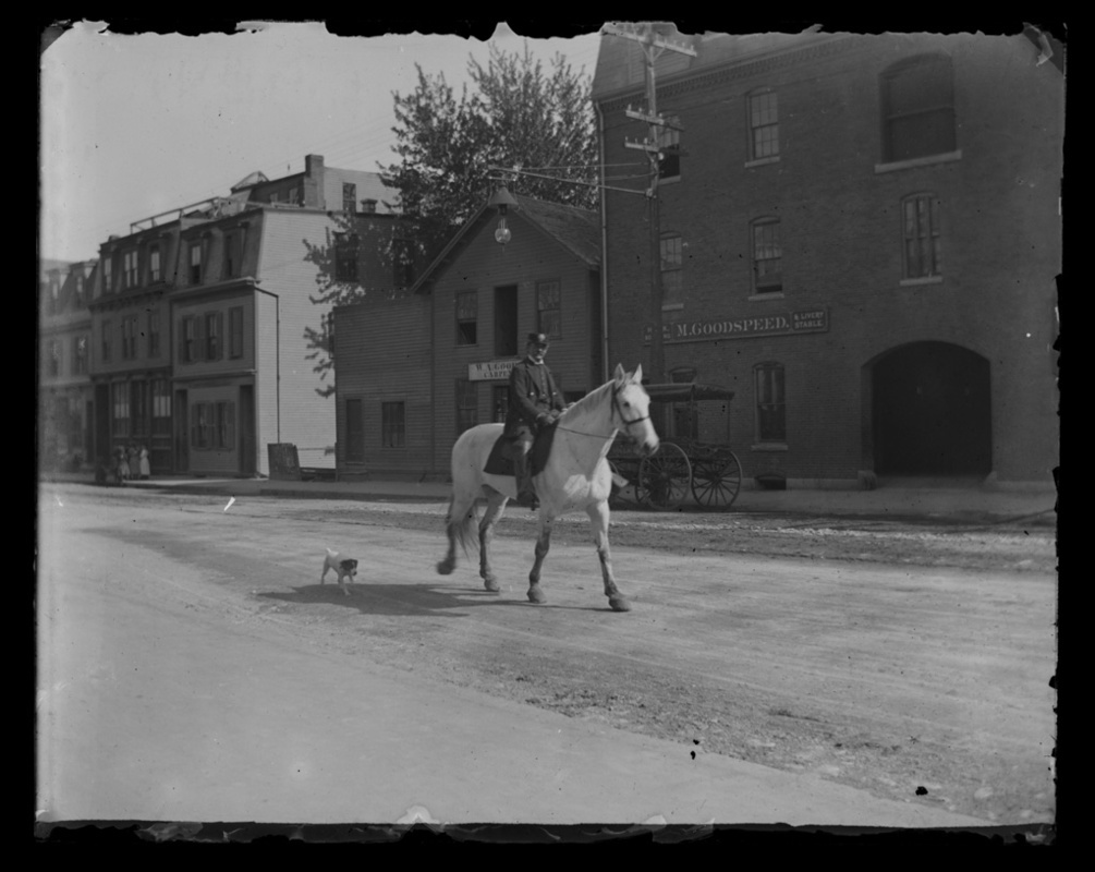
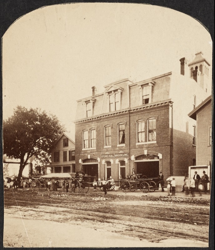
Goodspeed Livery Stable, 316 Washington St.
Just north of Harvard Square, opposite Holden St. Goodspeeds stable remained a business here until the early 1930s, later run by Munroe Goodspeeds son, Carl, and then other owners. The stable provided multiple services for both businesses and individuals. The S.S. Pierce Company boarded its horses and delivery wagons there, horse-drawn taxis could be called, horses were available for rent.
It is evident that Goodspeeds rented space in this building. For example, from 1895 to 1901 this building was also the address of Dr. James Marshall, veterinary surgeon newly graduated from school. There is a sign visible in the photo for J. C. Barthelmes, Undertaker. John C. Barthelmes had been running a hairdressing business in Brookline for decades and, circa 1895, apparently expanded into undertaking. However, there is no record of his business at this address and the purpose of the sign remains unclear.
[Source: Digital Commonwealth]
|
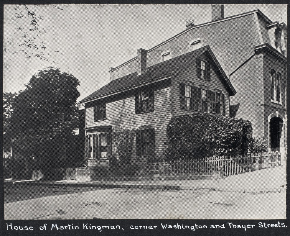 |
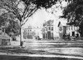
338 Washington St.
Northwest corner of Washington and Thayer. House of Martin Kingman from 1866 to 1913, when it was demolished.
[Source: Digital Commonwealth]
|
 |
Thayer Place
Buildings are no longer standing.
[Source: Digital Commonwealth]
|
 |
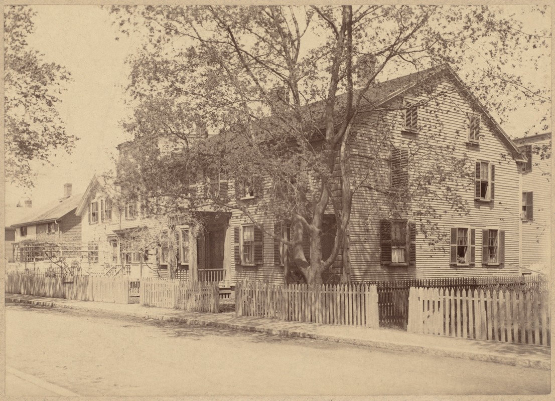
George H. Stone Hook and Ladder Company, circa 1875
Built in 1873, across from the public library, this building is still in use as a municipal building, housing the towns police and fire headquarters. On the left is the house of Martin Kingman on the corner of Thayer St.
[Source: Digital Commonwealth]
|
 |
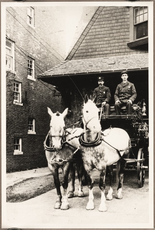
(Future Station B/Station 2) Hook and Ladder Company No. 1; Hose Company No. 2, Circa 1895
The building is still standing opposite the public library and is in use as the Public Safety Building. It was built in 1873 and first housed the George Stone Hook and Ladder Company. Shown is the first Hook & Ladder #1 truck with Fred Foster and George Newcomb (driver). The fire stations were named according to the equipment stationed there.
There would be some confusing juggling of equipment following this photo:
- 1897: New Hook & Ladder #1 truck purchased. This original Hook & Ladder #1 is renamed to Hook & Ladder #2 and moved to the fire house in the Village Square.
- 1899: This new Hook & Ladder #1 truck is moved to the new Washington Sq. firehouse
- 1899: The older Hook & Ladder #2 is moved back to its original location at 340 Washington St. albeit with its new name.
|
 |
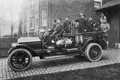
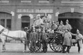
Station C (Future Station 3), 86 Monmouth St., 1902
Combination Wagon #3. Listed personnel at this station were L. F. Foster, Lieutenant; Edward McGrath, driver; Hiram C. Hamilton, hoseman.
[Source: Digital Commonwealth]
|
 |
Station C (Future Station 3), April 1912
Combination Wagon #3, 86 Monmouth St. From left to right:
- John J. McCarthy, hoseman, driving
- John W. Manley, Lieutenant
- Patrick J. Ryan, Hoseman
- William Keegen, Call man
- Michael J. Fahey, Driver
- An agent from American LaFrance, a fire truck vendor
[Source: Boston Publishing Co.]
|
 |
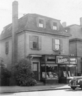
358/360 Washington St., circa 1940
Built circa 1868 as the house of Jonathan Dean Long and the location of his carpentry business. On the far left is a partial view of #352 followed by #354 and #358/360, all three were demolished shortly after this photo was taken. Photo taken by Marguerite (Long) Goodspeed, Longs granddaughter.
[Source: Fleming Collection]
|
 |
358/360 Washington St., circa 1940
Built circa 1868 as the house of Jonathan Dean Long and the location of his carpentry business. Photo by Marguerite (Long) Goodspeed, Longs granddaughter, taken shortly before it was demolished.
[Source: Fleming Collection]
|
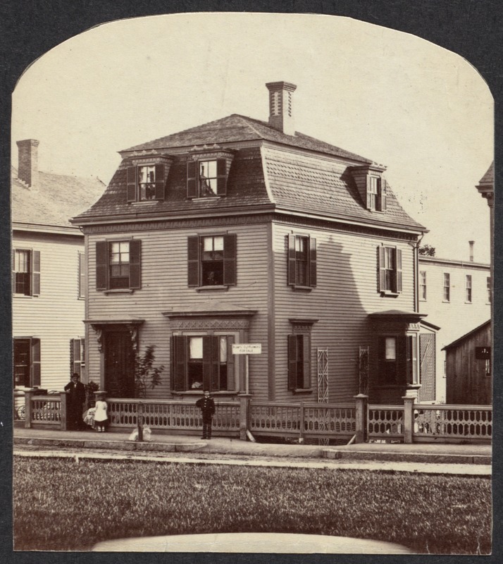 |
358 Washington St., circa 1872
Long time residence and business location of Jonathan Dean Long (1819-1889), carpenter and builder, roughly across the street from the library. He was also listed in the town directory as a horticulturist and there is a sign advertising Plants And Flowers For Sale in front of the house. Pictured here are, speculatively: John Long, age 52; wife, Mary, in the upstairs window; youngest child, Eliza, age 6; son, Joseph, age 10.
From Photographs of Brookline: taken about 1876 / Richard Hills. Call No.: BROOKLINE/Special (CAGE B.R. 974 H6), Brookline Public Library.
[Source: Digital Commonwealth]
|
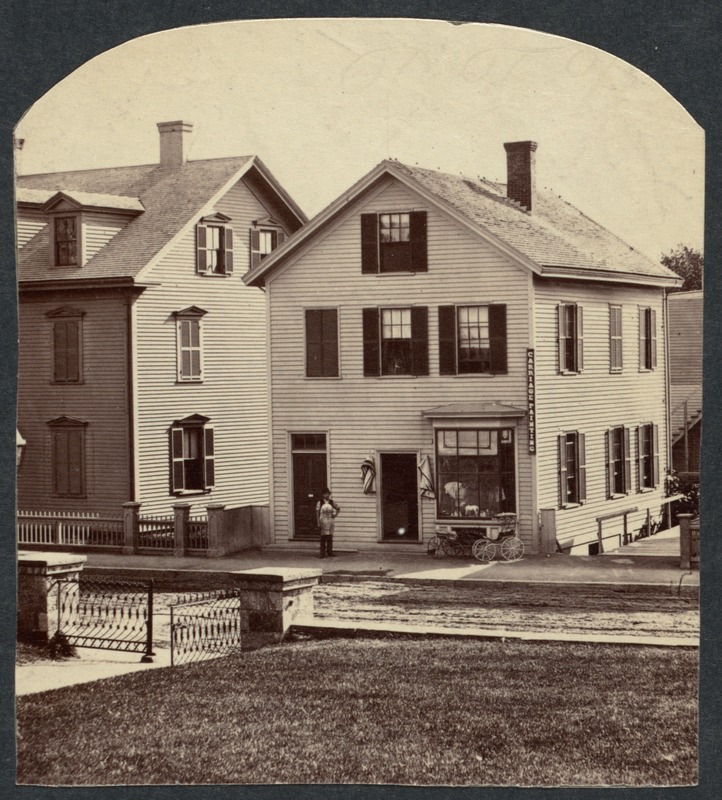 |
354 Washington St., circa 1872
House of Charles L. Palmer, carriage painter, harness maker, and manufacturer of childrens carriages (pictured out front). Charles was in his mid-fifties and may be standing out front. His son, Edward, also worked in the business and lived in the house. Partially visible in the rear is the building that would have served as the workshop. Across the street is the entrance to the old circular drive of the library.
From Photographs of Brookline: taken about 1876 / Richard Hills. Call No.: BROOKLINE/Special (CAGE B.R. 974 H6), Brookline Public Library.
[Source: Digital Commonwealth]
|
 |
(Future Station B/Station 2) Hook and Ladder No. 1, Hose Company No. 2
The building, located today at 350 Washington St. across from the public library, is still standing and in use as the Public Safety Building. It was built in 1873 and first housed the George Stone Hook and Ladder Company. On the right is the wagon for Hose Company No. 2 housed at 342 Washington St. On the left is the station for Hook and Ladder No. 1 housed at 340 Washington St. Note the two dogs on the wagon.
[Source: Joel Shield]
|
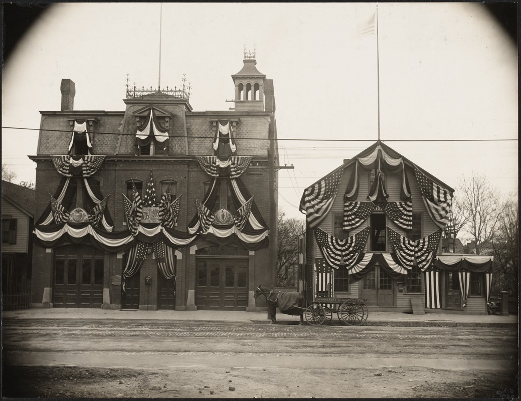 |
Station B (Future Station 2), Circa 1905
The station housed Hook and Ladder Company No. 1 and Hose Company No. 2. It formerly housed the original and then newer Hook & Ladder No. 1 trucks which were later juggled among several locations. The building, located across Washington St. from the public library, is still standing though no longer a fire station. It is decorated here for the towns bicentennial celebration.
To the right, the wagon of Oliver B. Delano's Sons, Carpenter is parked in front of their business. The father established himself here in 1866 and built his house in the rear, just visible, several years later. He died in 1893 and his sons took over the business.
[Source: Digital Commonwealth]
|
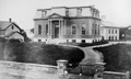 |
First Library Building
This is the first library building, built in 1869 at the same location as todays library (1909), shown here sometime before an 1889 addition. To the left is the rear of a house on School St. Behind the library is the first high school, built in 1856.
[Source: Brookline Preservation Department]
|
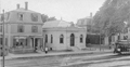 |
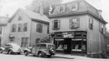
362-376 Washington St. Brookline Village
From left to right:
- 362 Washington St., no longer standing
- 366 Washington St., Brookline Savings Bank; built in 1898 on land owned by of David H. Daniels, still standing.
- 370 Washington St. House of David H. Daniels, Superintendent of Brookline Schools, from 1871 1902; still standing though demolition has been proposed in 2023
- 376 Washington St., partial view, still standing
[Source: Joel Shield]
|
|

