 |
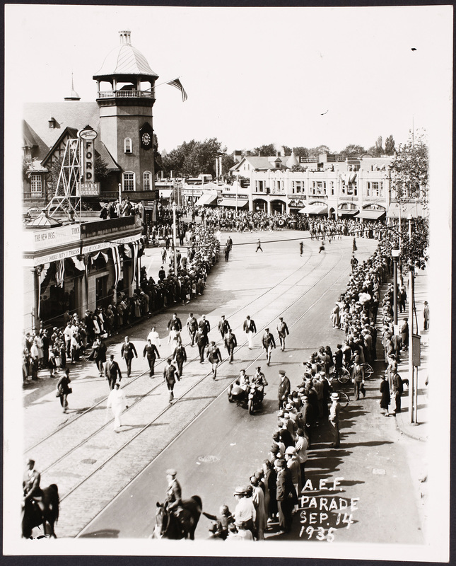
Parade, Coolidge Corner, September 14, 1935
Looking north on Harvard St. Some 15,000 veterans of the 101st Infantry American Expeditionary Forces held their annual reunion in Brookline and this is their parade. The route started at Harvard and Stedman Streets and proceeded south on Harvard Street to the Village Square, west on the Worcester Turnpike to Cypress Street, south on Cypress to High St. ending at the Brookline Field on Jamaica Rd. and Pond Ave.
Viewed on the western side of Harvard St. from left to right:
- The T. C. Baker Ford dealership at 1331 Beacon St.
- S. S. Pierce and Co. on the northwest corner of Beacon and Harvard streets.
Viewed on the eastern side of Harvard St. from left to right:
- 289 Harvard St. The awning of Gurleys Bakery
- Green St.
- 285-287 Harvard St. The Edison Shop, sellers of home appliances.
- 283a Harvard St. The Fanny Farmer Candy Shop
- 283 Harvard St. The Faneuil Hall Fruit Store
- 281a Harvard St. Carrolls Cut-Rate Perfumer
- 279 Harvard St. The First National Stores, groceries
- 275 Harvard St. Brookline Savings Bank
- 273 Harvard St. Frank W. Savage, real estate
- 271 Harvard St. The Dorothy Muriel Shop, deli and liquors
- 269 Harvard St. Entrance to the upstairs offices
- 267 Harvard St. Alice Merrill, florist (beneath the Red Cab office)
[Source: Digital Commonwealth]
|
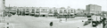 |
Coolidge Corner, circa 1934
[Source: Brookline Preservation Department]
|
 |
Pleasant St., 1934
Looking towards Beacon St. Photo by Henry A. Varney, Brookline town engineer.
[Source: Brookline Preservation Department]
|
 |
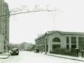
Pleasant St., 1934
Looking from Beacon St. A & P Grocery store is on the left. Photo by Henry A. Varney, Brookline town engineer.
[Source: Brookline Preservation Department]
|
 |
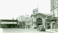
Coolidge Corner, 1930
[Source: Historic New England]
|
 |
Coolidge Corner: Coolidge & Brother General Store, Close-Up
|
 |
Harvard School
This school was located in a small triangle of land in Coolidge Corner formed by Beacon St., the short extension of Pleasant St. running southwest of Beacon St. and Harvard St. running southeast of Beacon St. completing the triangle. It was built shortly after the 1851 extension into Brookline of Beacon St. With the widening of Beacon St. in 1887/88 the school was demolished and the new brick Cabot School was built on nearby Marion St.
|
 |
Coolidge Corner
|
 |
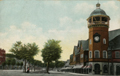
Coolidge Apartment Building, 1913
N.E. Corner Sewall Ave and Stearns Rd.
|
 |
Coolidge Corner, Early 1900s
|
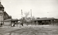 |
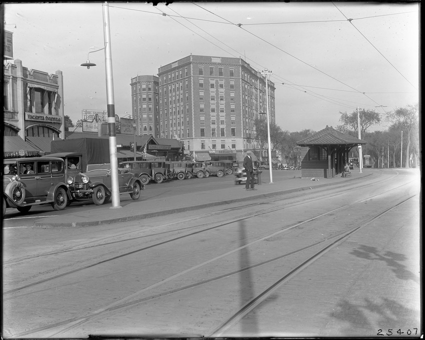
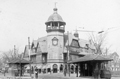
Coolidge Corner, circa 1901
Harvard St. feeds in off-photo to the left of the transfer platforms. A Harvard St. trolley coming from the north toward Beacon St. can be viewed in the distance between the platforms. The house at 278 Harvard St. is visible.
[Source: MBTA]
|
 |
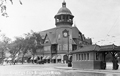
Coolidge Corner, 1908
|
 |
Coolidge Corner, 1905
|
 |
Coolidge Corner, 1906
|
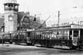 |
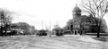
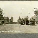
Three-car Train on Today's C
Seen here traveling east in Coolidge Corner, these cars were manufactured as part of a group of center-entrance cars, numbered from 6100 to 6299, that were introduced in1919/20. They were reduced in service by the late 1930s but briefly returned to service during periods of increased demand during World War Two.
|
 |
Coolidge Corner
[Source: Brookline Preservation Department]
|
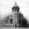 |
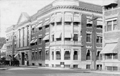
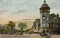
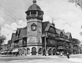
Coolidge Corner, S.S. Pierce Building
|
 |
Coolidge Corner
[Source: Brookline Preservation Department]
|
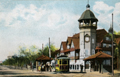 |
Coolidge Corner, 1913
|
 |
Coolidge Corner
[Source: Olmsted]
|

