 |
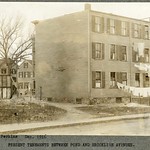
Rear of 670 (fmr. 55) & 666 (fmr. 59) Brookline Ave, December 1916
No longer standing
[Source: Olmsted]
|
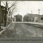 |
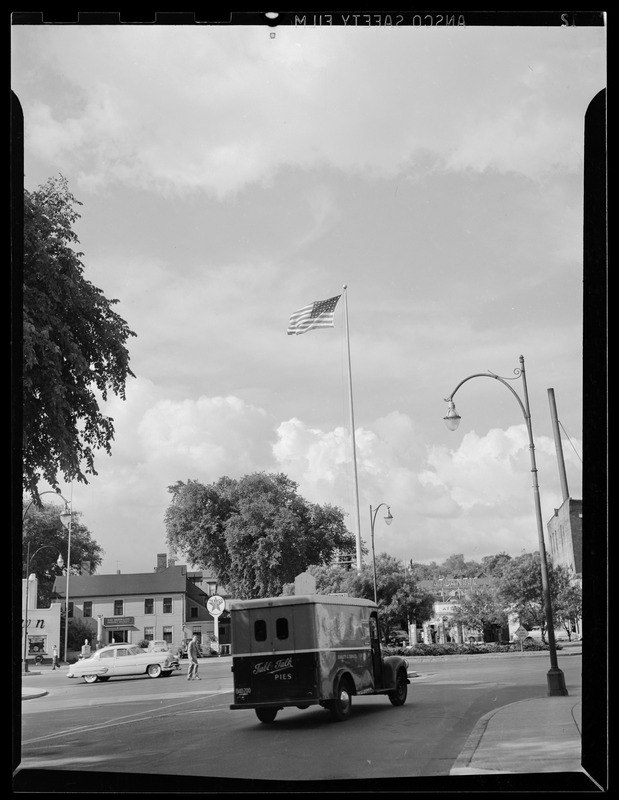
Brookline Ave. at Washington St.
#(710 (fmr 7) and #706 (fmr 17) at the left. Boston Consolidated Gas Company at the right. Visible center left is 40 Washington St. at the corner of Walter Ave., one of several buildings owned by Thomas Miskell. Walter Ave. no longer exists and was located at the present day entrance to the Brook House complex. At center right is a brick building owned by John Fleming. This account of later plans for the building appeared in the 1921 issue of Automobile Topics.BROOKLINE TO HAVE GARAGE FOR WOMEN
John F Fleming Plans for Garage That Will Be Managed Operated and Patronized by Women Comfort and Convenience of Patrons Considered
Brookline Mass is to have a garage that will be managed operated and patronized by the fairer sex. Disregarding a certain traditional feminine ineptitude for filings mechanical John F Fleming of Brookline is firmly convinced that the rapidly growing number of women drivers calls for a garage run exclusively by women. In other words not only will all the patrons be women but the establishment will be managed by a woman and there will be women attendants and mechanics throughout even the cab service to be operated in connection with the garage and for its women customers will have women drivers exclusively.
For the woman owner whose only interest in her car is to have it always ready for driving the garage will offer complete service. All she needs to do when she desires to use the car is to telephone the garage. A cab will be sent to her residence for her and when she reaches the garage her car will be ready to drive away. Upon retuming she will leave the car at the garage door and if she wishes have a cab take her home. In the interval between drives the car will be whipped into driving state and will be stored in a private stall.
On the other hand for the woman who likes to take care of her car the garage will offer exceptional attractions. There will be no men about the building so the mechanically bent lady can don overalls and crawl under the car or do any work on it she pleases. There will of course be trained women mechanics to assist her in anything mechanical she does not care to tackle alone.
During the Summer months Fleming plans to fit out the building which is located at 5O Washington street with the most up to date garage equipment and to put into operation a number of original ideas he has for the comfort and convenience of feminine motorists. When it is finished the garage will have the appearance of an automobile club for women with every facility for careful handling of cars and for their maintenance in first class condition. The front of the building will be fitted up as a lounge or waiting room. There will be comfortable chairs and tables desks and also an attractive fireplace.
The garage will accommodate not more than forty cars for it is the intention to allow plenty of space in each stall and no car will be put in front of another so that owners can work around their cars or get into and get out of them without being crowded by other cars. There is a large automobile elevator connecting all floors and there will be telephones all over building connecting with an outside switchboard in the office. On the exterior of building there are to be no signs except those denoting the entrance and exit.
It is Fleming's plan to close the garage fairly early in the evening Patrons who have their cars out late can leave them at his large general garage across the street and they will be taken to their places in the women's garage and cared for early in the morning.
[Source: Olmsted]
|
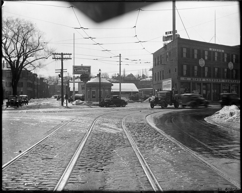 |
Lower Washington St.
Looking south on Brookline Ave. toward Lower Washington St. To the left is a relatively rare view of Walter Ave., now covered by the Brook House apartment complex. In the middle is the Atlantic Refining Co. at 40 Washington St. To the right is Hinds Hand Laundry, 50 to 60 Washington St. Both businesses first appear in the 1924 town directory and remained for a number of years.
[Source: Historic New England]
|
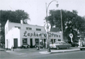 |
Lapham Brown Oil Co., 20 Washington St.
[Source: Brookline Preservation Department]
|
 |
Lower Washington St.
Looking south from Brookline Ave. Obscured by the truck is the entrance to Walter Ave.
[Source: Digital Commonwealth]
|
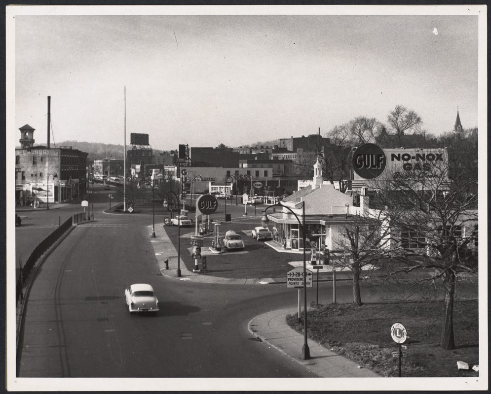 |
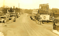
Lower Washington St., December 1956
Looking west on Lower Washington St. from the Boston border. Brookline Ave. enters between the Gulf and Esso stations.
[Source: Digital Commonwealth]
|
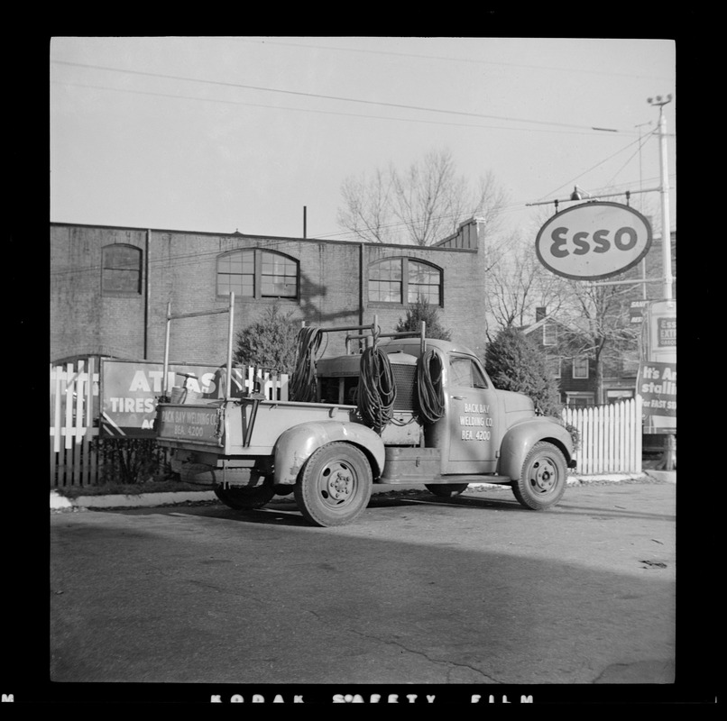 |
Esso Station, Lower Washington St. at Brookline Ave.
Standing in the Esso station at the northwest corner of Brookline Ave. and Lower Washington St. looking north. In the distance are the small house at 9 Emerald St. and the side of the apartment building at 657 Brookline Ave. The brick building was used by the Brookline Water Dept. and still stands.
[Source: Digital Commonwealth]
|
 |
Brookline Ave & Washington St (Rt. 9), 1923
Looking east on Washington St. (Rt. 9) toward the Boston line, Brookline Ave. to the left. Huntington Line of the Boston Elevated Railway.
[Source: Joel Shield]
|
 |
Brookline Village, 1937
Looking west from the Boston border on Lower Washington St. River Road is the first street on the right followed by Brookline Ave just before the sign for Cashman Motor Co.
[Source: Brookline Preservation Department]
|
 |
Jenney Service Station, Brookline Village
Standing on Pond Ave. looking west on Lower Washington St. This is a service station of the Jenney Oil Co. on land owned by Bernard Jenney who had a large mansion in the Cottage Farm neighborhood. Houses on Villa Lane can be glimpsed in the rear. No structures in this photo remain standing.
[Source: Brookline Preservation Department]
|
 |
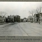
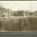
Start of Brookline Ave, December 1916
Looking north. Boston border on Washington St. to the right.
[Source: Olmsted]
|
 |
Start of Brookline Ave, December 1916
Looking north from NW corner of Washington St.
[Source: Olmsted]
|
 |
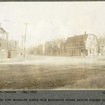
Lower Washington St., December 1916
Looking west toward Brookline Village from the Boston border. Middle, left: Pond Ave. entrance in front of the Gold Medal Flour billboard. Middle, right: two houses on Park Dr. facing Riverway Park.
[Source: Olmsted]
|
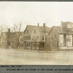 |
Lower Washington St., #1-#27, December 1916
Standing at the corner of Pond Ave. looking west toward Brookline Village
[Source: Olmsted]
|
 |
Lower Washington St., Looking West from the Boston Border, December 1915
Foreground left, left to right: entrances to Pond Ave., Villa Lane, Walter Ave., the begining of today's Brook House expanse. Foreground right, right to left: houses from #5 - 27 Washington St. followed by th entrance of Brookline Ave.
[Source: Olmsted]
|
 |
Lower Washington St.,Looking East to the Boston Border, December 1916
Brookline Ave. entering mid-left.
[Source: Olmsted]
|
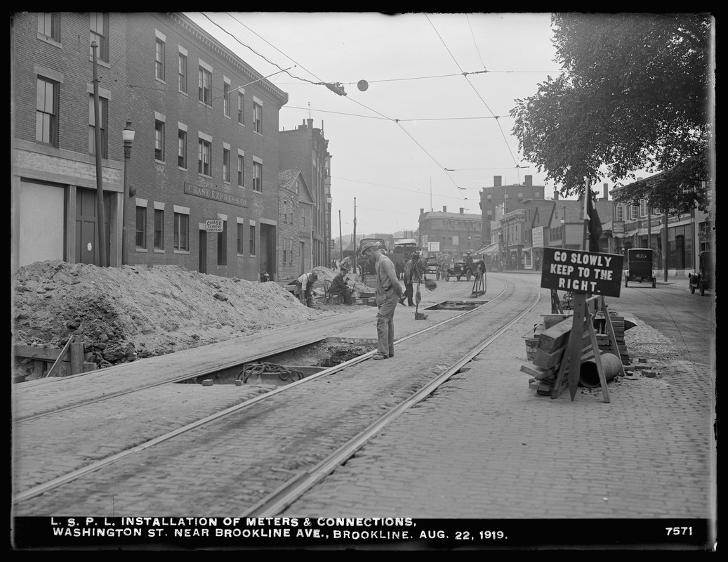 |
Lower Washington St., 1919
Looking west. A section of the Guild Building can be seen in the far distance where Washington St curves northward to the right. On the right, the car is approaching the intersection of Pearl St. and is about to pass by the sign hanging over the sidewalk for the Village Market at 89 Washington St.
From left to right:
- The brick Chase Express Co. building 66 Washington St.
- The partially visible two-story wooden structure and the sign of Quinlans Livery at 76 Washington St.
- The three-story brick building of James Driscoll & Son, General Contractors at 82 Washington St.
[Source: Digital Commonwealth]
|
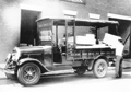 |
Chase Express, 66 Washington St/
Charles Chase opened an express business in Brookline in 1862 with a house and stables at the location of todays Town Hall and the company remained family-run in Brookline for eight decades. In late 1904, Chase Express moved into this new building on the south side of Lower Washington St. and remained there until late 1941. Shown is their 1929 White model 60 truck.
|
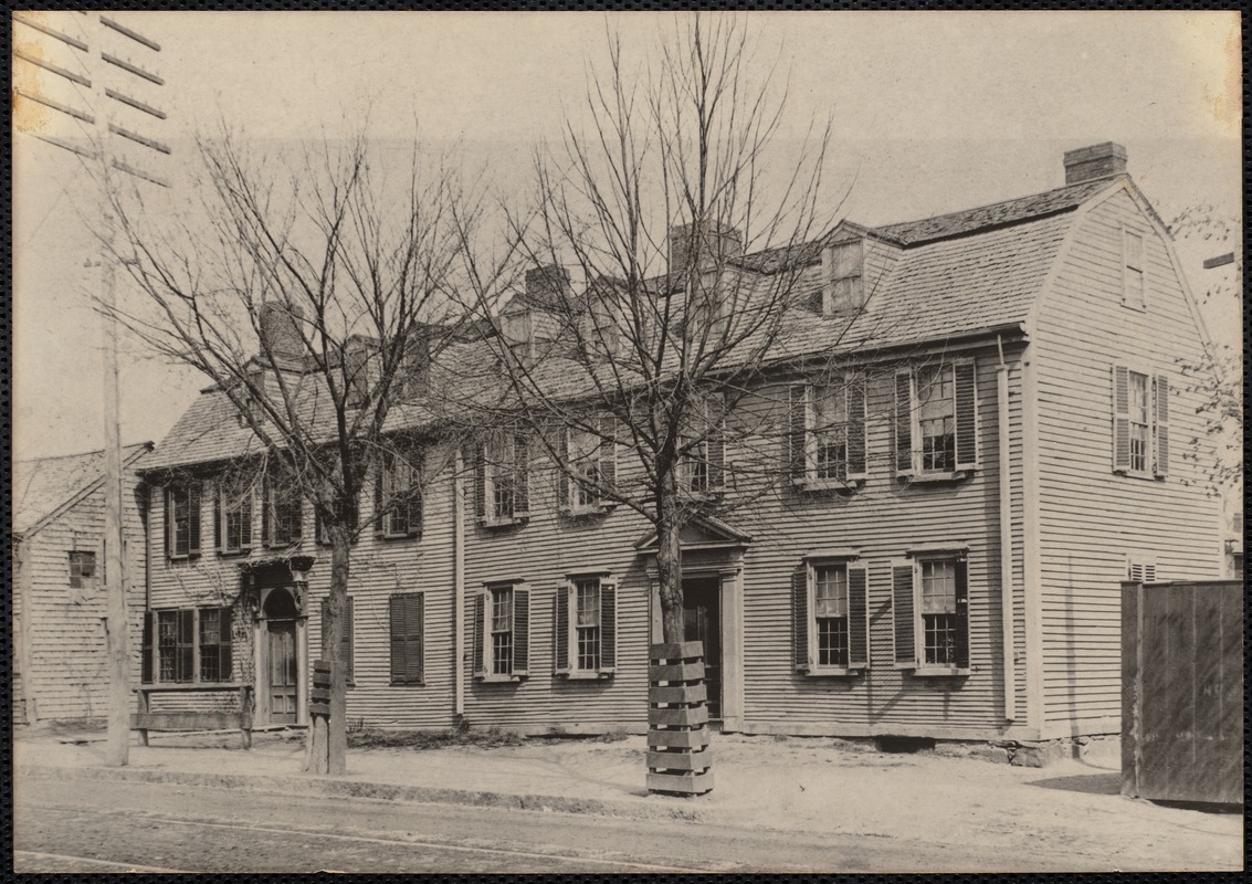 |
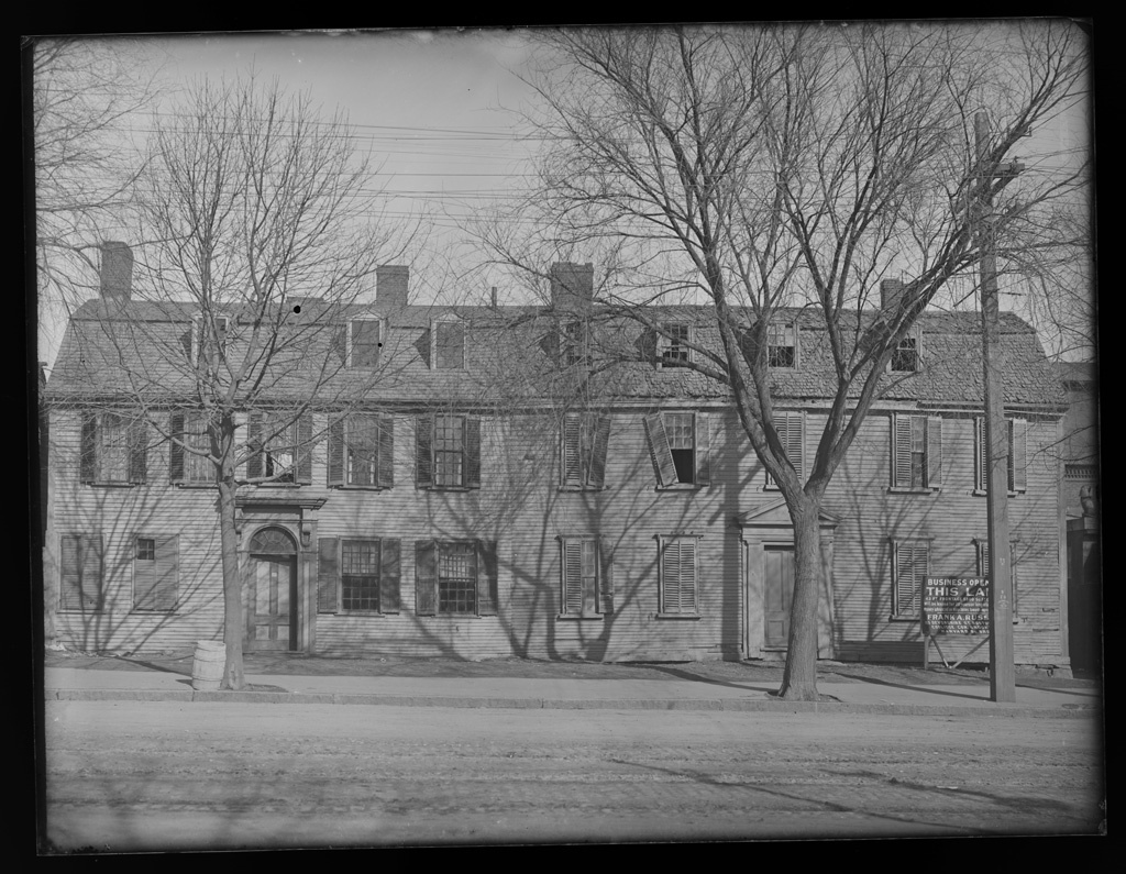
Griggs-Downer Houses, Lower Washington St.
These two conjoined houses were located near the northwest corner of Brookline Ave. and Lower Washington St. The house of Dr. George Griggs, on the right at 57 Washington St., was built in the early 1700s. Dr. Eliphalet Downer later added the house on the left side at 61 Washington St.
[Source: Digital Commonwealth]
|
 |
Griggs-Downer Houses, Lower Washington St.
These two conjoined houses were located near the northwest corner of Brookline Ave. and Lower Washington St. The house of Dr. George Griggs, on the right at 57 Washington St., was built in the early 1700s. Dr. Eliphalet Downer later added the house on the left side at 61 Washington St.
[Source: Digital Commonwealth]
|

