|
The Society
Historical Information
Photo & Map Collections
Exploring Brookline
Links
Program Archives
|
Recent Additions
 |
Downing Rd., January 19, 1915
Looking northeast on Downing Rd. toward Washington St. From left to right:
- 9 Downing Rd.
- Orchard Rd. intersection
- 25 Downing Rd.
- 797 Washington St. opposite Downing Rd.
From the photo album of Edith Draper Steinmetz, 31 Evans Rd.
[Source: Daniel Coston Collection]
|
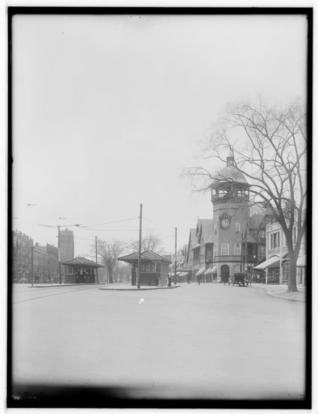 |
Coolidge Corner, May 11, 1914
[Source: Historic New England]
|
 |
Unidentified
[Source: Historic New England]
|
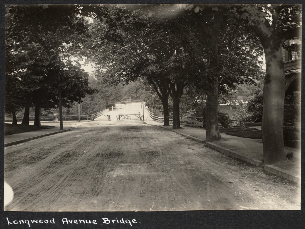 |
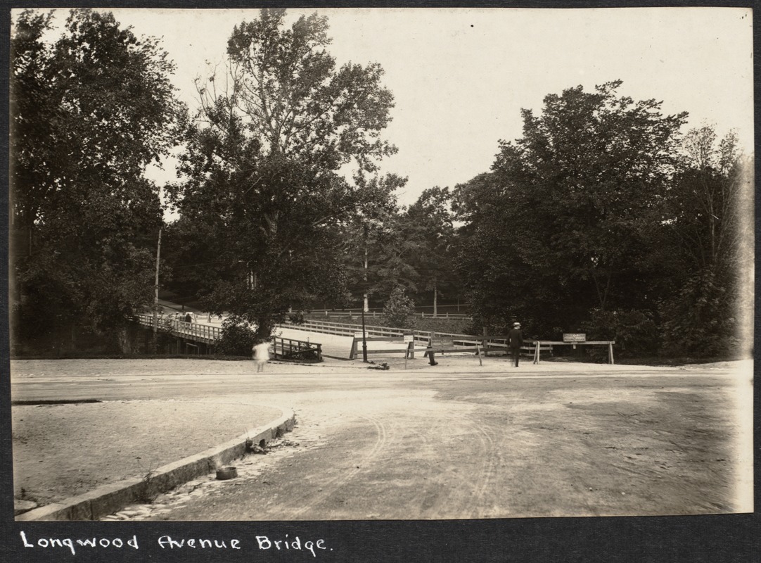
Longwood Ave., circa 1898
Standing at 197/199 Longwood Ave. looking east at the old wooden bridge at Chapel St. The bridge is closed which most likely indicates that construction of the new stone bridge is about to commence. Note two people seated in the hill in the distance on the right.
[Source: Digital Commonwealth]
|
 |
Longwood Ave., circa 1898
Looking east at the old wooden bridge at Chapel St. The bridge is closed which most likely indicates that construction of the new stone bridge is about to commence. .
[Source: Digital Commonwealth]
|
 |
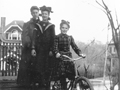
Ruhl Family, 37 Hyslop Rd.
Looking east on Hyslop Rd. from the Ruhl house at 37 Hyslop Rd. 29 Hyslop Rd. is under construction. The Ruhls moved to their new house, then oddly addressed as 88 Druce St., in 1905. The three younger daughters of Edward and Mary Ruhl - Elsie, Louise, and Mary - are standing across the street.
|
 |
Hyslop Rd. at Druce St., circa 1906
Looking west on Hyslop Rd. at the corner with Druce St. Most likely shown are Edward Ruhl, one of his daughters, and his son, In the distance on the right is 70 Hyslop Rd. and, in the middle, 125 Holland Rd., both still standing.
|
 |
Hyslop Rd. at Druce St., circa 1906
Looking west on Hyslop Rd. Most likely shown are Edward Ruhl and two of his daughters at the corner with Druce St. The houses in the photo are no longer standing.
|
 |
172 Buckminster Rd., circa 1902
Viewed from the side of 172 Buckminster Rd. with 169 Buckminster Rd. in the background. Mary and Edward Ruhl and their five children moved from Boston and began leasing this house in late 1901. Probably shown here, from left to right, are the three youngest daughters: Elsie, Louise, and Mary.
|
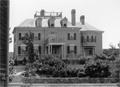 |
172 Buckminster Rd., circa 1903
Mary and Edward Ruhl and their five children moved from Boston and began leasing this house in late 1901. Ruhl, a German emigrant, was Secretary of the newly-formed conglomeration of brewers known as the Massachusetts Breweries Company. The Ruhls would purchase a nearby home in 1905.
|
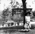 |
169 Buckminster Rd., circa 1903
Looking at 169 Buckminster Rd. from the front lawn of 172 Buckminster Rd., the home of Edward Ruhl, both houses are still standing. The girl is unidentified.
|
 |
Health Clinic, Brookline Friendly Society, 10 Walter Ave., 1943
The Brookline Friendly Society was a health and human services agency located at 10 Walter Ave. in the area known as The Farm.
|
 |
Pierce School Graduation, 1908
Identities inscribed with the photo were:
Front Row
- Fay -- from Cuba
- Irene Taylor
- Elizabeth Walsh
- Edith C Robinson
- Ruth Litchfield
- Sara Emerson Snell
- Christine Merrick Ayars
- Helen Margaret Leard
- Lillian Agnes Meany
- Viola Bassett Handy
Row Two
- Katherine G Sullivan
- Frances A Jefferson
- Ada E. Chevalier (teacher)
- Mary McSkimmon (principal)
- Maria F. Gardner (teacher)
- Marie Katherine Kelly
- Helena von Ladau
- Frances Converse McCormick
Row Three
- Vienna Francis Edwards
- Sarah M I Messer
- Annie ???
- Lillian Woodard
- Alice M. Potter
- Katharine Riley
- Esther A Richardson
- Emily Grace Smith (?)
- Gladys Florence Creaser
- Donna M. George
- Louise Cheney
Row Four
- Walter Kelley
- Harry H. Denning
- Karl Leavitt Thielscher
- George Francis McGillen
- Philip Ignatius Johnson
- Robert J. Rowe
- ? Dillingham
Row Five
- Arvin Edward Case
- Elwood B. Merritt
- Philip Leard
- William Walizer
- Antonio Nesmith Guimaraes
- Edward Estey Mason
- Philip R. G. Nordell
- Elliott W Hirshberg
- Edward A Manning
Not identified above but listed in the June 27th, 1908 issue of The Chronicle as receiving diplomas were:
Edith M Barrett,
Mabel Louise Blair,
Annah May Colby,
Etta May Coyne,
Annie R. Cross,
Elsie May Danckert,
James Walter Dane,
Katherine Margaret Duffy,
George C Dunlevy,
Edward M Emery,
Charles Ultin Farley,
Chester R. Fowler,
Pae Fowler,
Florence A Gottschalk,
Manon Lloyd Grant,
Elmer Philip Hatch,
Florence May Hunter,
Edward Charles Kelley,
Adelbert Libby Kilmer,
E Lewis Little,
Agnes J Lynch,
Grace Edith Mosher,
Owen Leo McGillen,
Emma Jane McNeilly,
Philip E Nason,
Frank Sewall Owen,
Everett D Phillips,
Vera Belle Purdy,
Joseph A Richardson,
William James Rix,
May Watson Shillady,
Jane E Smith,
Francis P Wall,
Elizabeth Margaret Walsh,
Harold M Watson
|
 |
Pierce School Class
This photograph was annotated with a date of 1905 and the names Lillian Scheinfein and Teacher Lunt. No Lillian Scheinfein or a Lunt could be identified in that era or with the Pierce schools.
|
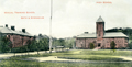 |
High School, Manual Training School, Bath House
|
 |
The Coolidge Apartment Building
Northeast Corner Sewall Ave and Stearns Rd.
|
 |
Hotel Beaconsfield, 1731 Beacon St.
Built in 1903 by Henry Whitney. Initially a luxurious 200-room apartment hotel, it apparently fell on hard times by the 1950s and was demolished after a fire in 1966.
|
 |
Brookline Motor Hotel, 1211-1217 Beacon St.
Formerly Richmond Court Apartments
|
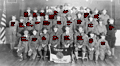 |
Boy Scout Troop 4, United Parish Church, circa 1927, With Annotations
Troop 4 was affiliated with the First Parish Church and was one of a number of Boy Scout troops in Brookline. Troop 4 was largely populated at the time by boys from wealthy families.
[Source: First Parish Brookline]
|
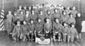 |
Boy Scout Troop 4, United Parish Church, circa 1927
Troop 4 was affiliated with the First Parish Church and was one of a number of Boy Scout troops in Brookline. Troop 4 was largely populated at the time by boys from wealthy families. From left to right:
Front row
- Robert Mason Whittemore
- Delano Wight
- John Moore Morse
- Robert Churchill Vose
- Richard Goodwin
- Edward Wiggin Robinson
- Charles Ogden Little
- Crocker Wight
Second row
- Henry Law Petri
- Robert Ware Bridgeman
- William Bond Wheelwright
- Richard Bent
- Richard Wentworth Pentecost
- Robert Schacht
- Seth Morton Vose
- Charles Storrow Denny
- Russell Hastings
- Unidentified
- Oliver Kennard Scott
Third row
- Richard Victor Prouty
- Irving Minot Shepard
- Andrew Marshall
- Cortlandt Van Dyke Hubbard
- John M. Little
- Cranford Rogers
- Unidentified
- Unidentified
- Herbert Phelps Vose
- Wendell Morse Hastings
- Unidentified
[Source: First Parish Brookline]
|
|

