 |
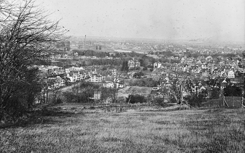
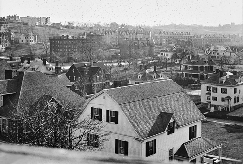
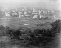
Harvard St. near Allston Border, circa 1903
Looking northeast from Corey Hill this is a rare photo of some of the older farms and estates around north Harvard St. Harvard St. bisects the photo from left to right. Below Harvard St., center left, is Kenwood St. and center right is Columbia St., both newly created. Above Harvard St., in the center of the photo, is the large house on the estate of James F. Ayer. Bordering the estate on the right, is Thorndike St. The open land in the center of the photo was the farm of David Sullivan Coolidge whose house can be viewed on Harvard St.
45/47 Kenwood St., built in 1903, is the final house in the photo on the north side of the street. #50, built in 1904, is not yet present.
[Source: Iowa State]
|
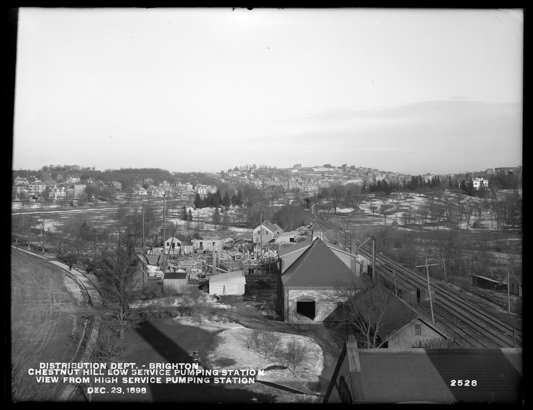 |
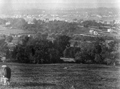
View Northeast From Chestnut Hill Reservoir
- [Lower Left] The curve of Beacon St. as it goes around the reservoir
- [Lower Right] The railroad way roughly representing the border between Brighton and Brookline now used by the MBTA D line
- [Upper Left] Brighton
- [Middle] Beacon St. running from left to right
- [Upper Center] Corey Hill
- [Far Right] Large white house on Chestnut Hill Ave.
[Source: Digital Commonwealth]
|
 |
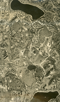
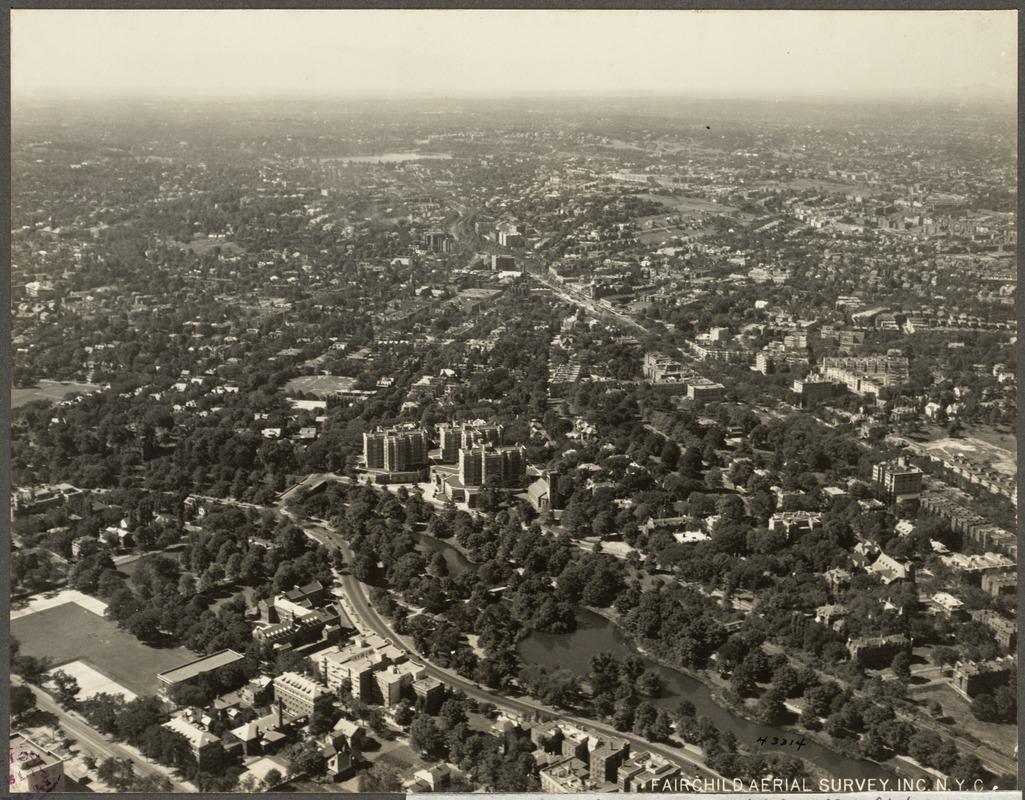
Aerial Photo, Warren St. Area, 1930
[Source: Digital Commonwealth]
|
 |
Aerial Photo, Warren St. Area, 1930
[Source: Digital Commonwealth]
|
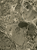 |
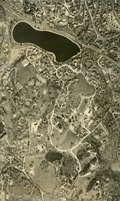
Aerial Photo, Sargent's Pond Area, 1930
Cottage St. on the left.
[Source: Digital Commonwealth]
|
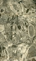 |
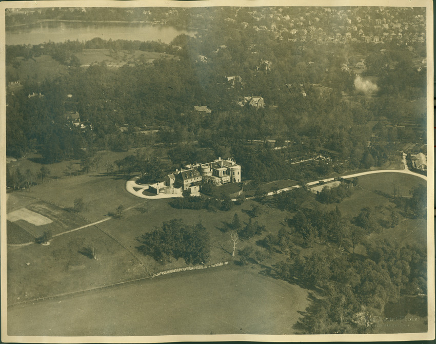
Aerial Photo, The Country Club Area, 1930
Newton St. runs left to right.
[Source: Digital Commonwealth]
|
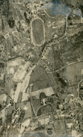 |
Aerial Photo, The Country Club Area, 1930
Newton St. runs left to right. Partial view of the Larz Anderson estate on the right.
[Source: Digital Commonwealth]
|
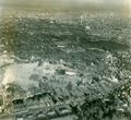 |
Aerial View, Larz Anderson Park Northward
Larz Anderson Park in the foreground, Jamaica Pond on the right, Charles River in the distance.
[Source: Brookline Preservation Department]
|
 |
Aerial View, Larz Anderson Park Northward
Locations by clock position:
- [2:30] Larz Anderson estate
- [3:30] Pond St.
- [8:30] Mt. Walley Ave.
- [11:00] The Country Club horse-racing track
[Source: Brookline Preservation Department]
|
 |
Aerial View, Larz Anderson Park Northward
[Source: Historic New England]
|
 |
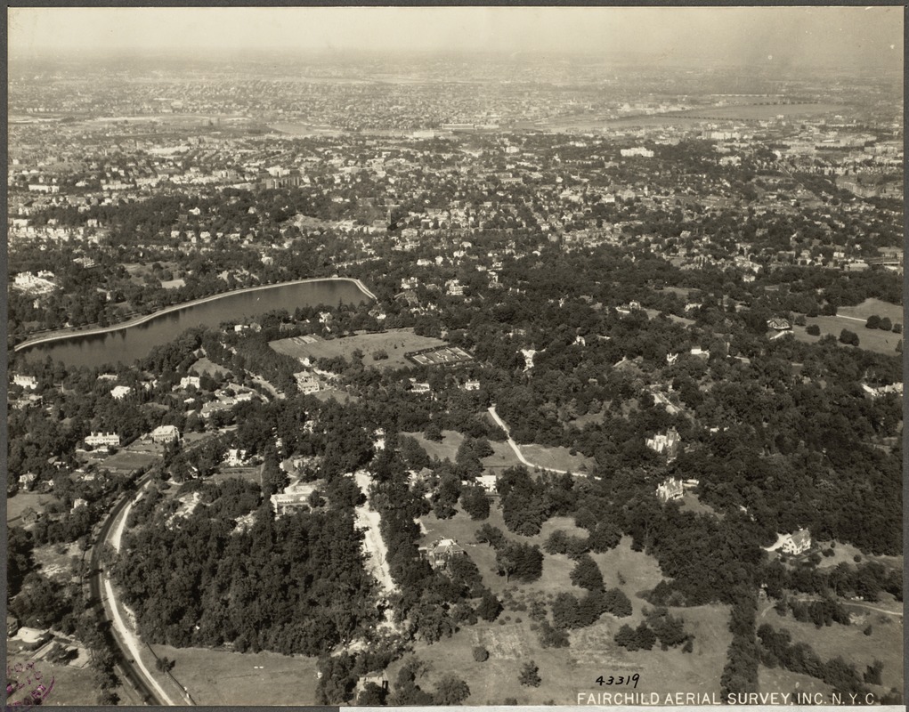
Aerial View, Southeast Brookline, Circa 1930
Looking from Jamaica Pond area toward Rt. 9 reservoir (photo middle), Fisher Hill Reservoir, and NW to Chestnut Hill Reservoir (photo upper left), Intersection of Goddard Ave. and Cottage St, photo lower left.
|
 |
Aerial View, Southeast Brookline, 1925
[Source: Digital Commonwealth]
|
 |
Aspinwall Hill, Looking SW from Lancaster Terrace
In the immediate foreground is the rear of the white house at 65 Westbourne Terrace. Slant right from it, in a view not yet blocked by the erection of the Michael Driscoll School, is the rear of 747 Washington St. Behind that, slant left, is the darker house at 736 Washington St. All are still standing.
In the rear of the photo are the apartment buildings across Beacon St. that make up the Beaconsfield Terrace complex.
[Source: Iowa State]
|
 |
Aerial View, Longwood Area, 1925
[Source: Digital Commonwealth]
|
 |
View From Corey Hill
Looking toward Allston-Brighton
[Source: Brookline Public Library]
|
 |
View From Corey Hill
Identification pending.
[Source: Brookline Public Library]
|
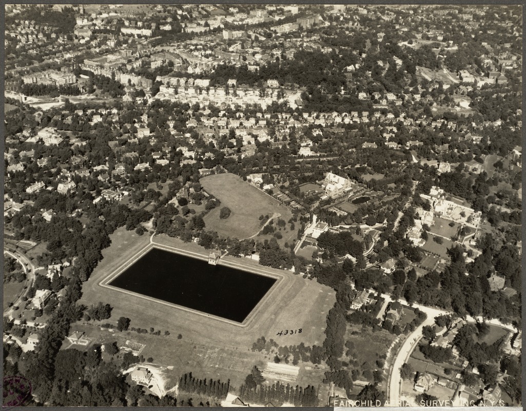 |
Aerial View, Fisher Hill, 1925
[Source: Digital Commonwealth]
|
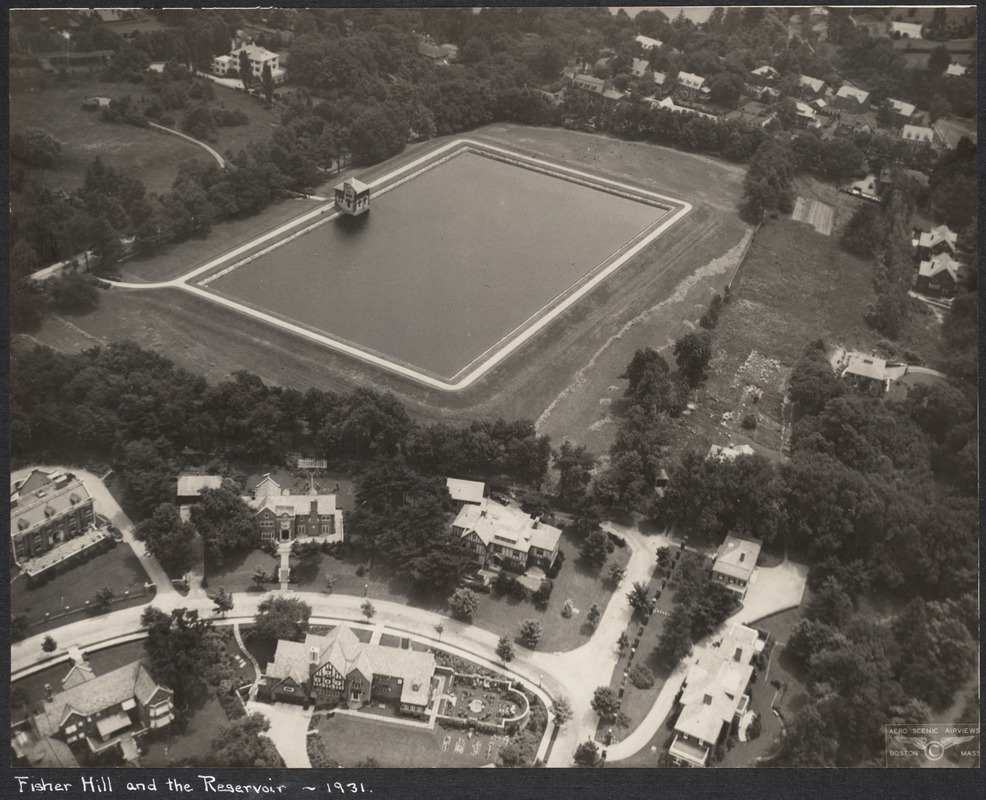 |
Aerial View of Fisher Hill, 1931
Viewed in the foreground abutting the reservoir, from left to right, are #146, #154, #166 Hyslop Rd. On the other side of Hyslop Rd. are #147 and #161. On the right is #170 Hyslop Rd. All are still standing.
[Source: Digital Commonwealth]
|
 |
Fisher Hill, Aerial View
[Source: National Archives]
|
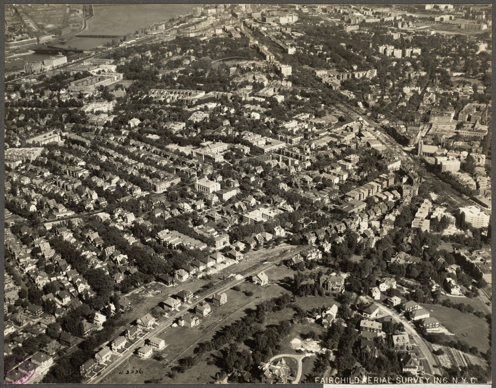 |
Aerial View, Corey Hill, 1925
[Source: Digital Commonwealth]
|

