|
The Society
Historical Information
Photo & Map Collections
Exploring Brookline
Links
Program Archives
|
The Marsh
 |
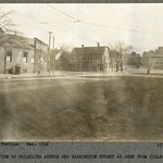
Start of Brookline Ave, December 1916
Looking north from NW corner of Washington St.
[Source: Olmsted]
|
 |
Esso Station, Lower Washington St. at Brookline Ave.
Standing in the Esso station at the northwest corner of Brookline Ave. and Lower Washington St. looking north. In the distance are the small house at 9 Emerald St. and the side of the apartment building at 657 Brookline Ave. The brick building was used by the Brookline Water Dept. and still stands.
[Source: Digital Commonwealth]
|
 |
Brookline Village, 1937
Looking west from the Boston border on Lower Washington St. River Road is the first street on the right followed by Brookline Ave just before the sign for Cashman Motor Co.
[Source: Brookline Preservation Department]
|
 |
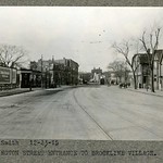
Lower Washington St., December 1916
Looking west toward Brookline Village from the Boston border. Middle, left: Pond Ave. entrance in front of the Gold Medal Flour billboard. Middle, right: two houses on Park Dr. facing Riverway Park.
[Source: Olmsted]
|
 |
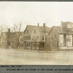
Lower Washington St., #1-#27, December 1916
Standing at the corner of Pond Ave. looking west toward Brookline Village
[Source: Olmsted]
|
 |
Lower Washington St., Looking West from the Boston Border, December 1915
Foreground left, left to right: entrances to Pond Ave., Villa Lane, Walter Ave., the begining of today's Brook House expanse. Foreground right, right to left: houses from #5 - 27 Washington St. followed by th entrance of Brookline Ave.
[Source: Olmsted]
|
 |
Lower Washington St.,Looking East to the Boston Border, December 1916
Brookline Ave. entering mid-left.
[Source: Olmsted]
|
 |
Griggs-Downer Houses, Lower Washington St.
These two conjoined houses were located near the northwest corner of Brookline Ave. and Lower Washington St. The house of Dr. George Griggs, on the right at 57 Washington St., was built in the early 1700s. Dr. Eliphalet Downer later added the house on the left side at 61 Washington St.
[Source: Digital Commonwealth]
|
 |
Griggs-Downer Houses, Lower Washington St.
These two conjoined houses were located near the northwest corner of Brookline Ave. and Lower Washington St. The house of Dr. George Griggs, on the right at 57 Washington St., was built in the early 1700s. Dr. Eliphalet Downer later added the house on the left side at 61 Washington St.
[Source: Digital Commonwealth]
|
 |
#91, 93 Washington St., Circa 1900
From left to right:
- Entrance to Pearl St.
- 93 Washington St., Benjamin F. Baker, Sign Painter
- 91 Washington St., Thomas Nagle, horse shoeing and Carriage Work. Thomas Nagle emigrated from Ireland in 1872, married in Brookline in 1874, and opened his shop here circa 1876. Visible on the front of the stable is a sign for his son, Luke T. Nagle, who became a veterinarian circa 1899.
- The top of mansard-roofed house that still stands at 49 Kent St.
- Houses on Pearl St.
[Source: Digital Commonwealth]
|
 |
Lower Washington St., Brookline Village
North Side of lower Washington St. Pearl St. is in between Benjamin Baker, sign and house painter, #93, on the right; #97 on the left.
[Source: Digital Commonwealth]
|
 |
B. F. Baker, House and Sign Painting, 93 Washington St., circa 1895
The entrance to Pearl St. is steps to the left. Visible above the door is the new street number reflecting the 1894 update of Washington St. addresses. Extending up Pearl St. behind this visible building are additional attached structures.
Standing in the doorway is Benjamin Franklin Baker (1820-1898). He began work at the paint shop of Silas Snow in 1841 and, circa 1856, became the owner of the property and the business. After Baker’s death, a former employee, Daniel Hunt, took over the business.
[Source: Digital Commonwealth]
|
 |
Lower Washington St., North Side, circa 1910
From right to left:
:: First building: #97/99 Washington at the intersection with Pearl St.
:: Second building: #101/103 Washington
:: Third building (narrow brick): #105 Washington; living quarters with a small storefront
:: Fourth building (draped in bunting):
#107 rear (probably an outhouse down the alley): home of James H. Maher
#109: The logo used by the Lyceum Café (1905-1910) is visible on the windows
#111 (single door, in the middle): James H. Maher, Carriage Maker
#113: Lyceum Hall Pharmacy
:: Fifth building (billboard on top) #115 Washington
Hosts the billboard for “Boyle & O’Neil Honeybrook Whiskey, Roxbury Crossing” that was also present in a 1914 photo
[Source: Digital Commonwealth]
|
 |
Lower Washington St., 1914
The top floor of the Lyceum Hall was removed after the fire. The March 4, 1914 edition of the Brookline Chronicle reported:
”Shortly after 4:00 AM Charles Pooley the nightman in Mack’s restaurant discovered a blaze near the cook stove and, rushing across the street to station “A”, summoned the department. Returning to the store he fought the flames with the assistance of two customers and, by the time Chief Johnson arrived, according to all outward appearance the fire was out but when the chief had a strip of wall removed he found that the flames were racing through the building between the partitions and the dry timbers made excellent food for the flames.
A second alarm was sounded and later a third calling all the Brookline apparatus to the scene. Tons of water were poured into the windows and the slate-over-shingles roof was torn asunder by the high pressure service causing a shower of slate to pour down on the firefighters.”
1914 photo by L. F. Foster, Boston.
|
 |
Lyceum Hall Demolition, Late 1937
The “Brookline Theater”, a movie theater, is under construction and the first show will occur on January 9, 1938. Awaiting demolition are Mullaney's Tobacco Store (111 Washington St.), O'Reilly's Lunch (109 Washington St.), and upstairs, the Lyceum Hall (107 Washington St.).
[Source: Brookline Preservation Department]
|
 |
Lyceum Hall Building, Lower Washington St., circa 1905
The Lyceum Hall, a longtime landmark on Lower Washington St., housed the Lyceum Pharmacy at #113 and the Lyceum Cafe at #109 (1905-1910). The entrance to the business of J. H. Maher, carriage and harness manufacturer, was in the middle at #111. James W. Clattenburgh ran his coal delivery business in the back at #107 and he lived next door at #105 until 1903. The best guess is that his sign hasn’t been taken down yet.
[Source: Digital Commonwealth]
|
 |
Brookline Village, Mid 1930s
This is one of three photos taken of this block. Looking at the north side of Lower Washington St. This is one of three photos taken of this block. From left to right:
- The Davis Candy Shop at 121 Washington St., partial view
- The Village Spa at 115 Washington St., run by the Rozantes family who lived upstairs above the store.
- The Lyceum Hall Pharmacy at 113 Washington St. maintained by Emanuel de Vicq since 1898.
- A car advertising Brick Bradford, a science-fiction comic strip in Boston’s Daily Record newspaper
- The small awning and projecting sign of Mullaney's Tobacco Store at 111 Washington St.
- O’Reilly’s Lunch at 109 Washington St.
- The truck of A. Burkhardt is from a family firm, now called Burkhardt Bros. Moving and Storage, that was started in 1888 and is still in business today.
[Source: Historic New England]
|
 |
Lower Washington St., Brookline Village, circa 1898
Looking east at Lower Washington St. from Boylston St. This photo contains a rare view of the north side of Lower Washington St.
On the far left is the wooden structure known as the "Russell Block". From left to right it houses:
- [153 Washington St.] The kitchenware and variety store of Albert Levien. Levien was a Russian immigrant who arrived in the United States in 1882, at the age of nineteen. He first had a store just over the Boston border on Tremont St. but soon moved to this location in 1888. He lived upstairs for the first sixteen years and maintained the store for over thirty years.
- [145-147 Washington St.] The store with the three awnings is the provisions store of Thomas S. Brown
- [137-139 Washington St.] J. V. Pyne & Co., dry goods
The large brick building to the right of the Russell Block, 127-131 Washington St., houses Jacob Morlock's "Bakery, Restaurant, Provisions" with the Morlock Hotel on the upper floors.
On the right side of the photo, from right to left, the identifiable structures are Hose House #1/Ladder #2 followed by Sing Lee’s Laundry. Hook and Ladder Co. #2 was only briefly located here, between late 1897 to mid-1899, before moving to the fire station at 342 Washington St.
[Source: Digital Commonwealth]
|
 |
Brookline Village, September, 1938
The two films on the marquee played at the New Brookline Theater from September 8-10. In the distance, a bus prepares to turn right from Brookline Ave. onto Lower Washington St. In an effort to reduce the heavy traffic congestion in the Village, it had recently been decided to substitute busses for the trolleys on the Allston-Dudley route. The trolley transfer stations are being removed. None of the buildings in the photo still stand.
[Source: Digital Commonwealth]
|
 |
Brookline Village, Boston and Albany Railroad, 1917
Looking east from the Washington St. overpass. Station St. is on the left, Pearl St. is on the right. Brookline Coal on the north side of Pearl St. is visible. Note the horse-drawn wagon unloading cargo from the boxcar.
[Source: Digital Commonwealth]
|
|