 |
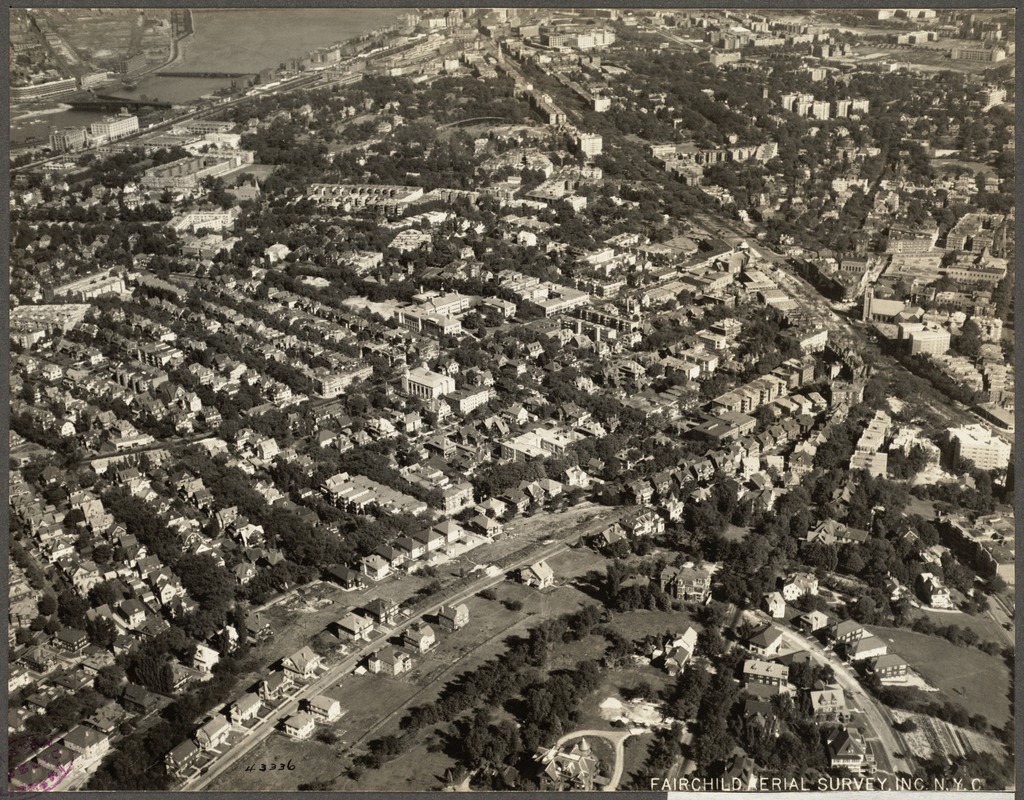
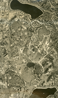
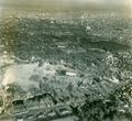
Aerial View, Corey Hill, 1925
[Source: Digital Commonwealth]
|
 |
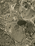
View Northeast From Chestnut Hill Reservoir
- [Lower Left] The curve of Beacon St. as it goes around the reservoir
- [Lower Right] The railroad way roughly representing the border between Brighton and Brookline now used by the MBTA D line
- [Upper Left] Brighton
- [Middle] Beacon St. running from left to right
- [Upper Center] Corey Hill
- [Far Right] Large white house on Chestnut Hill Ave.
[Source: Digital Commonwealth]
|
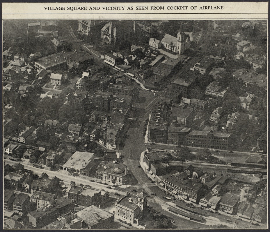 |
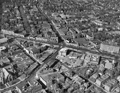
Brookline Village, Aerial View, circa 1930
Looking north.
[Source: Digital Commonwealth]
|
 |
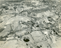
Aerial Photo, Warren St. Area, 1930
[Source: Digital Commonwealth]
|
 |
Aerial Photo, Warren St. Area, 1930
[Source: Digital Commonwealth]
|
 |
Aerial Photo, Sargent's Pond Area, 1930
Cottage St. on the left.
[Source: Digital Commonwealth]
|
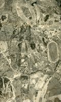 |
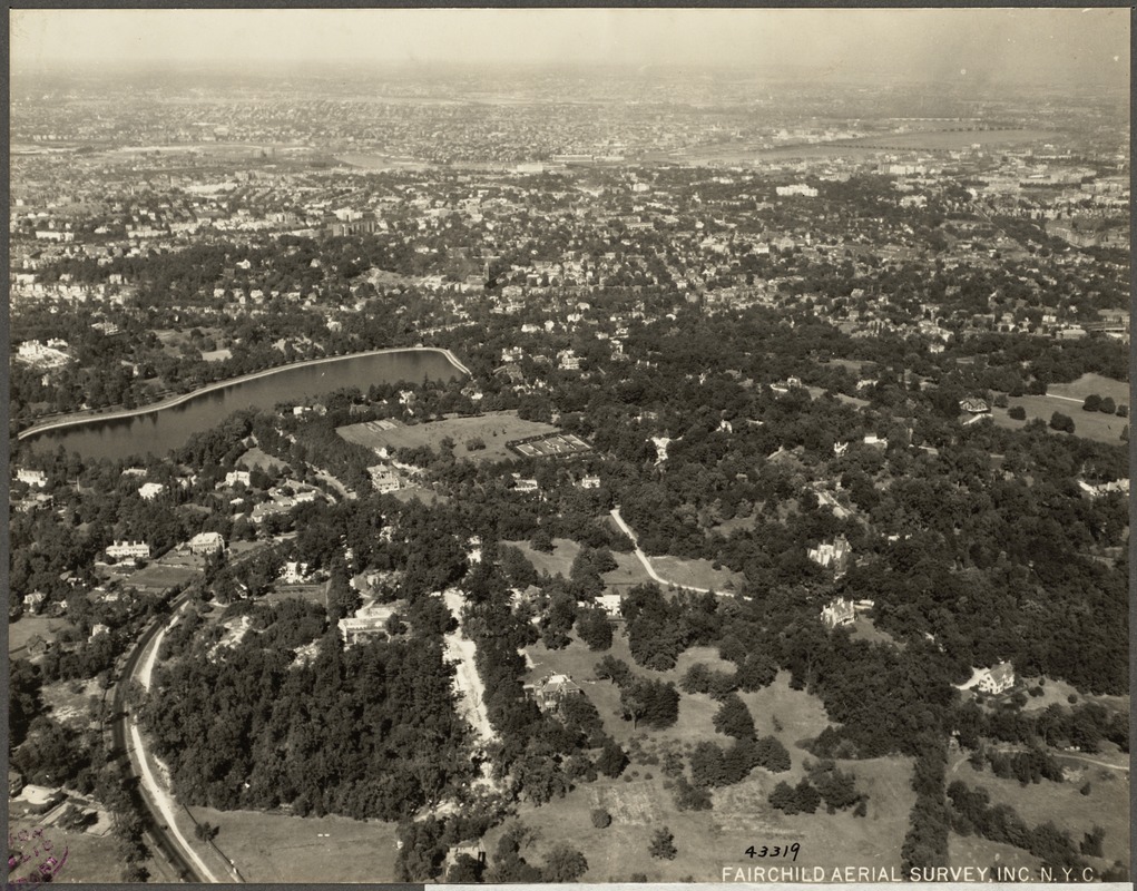
Aerial Photo, The Country Club Area, 1930
Newton St. runs left to right.
[Source: Digital Commonwealth]
|
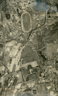 |
Aerial Photo, The Country Club Area, 1930
Newton St. runs left to right. Partial view of the Larz Anderson estate on the right.
[Source: Digital Commonwealth]
|
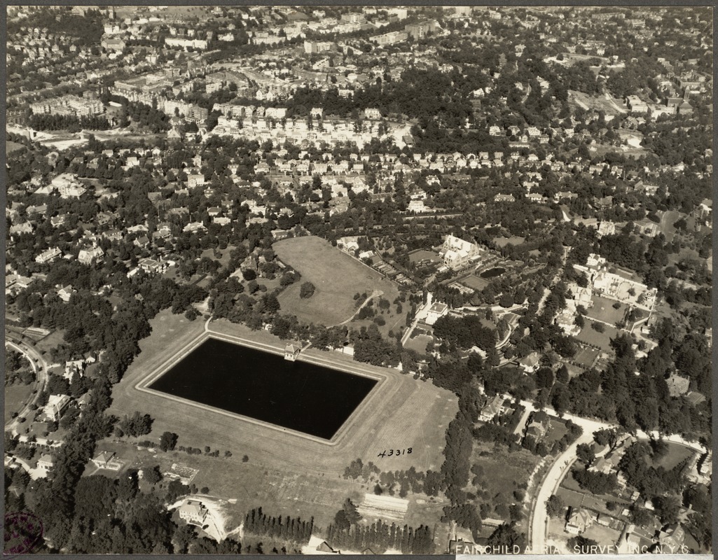 |
Aerial View, Fisher Hill, 1925
[Source: Digital Commonwealth]
|
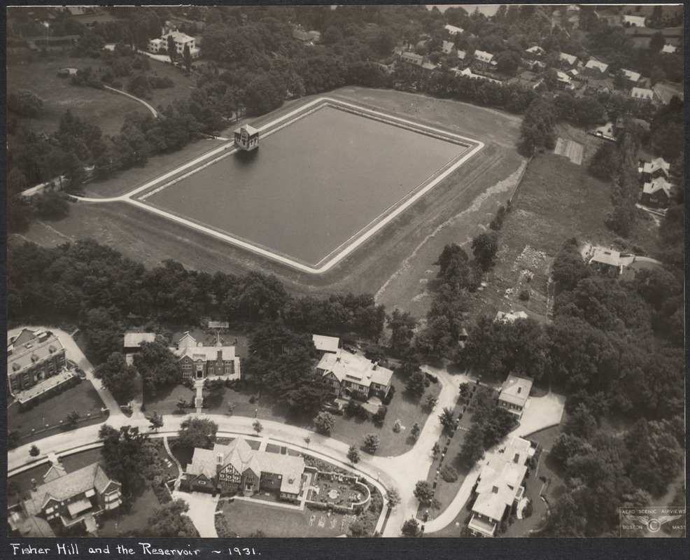 |
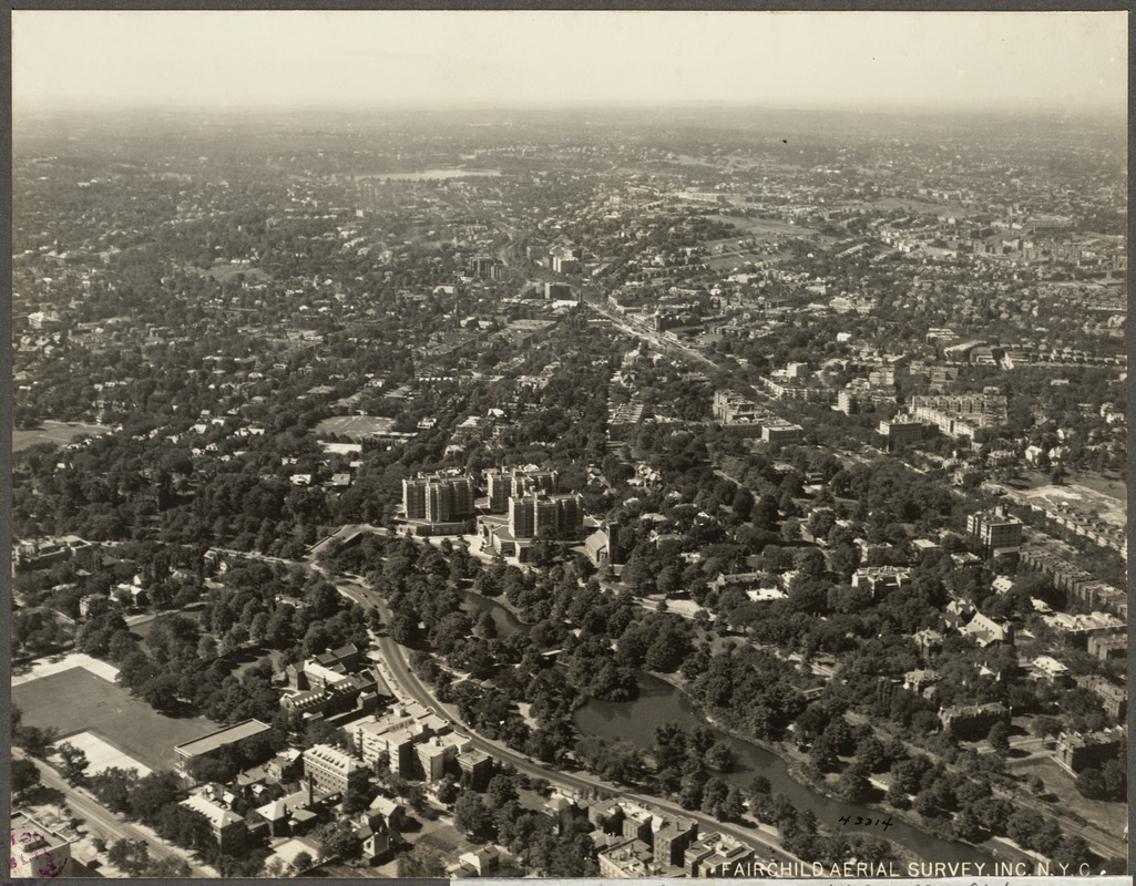
Aerial View of Fisher Hill, 1931
Viewed in the foreground abutting the reservoir, from left to right, are #146, #154, #166 Hyslop Rd. On the other side of Hyslop Rd. are #147 and #161. On the right is #170 Hyslop Rd. All are still standing.
[Source: Digital Commonwealth]
|
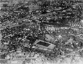 |
Fisher Hill, Aerial View
[Source: National Archives]
|
 |
Aerial View, North Brookline, Circa 1930
Charles River (photo top left); Beacon St (photo middle top to middle right); Summit Ave. (photo middle bottom)
|
 |
Aerial View, Coolidge Corner
[Source: Brookline Preservation Department]
|
 |
Aerial View, Longwood Area, 1925
[Source: Digital Commonwealth]
|
 |
Aerial View, Southeast Brookline, Circa 1930
Looking from Jamaica Pond area toward Rt. 9 reservoir (photo middle), Fisher Hill Reservoir, and NW to Chestnut Hill Reservoir (photo upper left), Intersection of Goddard Ave. and Cottage St, photo lower left.
|
 |
Aerial View, Southeast Brookline, 1925
[Source: Digital Commonwealth]
|
 |
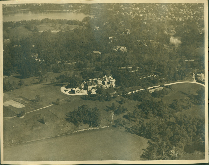
Aerial View, Larz Anderson Park Northward
Larz Anderson Park in the foreground, Jamaica Pond on the right, Charles River in the distance.
[Source: Brookline Preservation Department]
|
 |
Aerial View, Larz Anderson Park Northward
Locations by clock position:
- [2:30] Larz Anderson estate
- [3:30] Pond St.
- [8:30] Mt. Walley Ave.
- [11:00] The Country Club horse-racing track
[Source: Brookline Preservation Department]
|
 |
Aerial View, Larz Anderson Park Northward
[Source: Historic New England]
|
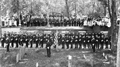 |
Memorial Day Ceremony
At the Old Burying Ground on Walnut St.
[Source: Brookline Preservation Department]
|

