|
The Society
Historical Information
Photo & Map Collections
Exploring Brookline
Links
Program Archives
|
Photo Collection
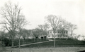 |
Property of W. B. Sears, circa 1888
Northwest corner of Washington and Beacon Streets, located approximately at today's 740 Washington St. Torn down in 1897.
|
 |
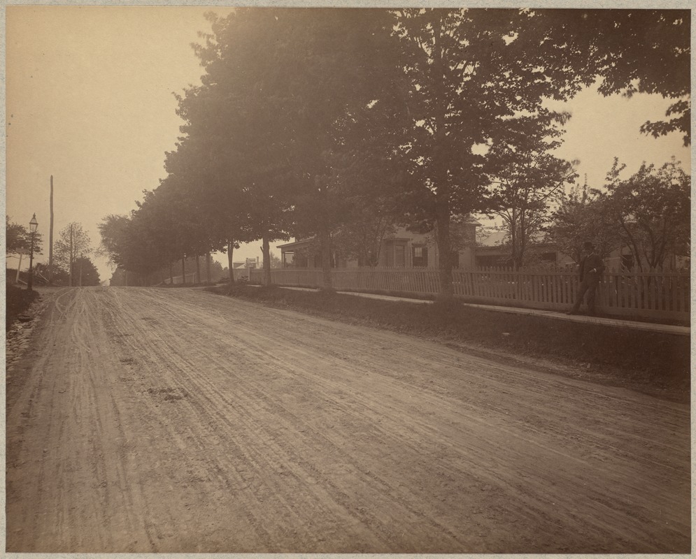
Washington Sq. Looking West on Beacon St., 1887
Winthrop Rd. is along the top of the hill.
From the 1887 photo series taken just before the widening of Beacon St., most likely by Augustine H. Folsom, a Boston photographer.
This photo contains the mystery man, here sitting on the stone fence, who was posed in a number of the 1887 photos.
|
 |
Beacon St., Washington Sq., 1887
Looking West on Beacon, Washington St. going north to the right.
From the 1887 photo series taken just before the widening of Beacon St., most likely by Augustine H. Folsom, a Boston photographer.
This photo contains the mystery man, here sitting on the stone fence, who was posed in a number of the 1887 photos.
[Source: Digital Commonwealth]
|
 |
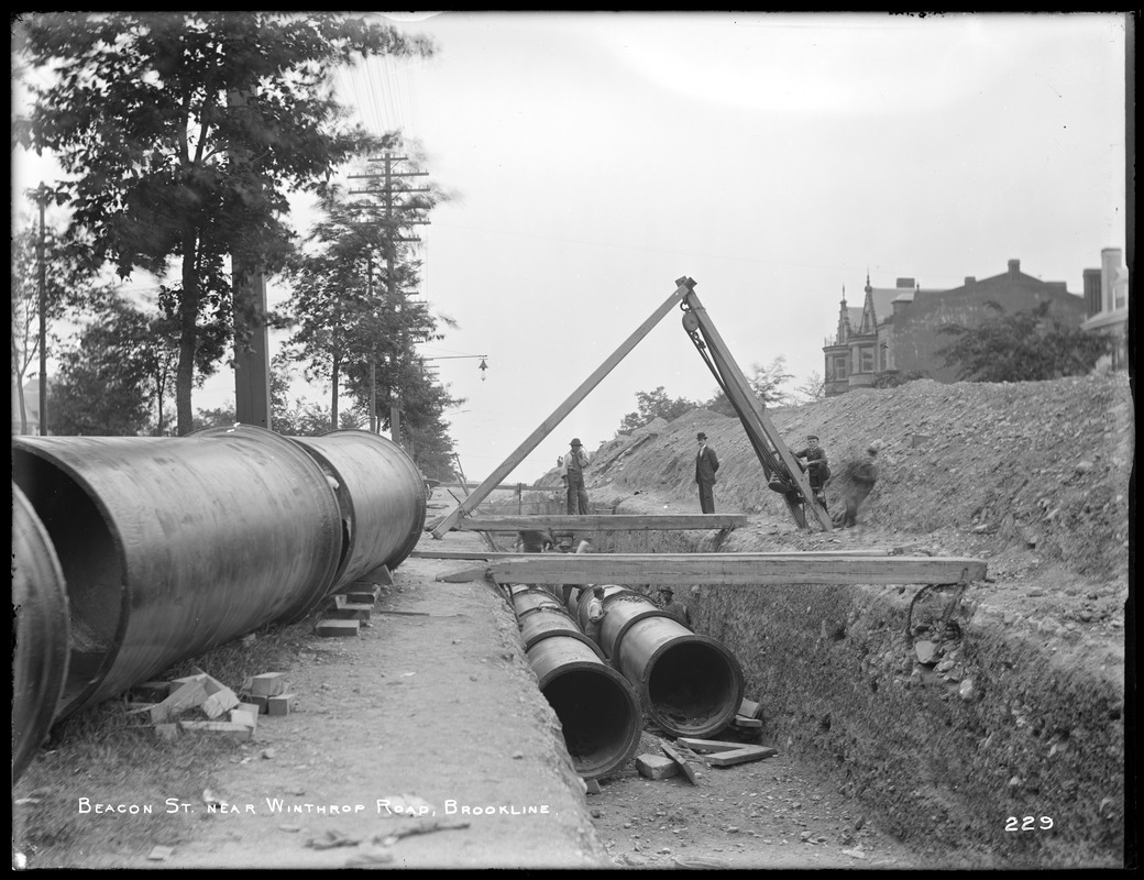
Beacon St., East of Washington Sq., 1896
Looking west on Beacon St. just before the intersection with Washington St. From left to right:
- South side of Beacon St.: unidentified apartment building
- 1680 Beacon St., still standing, opposite Winthrop Rd.
- 1668 Beacon St.: the white house, no longer standing.
- Center photo, the northwest corner of Washington St.: a small one-room building with large lettering on three sides
- Right, obscured by trees: three houses possibly on the northeast corner with Washington St.
- Near right, behind the pipes: the pedestrian stairs by Lancaster Terrace
[Source: Digital Commonwealth]
|
 |
Beacon St., East of Winthrop Rd., 1896
Looking west on Beacon St. The building viewed is at 1680 Beacon St., still standing, opposite Winthrop Rd.
[Source: Digital Commonwealth]
|
 |
Beacon St. Just West Of Washington Sq.
Looking east, Corey Hill on the left, Washington St. crossing at the bottom of the hill. Eben Jordan mansion, built in 1890, prominent.
|
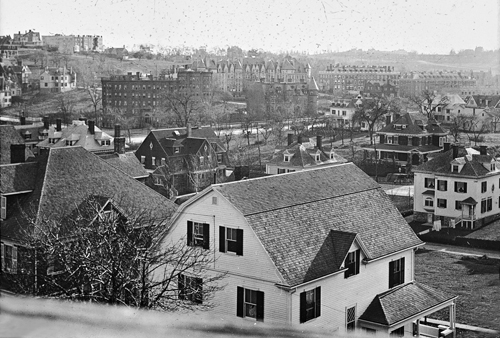 |
Aspinwall Hill, Looking SW from Lancaster Terrace
In the immediate foreground is the rear of the white house at 65 Westbourne Terrace. Slant right from it, in a view not yet blocked by the erection of the Michael Driscoll School, is the rear of 747 Washington St. Behind that, slant left, is the darker house at 736 Washington St. All are still standing.
In the rear of the photo are the apartment buildings across Beacon St. that make up the Beaconsfield Terrace complex.
[Source: Iowa State]
|
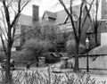 |
16 Addington Rd.
[Source: Brookline Preservation Department]
|
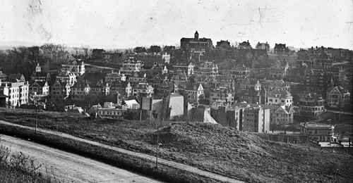 |
Aspinwall Hill, Looking SSW from Corey Hill
Background: Washington, University, Winthrop streets
Foreground right: building currently housing Athan's, corner Washington & Beacon
Background center: skyline houses on Addington Rd. Large mansion to the left with the tall spire was built by Clarence Esty at 97 Addington Rd. part of a group of Esty houses that have since been replaced by Schick Park. The spire was an observation tower equipped with a high-powered telescope that enabled detailed viewing of distant scenes.
[Source: Iowa State]
|
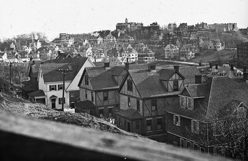 |
Aspinwall Hill, Looking SSW from Corey Hill
Background center: Washington, University, Winthrop streets
Foreground: rear of houses of Westbourne Terrace (from right to left: 61, 57, 53, 49, 45)
[Source: Iowa State]
|
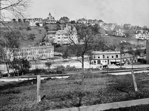 |
Corey Hill
Viewed from Gardner Road. [Center right] building currently housing Athan's, corner Washington & Beacon
[Source: Iowa State]
|
 |
Corey Hill Terraces
Circa 1890. Plan of lots, Aspinwall and Lincoln, Engineers
[Source: Leventhal Map enter]
|
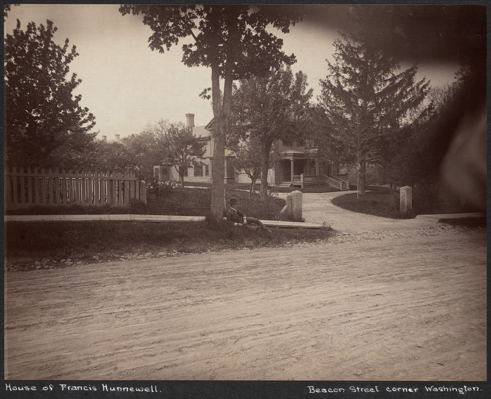 |
Beacon St., Francis Hunnewell House, 1887
Beacon St. north side, just west of Washington St.
From the 1887 photo series taken just before the widening of Beacon St., most likely by Augustine H. Folsom, a Boston photographer.
This photo contains the mystery man, here leaning against the tree, who was posed in a number of the 1887 photos.
[Source: Digital Commonwealth]
|
 |
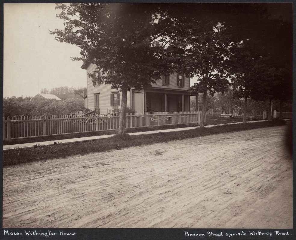
Moses Withington House, Beacon St., 1887
Across from Winthrop Rd., around today's #1680 Beacon St.
From the 1887 photo series taken just before the widening of Beacon St., most likely by Augustine H. Folsom, a Boston photographer.
This photo contains the mystery man, here leaning against the fence, who was posed in a number of the 1887 photos.
[Source: Digital Commonwealth]
|
 |
Moses Withington House, Beacon St., 1887
Across from Winthrop Rd., around today's #1680 Beacon St. Visible is the partial removal of the fence in preparation for moving the house back to accommodate the widening of Beacon St..
From the 1887 photo series taken just before the widening of Beacon St., most likely by Augustine H. Folsom, a Boston photographer.
[Source: Digital Commonwealth]
|
 |
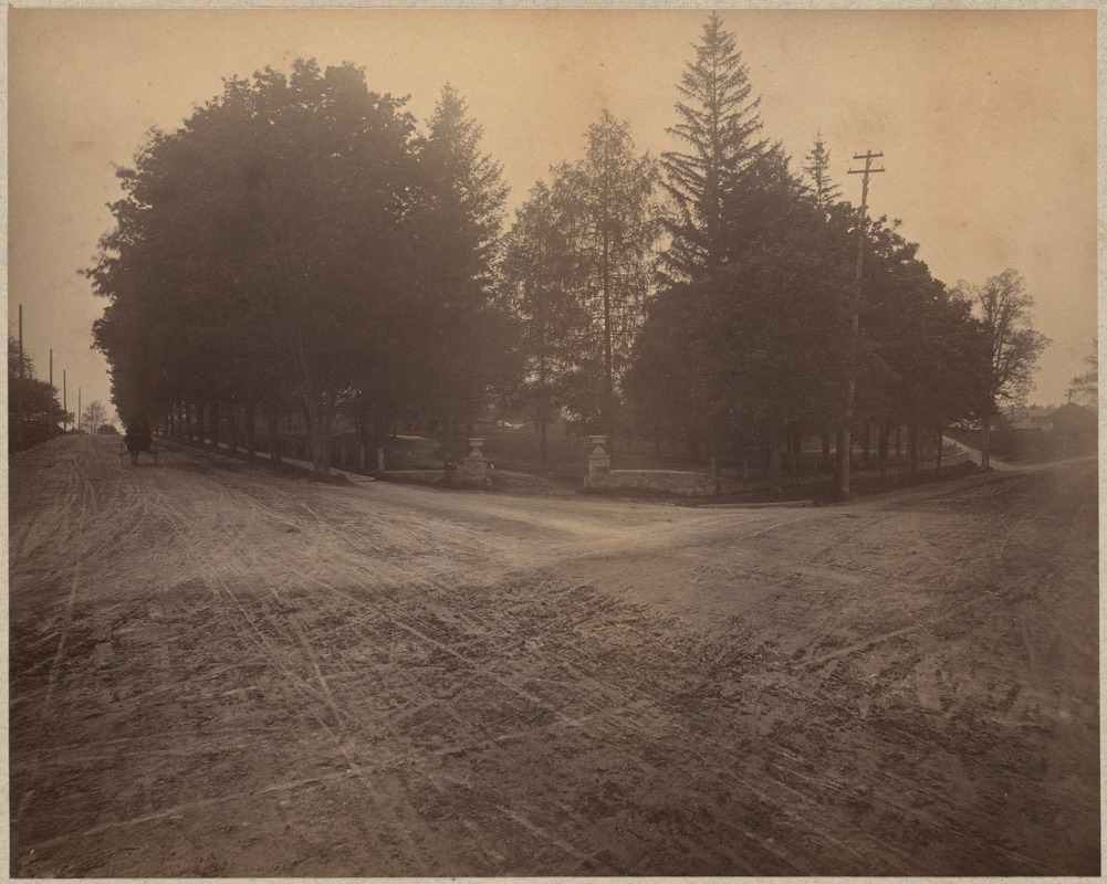
Beacon St. & Winthrop, 1887
Looking east on Beacon St., Winthrop on the right. Washington Square is at the bottom of the hill. In the distance is the Clark house (formerly the Otis Withington house), roughly located at today's Lancaster Terrace. Note gas lamp in center of photo.
From the 1887 photo series taken just before the widening of Beacon St., most likely by Augustine H. Folsom, a Boston photographer.
|
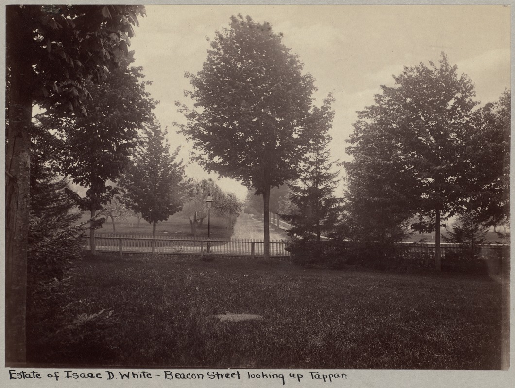 |
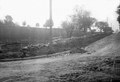
Beacon St. at Tappan St., 1887
Standing on the White property looking south at Tappan St.
From the 1887 photo series taken just before the widening of Beacon St., most likely by Augustine H. Folsom, a Boston photographer.
[Source: Digital Commonwealth]
|
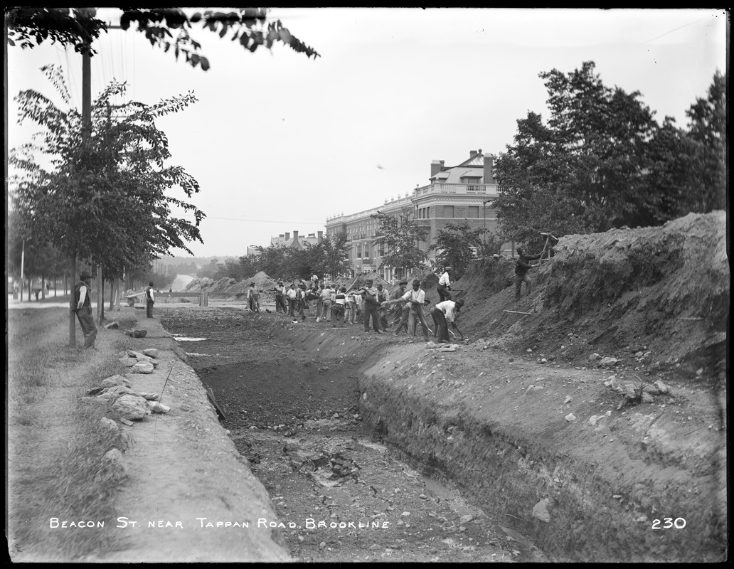 |
Beacon St. at Tappan St., 1896
Looking west
[Source: Northeastern University]
|
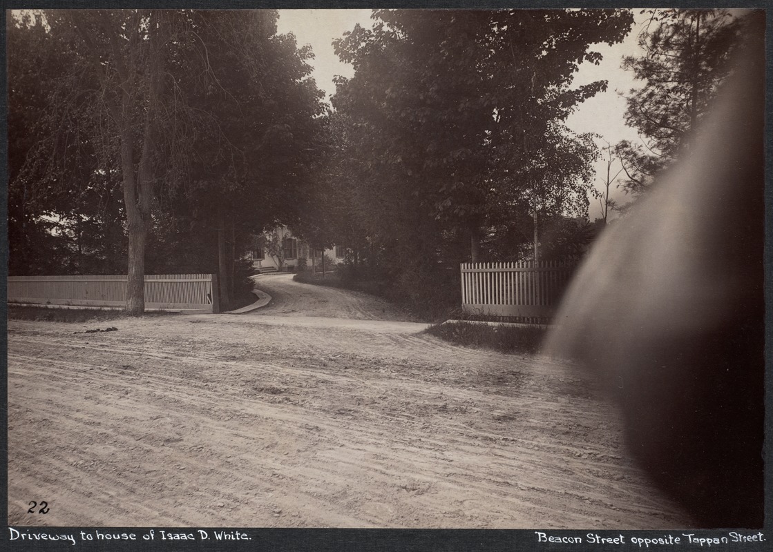 |
Beacon St., Isaac D. White House, 1887
Beacon St. going west to the left. At about #1702, across from Tappan St.
From the 1887 photo series taken just before the widening of Beacon St., most likely by Augustine H. Folsom, a Boston photographer.
[Source: Digital Commonwealth]
|
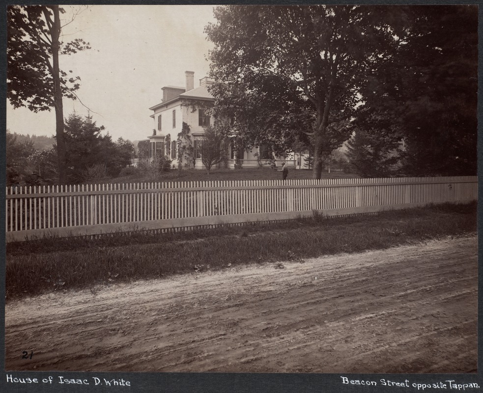 |
Beacon St., Isaac D. White House, 1887
At about #1702, across from Tappan St.
From the 1887 photo series taken just before the widening of Beacon St., most likely by Augustine H. Folsom, a Boston photographer.
[Source: Digital Commonwealth]
|
|

