|
The Society
Historical Information
Photo & Map Collections
Exploring Brookline
Links
Program Archives
|
Photo Collection
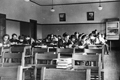 |
High School Biology Class, 1933
From the pamphlet entitled Brookline School Photos, Taken and Finished by the Guidance Department, 1933
[Source: Brookline Preservation Department]
|
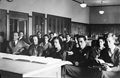 |
High School Chemistry Class, 1933
From the pamphlet entitled Brookline School Photos, Taken and Finished by the Guidance Department, 1933
[Source: Brookline Preservation Department]
|
 |
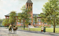
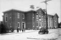
High School
Built in 1893.
Seen from the rear. The auditorium is in the center rear.
[Source: Brookline Preservation Department]
|
 |
High School
Built in 1893
|
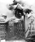 |
High School Fire, 1936
|
 |
Pierce Primary School
(ID) 028
(Slide ID) P 25-19
[Source: William Robert Murphy Collection]
|
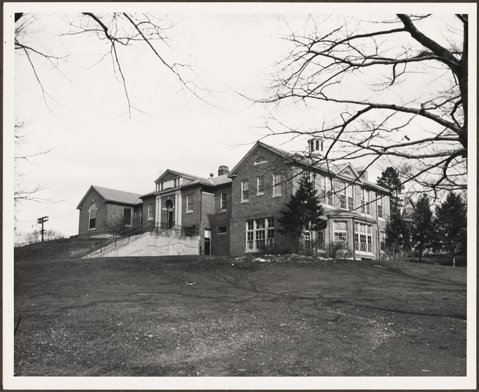 |
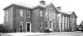
Baldwin School, 1957
Opened in 1927
[Source: Digital Commonwealth]
|
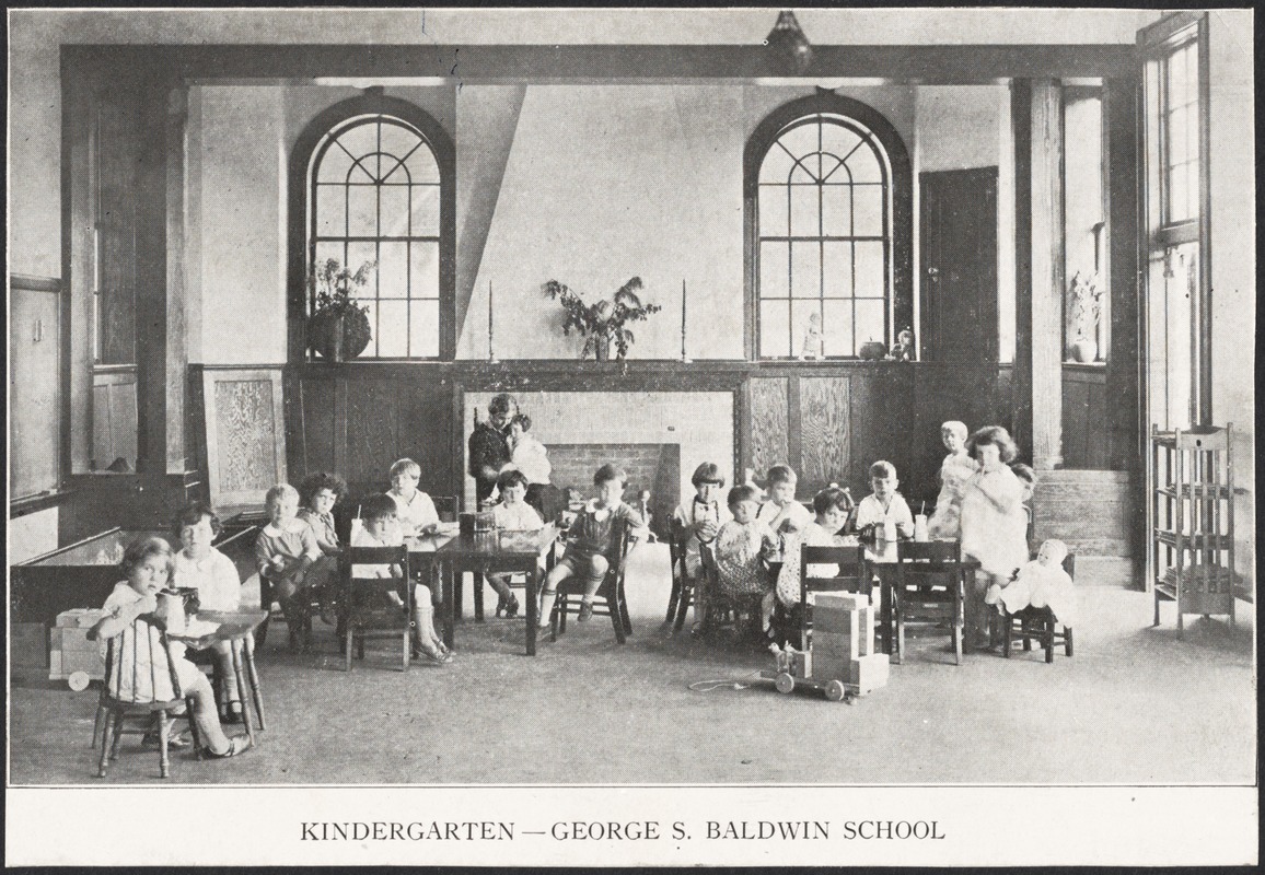 |
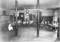
Kindergarten, Baldwin School
Opened in 1927
[Source: Digital Commonwealth]
|
 |
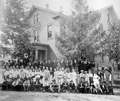
St. Mary of the Assumption Band, 1912
Front Row, Left to Right: Francis McAdams, James Mahoney, Joseph Sweeney, William Kendrick, John O'Neill, Leo O'Neill, Constantino Martini, Leonard Hope.
Second Row: Alphonsus Johnson, George O'Day, Thomas .Kendrick, Joseph Nevins (Drum Major), Rev. John P. Sheehan, Prof A. Ferretti (Director), James O'Neill, Thomas Maguire, John Sullivan, James Tonra.
Third Row: Edward Kickham, Peter Rooney, John Mulvey, Thomas Love, Francis Regan, Arthur Mulholland, John Maguire, William Ward, Michael Tonra, John Hope.
Fourth Row: Edward Keaveny, Patrick Tonra, Roy Videon, Francis Kelleher, Edward O'Neil, Fergus Hickey, Francis Mahon, Francis Lorance, Charles Lacy.
Fifth Row: Michael Mulvey, John Hickey, Edward McGrath, William Donovan, John Kendrick, Edward Lee.
|
 |
Parsons School, First Grade, 1892
Walter Ave. in neighborhood formerly known as "The Farm" that was later razed and replace by the Brook House development.
Page 10, plate 7284. From an album of fifty photographs of Brookline schools, classrooms, and examples of clay modeling, wood-working, and cooking. Produced for the 1893 World's Columbian Exposition.
[Source: Brookline Preservation Department]
|
 |
Runkle School, Graduating Students, 1921
These buildings were demolished in 1962 and replaced by the current buildings at 50 Druce St. The June 25, 1921 issue of the Chronicle lists the following 83 graduates (29 boys and 54 girls). The class photo, however, only shows 41 students (14 boys and 27 girls). The discrepancy is unexplained. An additional curiosity is the fact that the girls outnumber the boys two-to-one.
Class list:
Josephine J. Albrecht
Alice Atkins
Mildred E. Bates
Norman J. Beisel, Jr.
Lydia N. Blythe
Jennie Z. Bronstein
Emily E. S. Bull
Robert M. Burley
Sylvia R. Carol
Elizabeth A. Chisholm
Elizabeth Clark
Sylvia Clark
Eleanor M. Coakley
Phyllis E. Coffin
Mabel P. Cook
Dorothy Cottrell
Rosamond M. Cummings
Ellwood M. Currier
Lawrence E. Duane
Eleanor F. Duff
Margaret W. Dukelow
Olga W. Eastman
Elbridge G. Emmons, Jr.
J. Prescott Emmons
Eleanor A. Fitts
Helena F. Flanagan
John T. Floyd, Jr.
Margaret Folsom
Charles Frank, Jr.
Elizabeth Frank
Natalie Gallagher
Eileene G. Goudey
Marion F. Gould
Nannette Gutman
Sears L. Hallett
Elizabeth C. Haven
Virginia Haynes
Virginia Heiges
Ransom F. Hodges
Clarice G. Holloway
George C. Humphreys
|
Charlotte L. James
Margaret Jenkins
Albert A. Johnson, Jr.
Barbara T. Joss
Elisabeth B. Keyes
Dorothy Klous
Cynthia W. Lynch
Florence W. MacDougall
Florence M. Marshall
Merriam J. Marshall
Eleanor H. Matsuki
John A. McField
Paul D. McManus
Sheldon Miner
Dorothy L. Morgan
Eugenia E. Morse
William W. Munsell
Madeline E. Murphy
Frederick K. Daggett, Jr.
Kingsbury S. Nickerson
Estella M. Norris
George F. Olsen, Jr.
Miriam S. Orlick
Mary E. Roblin
Barbara D. Rogers
Richard W. Sallinger
Henry S. Shea
Frank E. Sheldon
Wilma Small
Eric F. Smith
Carolyn Stanley
Dorothy Stone
Righton M. Swicegood
Edith H. Townsend
Gordon Tucker
Francis W. Tully, Jr.
Constance Tyler
Ruth Walker
Ethel M. Ward
George M. Watson, Jr.
Katharine B. Whitney
William H. Willis, Jr.
|
|
 |
John D. Runkle School, circa 1900
Looking east at 50 Druce St. This is an early photo of the first building that was opened in 1897. Two more were added in 1902 to form three quarters of a quadrangle. They were all replaced by the current school in 1962.
[Source: Digital Commonwealth]
|
 |
John D. Runkle School
Looking east at 50 Druce St. The first building, on the right, was opened in 1897. The other two, forming three quarters of a quadrangle, were added in 1902. They were all replaced by the current school in 1962.
[Source: Digital Commonwealth]
|
 |
Runkle School Children
Buildings demolished in 1962 and replaced by the current buildings at 50 Druce St.
|
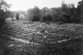 |
Unidentified School Gardens
[Source: Brookline Preservation Department]
|
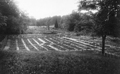 |
Unidentified School Gardens
[Source: Brookline Preservation Department]
|
 |
Union Building, Kindergarten Class, 1892
The Union Building, located at the corner of High and Walnut streets, was razed in 1961 for public housing.
Page 11, plate 7285. From an album of fifty photographs of Brookline schools, classrooms, and examples of clay modeling, wood-working, and cooking. Produced for the 1893 World's Columbian Exposition.
[Source: Brookline Preservation Department]
|
 |
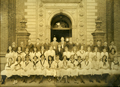
Pierce Grammar School, Prospect St., circa 1876
The students are arrayed in front of the original Pierce Grammar School. There are a number of older-appearing students so it can be assumed that the photo includes students from the high school that was just next door.
There were two Pierce School buildings, Grammar and Primary. This is the original Grammar building, built in 1855 on the west side of Prospect St. This building was incorporated into the 1904 replacement building for the Primary School, still standing, and its right side can be viewed there today.
[Source: Brookline Public Library]
|
 |
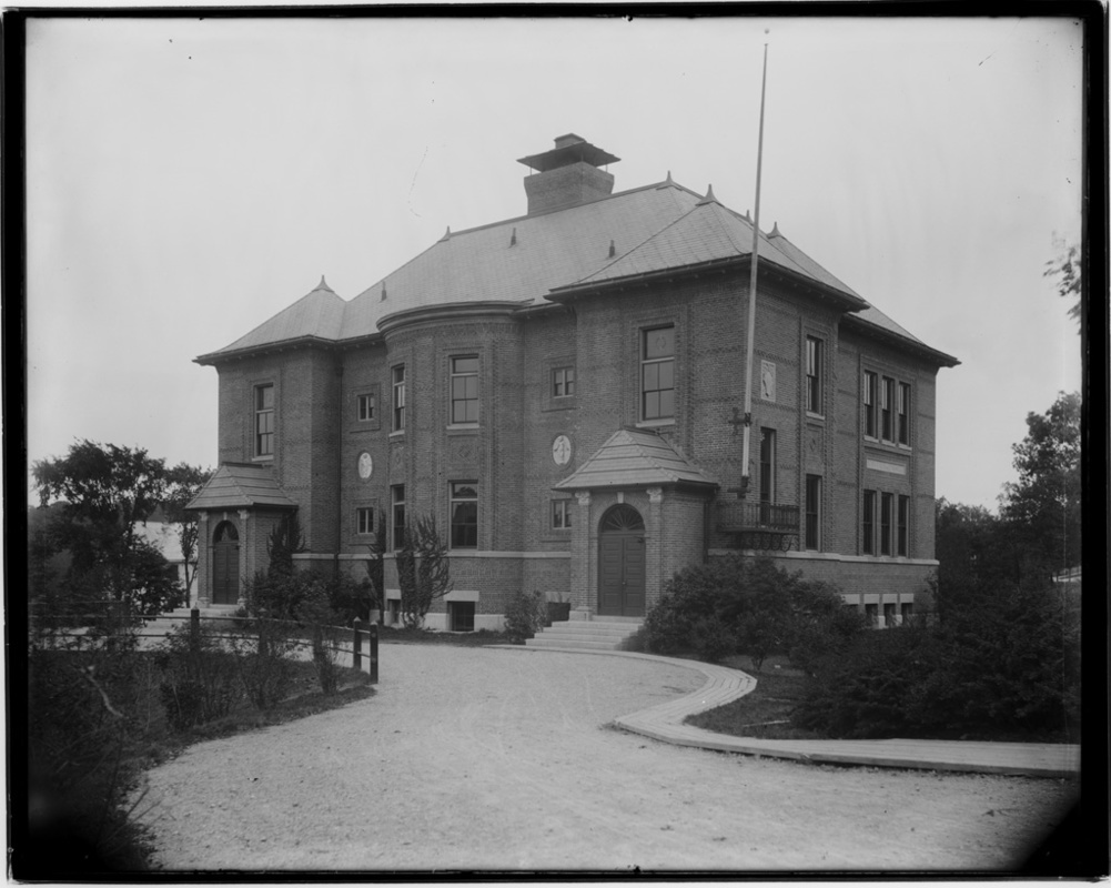
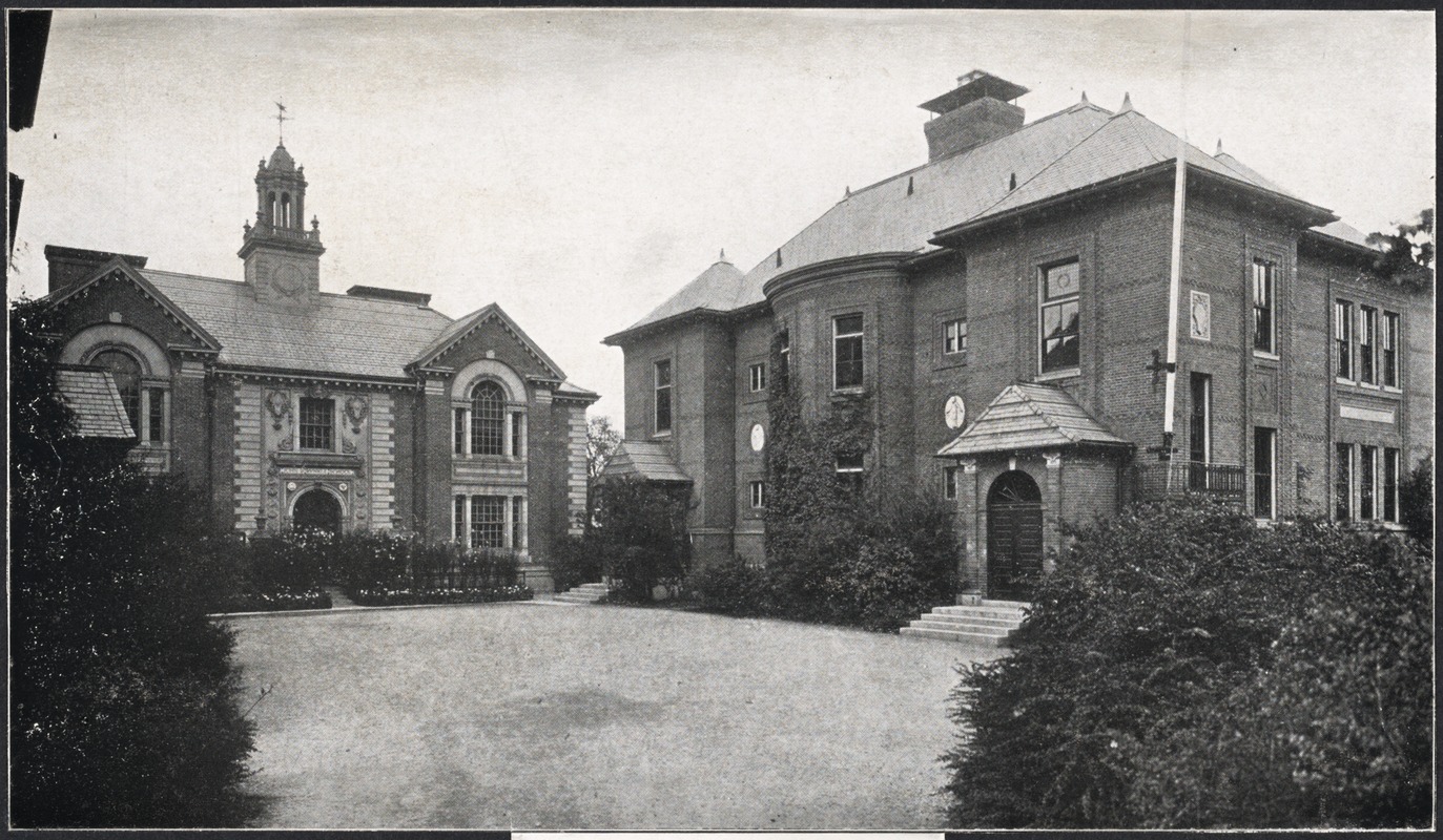
Pierce Primary School
There were two Pierce buildings, Grammar and Primary. A new, larger, Pierce Grammar School had recently opened on School St. in 1901. This building, the new Primary School building, was opened in 1904 as part of an expansion of both schools. It incorporated parts of the old Pierce Grammar School, accessible today around the right side, and still stands today as the Pierce Historical Building.
|
 |
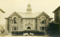
Pierce Grammar School, School St., 1905
Opened in 1901 as a replacement for the much smaller school located behind it on Prospect St. No longer standing.
|
|

