 |
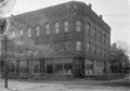
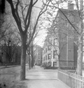
Harvard St. at School St.
Standing on Aspinwall Ave. School St. is on the right with the houses at 16/18 School St. and 2 Prospect St. and the Pierce Grammar School are visible. Harvard Hall at 6 School St. was a large area upstairs used for parties and meetings. The stores, numbered 82-90, are on the west side of Harvard St. The only identifiable one is William Sundell, Painting & Glazing, 84 Harvard St.
(ID) 139
(Slide ID) P-8-8
[Source: William Robert Murphy Collection]
|
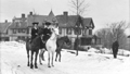 |
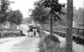
Hyslop Rd. at Druce St., circa 1906
Looking west on Hyslop Rd. Most likely shown are Edward Ruhl and two of his daughters at the corner with Druce St. The houses in the photo are no longer standing.
|
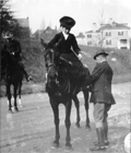 |
Hyslop Rd. at Druce St., circa 1906
Looking west on Hyslop Rd. at the corner with Druce St. Most likely shown are Edward Ruhl, one of his daughters, and his son, In the distance on the right is 70 Hyslop Rd. and, in the middle, 125 Holland Rd., both still standing.
|
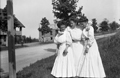 |
Ruhl Family, 37 Hyslop Rd.
Looking east on Hyslop Rd. from the Ruhl house at 37 Hyslop Rd. 29 Hyslop Rd. is under construction. The Ruhls moved to their new house, then oddly addressed as 88 Druce St., in 1905. The three younger daughters of Edward and Mary Ruhl - Elsie, Louise, and Mary - are standing across the street.
|
 |
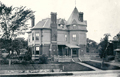
30 Irving St.
Looking down Irving St. toward Walnut St. Upland Rd. is on the right. The longtime home of Dr. George Sabine and later, the Oveson family, it was torn down in the late 1930s.
[Source: Brookline Preservation Department]
|
 |
39 Irving St., Before 1890
Upland Rd. is to the right of the house followed by a partial view of 43 Upland Rd., both houses are still standing. None of the houses that were constructed in the rear on Upland Rd. beginning in 1890 are present.
[Source: Brookline Preservation Department]
|
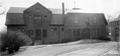 |
Town Stables, Kendall St. and Cypress St.
Cypress St. is to the left, building is still standing.
(ID) 091
(Slide ID) P 24-8
[Source: William Robert Murphy Collection]
|
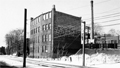 |
65 Kent St., Rear, January 1966
This substantial brick building was torn down in 1974 as the Marsh Urban Renewal Project was entering its core phase. Its removal accommodated the addition of a few additional feet for the covered parking platform straddling the tracks that remains today.
In the distance o the right is 74 Kent St. The large smoke stack of Brannens Laundry had been there for 75 years and was even considered to be an historic landmark of sorts when it had to be torn down in 1980.
From a notebook of property-appraisal photos taken in 1965 and early 1966 for The Marsh Urban Renewal Project run by the Brookline Redevelopment Authority. Only a few scattered peripheral structures remain today.
|
 |
Netherlands Rd. Bridge Over the Muddy River
Looking northwest across Netherlands Rd. at the garage and rear of the house at 203 Kent St.
(ID) 120
(Slide ID) P-28-2
[Source: William Robert Murphy Collection]
|
 |
Kent St.
Looking north on Kent St. from Linden St. The entrance porch to 122 Kent St. is visible on the left. The bridge over Aspinwall is faintly visible on the right.
(ID) 144
(Slide ID) P-9-8
[Source: William Robert Murphy Collection]
|
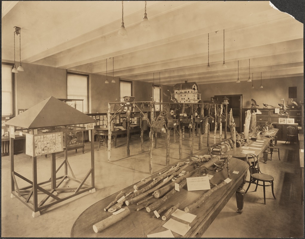 |
Brookline Bird Club Exhibition, 1914
This is an exhibition of the Brookline Bird Club and the town forestry department held at the library in April 1914.
[Source: Digital Commonwealth]
|
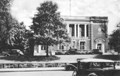 |
Public Library, 1940
|
 |
Linden Street Development Plan Early Sketch
[Source: Brookline Preservation Department]
|
 |
Linden Street Development Plan
[Source: Brookline Preservation Department]
|
 |
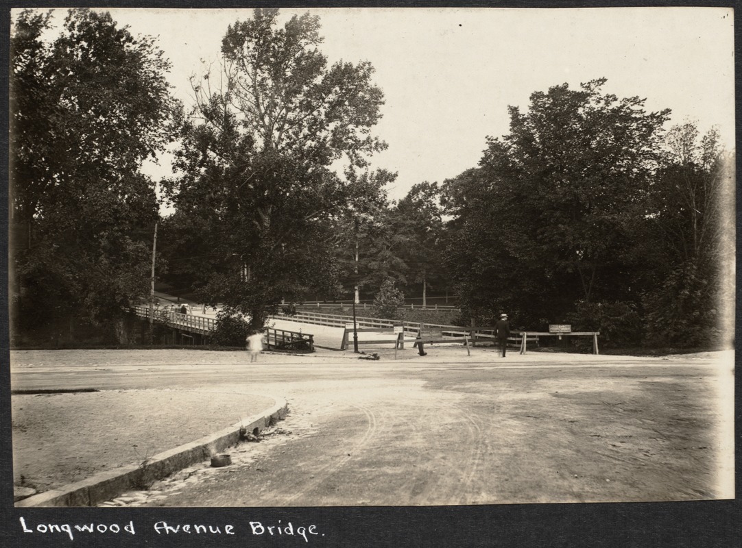
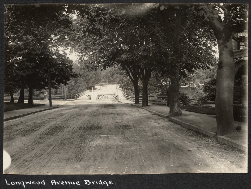
Longwood Ave. Bridge, 1899
Looking toward Boston from Chapel St. The bridge has recently opened and replaced the old wooden bridge there.
(ID) 161
(Slide ID) P-27-11
[Source: William Robert Murphy Collection]
|
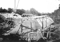 |
Construction of the Longwood Ave. Bridge, July 16, 1898
Looking toward Boston.
(ID) 040
(Slide ID) P 26-25
[Source: William Robert Murphy Collection]
|
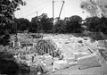 |
Construction of the Longwood Ave. Bridge, July 16, 1898
Looking west. In the background on the right is the carriage house of the Richards estate, location of the present-day Longwood Towers. On the left is 197/199 Longwood Ave., still standing.
(ID) 041
(Slide ID) P 26-24
[Source: William Robert Murphy Collection]
|
 |
Longwood Ave., circa 1898
Looking east at the old wooden bridge at Chapel St. The bridge is closed which most likely indicates that construction of the new stone bridge is about to commence. .
[Source: Digital Commonwealth]
|
 |
Longwood Ave., circa 1898
Standing at 197/199 Longwood Ave. looking east at the old wooden bridge at Chapel St. The bridge is closed which most likely indicates that construction of the new stone bridge is about to commence. Note two people seated in the hill in the distance on the right.
[Source: Digital Commonwealth]
|
 |
Carlton St. at Monmouth St., circa 1910
Lookng north from Monmouth St. The apartment building at 40 Carlton St. on the northwest corner has not yet been erected (1924).
|

