 |
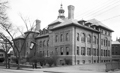
Pierce Grammar School, School St.
Opened in 1901 as a replacement for the much smaller school located behind it on Prospect St. No longer standing.
(ID) 122
(Slide ID) P-25-18
[Source: William Robert Murphy Collection]
|
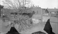 |
Park Department Stables, Pierce St.
On the right is the rear of a house set back from Harvard St. across from St. Mary's church.
(ID) 126
(Slide ID) P-24-9
[Source: William Robert Murphy Collection]
|
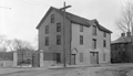 |
Brookline Waterworks, Pearl St.
This location was the pipe yard for the water department for many years. The rear of the Winthrop School building on Brookline Ave. is to the right.
(ID) 132
(Slide ID) P-24-17
[Source: William Robert Murphy Collection]
|
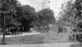 |
Reservoir Rd., 1910
Unidentified project
(ID) 026
(Slide ID) P 27-16
[Source: William Robert Murphy Collection]
|
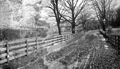 |
Reservoir Rd., 1903
Looking sorth as the road approaches Boylston St. From left to right:
- Foreground left: the land of Ebenezer Warren Reed that will soon become the site of the Heath School
- 39 Eliot Crescent, on the far left; a three-story apartment building built in 1901, still standing
- Houses on Duffy Court, Eliot Crescent, and Boylston St.
- At the end of Reservoir Road at the corner of Boylston Street – the house of Ebenezer Warren Reed
(ID) 123
(Slide ID) P-9-2
[Source: William Robert Murphy Collection]
|
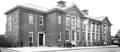 |
Pierce Primary School
(ID) 028
(Slide ID) P 25-19
[Source: William Robert Murphy Collection]
|
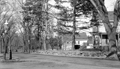 |
168 South St. at Grove St.
This is speculatively identified as looking north on South St. with Grove St. to the right, the long-time home of John Magee and family.
(ID) 085
(Slide ID) P 60-12
[Source: William Robert Murphy Collection]
|
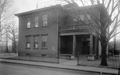 |
Longwood School, St. Mary's St.
This is the only known photo of the school. Note that this is a different school than the Longwood Day School on Browne St.
(ID) 119
(Slide ID) P-25-11
[Source: William Robert Murphy Collection]
|
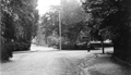 |
Thayer St. and Waverly St, August 17, 1926
Thayer St. is straight ahead.
(ID) 066
(Slide ID) P 63-17
[Source: William Robert Murphy Collection]
|
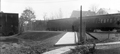 |
Beaconsfield Train Station; October 31, 1917
Standing by the garage for the Beaconsfield Terraces complex looking south at 311 and 317 Clark Rd.
(ID) 112
(Slide ID) ?
[Source: William Robert Murphy Collection]
|
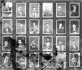 |
Portrait Photos, Town Engineering Dept., 1924
(ID) 114
(Slide ID) ?
[Source: William Robert Murphy Collection]
|
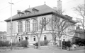 |
Police Station, Jan 31, 1919
(ID) 145
(Slide ID) P-23-14
[Source: William Robert Murphy Collection]
|
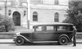 |
Police Ambulance, 1930
(ID) 162
(Slide ID) P-98-5
[Source: William Robert Murphy Collection]
|
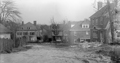 |
Unidentified, April 30, 1927
Possibly in the Aspinwall Hill area
(ID) 124
(Slide ID) P-9-22
[Source: William Robert Murphy Collection]
|
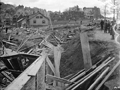 |
1501 Beacon St.
Standing on the south side of Beacon St. looking west. The apartment building at 108-116 Winthrop Rd. is in the upper left corner. In the distance on the right is the six-story apartment building at 1569-1571 Beacon St., still standing. In the foreground is the future location of Brandon Hall at 1501 Beacon St. The pile of debris is unexplained as there was no structure there previously.
(ID) 158
(Slide ID) P-1-4
[Source: William Robert Murphy Collection]
|
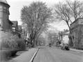 |
Waverly St., April 18, 1931
(ID) 064
(Slide ID) P 106-H
[Source: William Robert Murphy Collection]
|
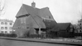 |
Parsons School, Walter Ave.
This is the only known photo of the school.
(ID) 117
(Slide ID) ?
[Source: William Robert Murphy Collection]
|
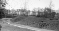 |
University Rd., 1912
Standing at the eastern end of University Rd. and Washington St. Looking at the rear of houses on Winthrop Rd. Construction of houses on University Rd. has not yet begun.
(ID) 157
(Slide ID) P-27-28
[Source: William Robert Murphy Collection]
|
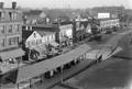 |
Lower Washington St., December 18, 1931
(ID) 015
(Slide ID) P-115-18
[Source: William Robert Murphy Collection]
|
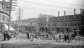 |
Relocation of the Village Brook, 1893
The work on the tunnel was completed in early 1894. Lower Washington St. going toward Boston is to the left. Note that this is one of two different views taken at the same time.
On the north side of Washington St. on the left:
- Unidentified delivery wagon labeled “B. Bancroft”
- 145 Washington St., awning of Thomas S. Brown & Co., provisions
On the south side of Washington St., from left to right:
- Trolley car on the Cypress St. line
- 106 Washington St., house of Jeremy Guilfoyle with a wagon out front
- 110 Washington St., H. G. Jordan, Coal and Wood, the office and also a sign above the alleyway leading to their coal yard at the corner with Morss Ave.
- 126 Washington St., William Frawley, custom shoemaker (note picture of boot on sign
- 126 Washington St., Luigi Barba (aka Louis Barbour and Louis Barber), fruit
- 128 Washington St., Frank T. Fay, newsdealer, cigars and tobacco
- 134 Washington St., John Barthelmes, hairdresser
- 136 Washington St., Sing Lee, laundry
Tom Condon, Sr. Civil Engineer for Brookline writes:
The work shown is part of the relocation of the outlet of the Village Brook. …(in the pile of lumber in the background you can see a piece of the curved falsework used
to hold the brick arch until the cement mortar set.). Leverett Pond was created from the Muddy River marsh located just south of Washington Street by installing a stop plank manhole (in effect an adjustable height dam) in the new culvert under Washington Street. This stop plank manhole was necessary to hold back the pond since the Charles and therefore the Muddy Rivers were still tidal at that time. Presumably, Alexis French (who was both Olmsted's engineer and the Town Engineer) determined that more flow into this new pond was necessary. To provide this additional flow, the Village Brook which flows alongside what is now the MBTA "D" line was diverted into the culvert shown under construction. The culvert runs east down Washington Street, crosses Walnut Street, runs down Morss Avenue (now discontinued), across Pond Avenue and into Leverett Pond.
(ID) 013
(Slide ID) P-13-13
(Notes) Replaces existing image
[Source: William Robert Murphy Collection]
|

 The Society
 Program Archives