 |
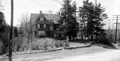
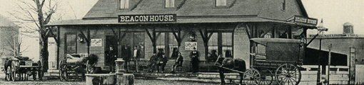
471 Heath St.
Seen from the rear on Boylston St.
(ID) 059
(Slide ID) P 2-8
[Source: William Robert Murphy Collection]
|
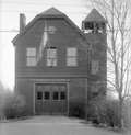 |
Fire Station F (Future Station 6), 550 Heath St.
The station opened on outer Heath St. in 1899 as Combination Wagon No. 2 with five men on site and another three on call. It was soon renamed to “Station F” following the renaming of all the houses to “stations” at the end of the same year. In the 1930s, there was another system-wide renaming from lettered stations to numbered stations. Station F became Station 6.
By 1930, it was evident that the south and west areas of town had seen a large increase in population in recent years with no change to fire coverage. It was even reported that homeowners were being charged higher insurance rates as a result. To rectify this a larger Station D on Boylston was soon built and, in 1939, Station F, now known as Station 6, was closed and the personnel moved to the new Station 6 at Hammond St. and Newton St.
(ID) 045
(Slide ID) P 24-28
[Source: William Robert Murphy Collection]
|
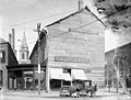 |
Harvard Square, circa 1905
This is a rare photo of the Harvard Hall building just prior to its replacement after a battle with the town and the invocation of eminent domain. The town needed to widen both Washington St. and Harvard St. and was literally shaving off sections of the building which sat at the apex of the two streets. The grocer, T. H. Dyer, insisted on remaining open and the building owner, in litigation with the town, covered the reduced and now-asymmetrical building with makeshift boarding.
(ID) 140
(Slide ID) P-14-12
[Source: William Robert Murphy Collection]
|
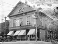 |
Harvard Square, Brookline Village, August 11, 1903
This photo shows the final stage of the full building at 11-13 Harvard Square. On the left, with its delivery wagons parked out front, is T. H. Dyer, Provisions. On the right, at #13 Harvard Sq., is Frank F. Seamens, Groceries recently renamed to L. N. Danforth. It appears that Lucius N. Danforth, a clerk at the Dyer store for two decades and at the George Joyce store there before that, has recently taken over the Seamens store. But the Danforth store will be short-lived. The town had that side of the building removed to allow for the widening of Harvard St. and a new building would replace it in two years.
(ID) 141
(Slide ID) P-14-8
[Source: William Robert Murphy Collection]
|
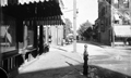 |
Harvard Square, 1898
Standing in Harvard Square looking at Kent St. From left to right:
- 11 Harvard Sq., Frank F. Seamens, Groceries. Note dated poster in the window.
- Man and unusual wagon on Kent St.
- #9 Harvard Sq., C. A. Delano, Dry Goods
(ID) 143
(Slide ID) P-7-1
[Source: William Robert Murphy Collection]
|
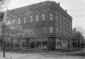 |
Harvard St. at School St.
Standing on Aspinwall Ave. School St. is on the right with the houses at 16/18 School St. and 2 Prospect St. and the Pierce Grammar School are visible. Harvard Hall at 6 School St. was a large area upstairs used for parties and meetings. The stores, numbered 82-90, are on the west side of Harvard St. The only identifiable one is William Sundell, Painting & Glazing, 84 Harvard St.
(ID) 139
(Slide ID) P-8-8
[Source: William Robert Murphy Collection]
|
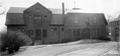 |
Town Stables, Kendall St. and Cypress St.
Cypress St. is to the left, building is still standing.
(ID) 091
(Slide ID) P 24-8
[Source: William Robert Murphy Collection]
|
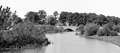 |
Netherlands Rd. Bridge Over the Muddy River
Looking northwest across Netherlands Rd. at the garage and rear of the house at 203 Kent St.
(ID) 120
(Slide ID) P-28-2
[Source: William Robert Murphy Collection]
|
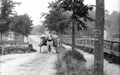 |
Kent St., circa 1903
Looking north on Kent St. from Linden St. The entrance porch to 122 Kent St. on the corner of Brook St. is visible on the left. The bridge on Aspinwall Ave. over the train tracks is faintly visible on the right.
Assigning a date to this interesting photo is challenging. The records of sewer work on Bowker St. and the apparent lack yet of a Welsbach gas lamp at Kent and Bowker point to a date around 1900. More compelling perhaps is the for-sale sign on the far right. The land had been owned by Thomas Howe who lived nearby on Linden St. His daughter, Kate, was married to Charles W. Chamberlin, the agent listed on the sign and a trustee of Howe’s estate. The plot of land was legally approved for sale in June, 1903 and purchased by the Town of Brookline in September.
(ID) 144
(Slide ID) P-9-8
[Source: William Robert Murphy Collection]
|
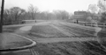 |
Longwood Ave. Bridge, 1899
Looking toward Boston from Chapel St. The bridge has recently opened and replaced the old wooden bridge there.
(ID) 161
(Slide ID) P-27-11
[Source: William Robert Murphy Collection]
|
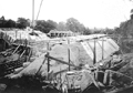 |
Construction of the Longwood Ave. Bridge, July 16, 1898
Looking toward Boston.
(ID) 040
(Slide ID) P 26-25
[Source: William Robert Murphy Collection]
|
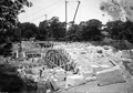 |
Construction of the Longwood Ave. Bridge, July 16, 1898
Looking west. In the background on the right is the carriage house of the Richards estate, location of the present-day Longwood Towers. On the left is 197/199 Longwood Ave., still standing.
(ID) 041
(Slide ID) P 26-24
[Source: William Robert Murphy Collection]
|
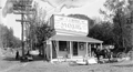 |
Store of Timothy J. Burke, Hammond St., 1900
This is the southeast corner with Boylston St. The new tracks are being laid out to the Newton line. The Burke store has been at this location for several years - it can be assumed that he was anticipating an increase in traffic and business from the new trolley line.
(ID) 024
(Slide ID) 5-17
[Source: William Robert Murphy Collection]
|
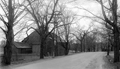 |
184 Newton St., April 18, 1931
Looking southwest on Newton St. just west of the junction with Clyde St. On the left is the outbuilding of the Joseph Orlinksi house at 184 Newton St.
(ID) 020
(Slide ID) P-110-63
[Source: William Robert Murphy Collection]
|
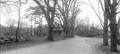 |
184 and 209 Newton St., April 18, 1931
Looking southwest on Newton St., Clyde St. enters on the right. On the left is the house of the Joseph Orlinksi house at 184 Newton St. Note the man crouched down on the side and the old hydrant for the street-watering wagons. On the right is the house, still standing, of George A. Lyon at 209 Newton St.
(ID) 021
(Slide ID) P-110-61
[Source: William Robert Murphy Collection]
|
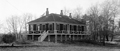 |
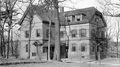
Board of Health Hospital, Newton St.
(ID) 116
(Slide ID) P-24-5
[Source: William Robert Murphy Collection]
|
 |
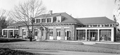
Alms House, Newton St.
(ID) 093
(Slide ID) P 24-6
[Source: William Robert Murphy Collection]
|
 |
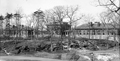
Contagious Hospital, Newton St.
This is probably one of the two wooden buildings built circa 1895 on the hill above the Putterham School to isolate and treat the rising number of cases of diphtheria and scarlet fever. They were replaced by a more substantial complex in 1902.
(ID) 100
(Slide ID) P-24-4
[Source: William Robert Murphy Collection]
|
 |
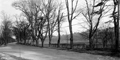
Contagious Hospital, Newton St.
These two hospital buildings and the administration building in the middle were constructed in 1902 on the hill above the Putterham School to isolate and treat the rising number of cases of diphtheria and scarlet fever.
[ref. The Chronicle, October 25th, 1902]
(ID) 127
(Slide ID) P-24-11
[Source: William Robert Murphy Collection]
|
 |
Newton St., April 18, 1931
Looking east, Goddard Ave. curving to the left, Larz Anderson park in the distance.
(ID) 031
(Slide ID) P 10-60
[Source: William Robert Murphy Collection]
|

 The Society
 Program Archives