|
The Society
Historical Information
Photo & Map Collections
Exploring Brookline
Links
Program Archives
|
Photo Collection
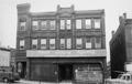 |
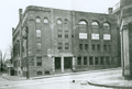
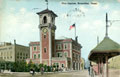
171 Washington St.
The tracks to the D subway line lie immediately to the left. The building anchored the northwest corner of the area then known as The Marsh that would soon be completely leveled in an urban renewal project. Ames Supply Co. was one of thirteen businesses forced out by the Brookline Redevelopment Authority, being deemed not essential to Village Life and therefore not eligible for local relocation on redeveloped land.
From a notebook of property-appraisal photos taken in 1965 and early 1966 for The Marsh Urban Renewal Project run by the Brookline Redevelopment Authority. Only a few scattered peripheral structures remain today.
|
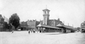 |
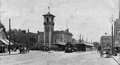
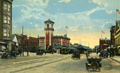
Brookline Village, circa 1910
Fire station #1 and the new trolley island
|
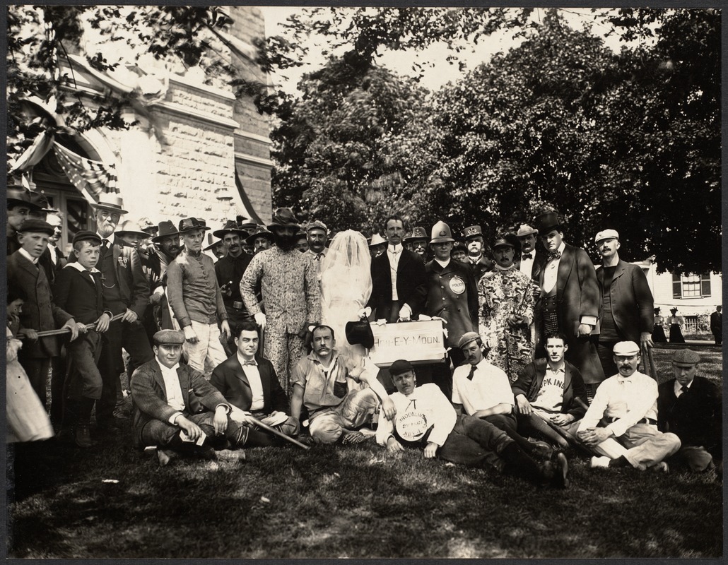 |
Post Parade Gathering, July 4, 1899
In the late 1800s Brookline hosted an annual parade on the Fourth of July with elaborate and sometimes outlandish floats and costumes for which prizes were awarded. Some of those gathered here in front of town hall after the parade were float participants. The photo was one of a group of photos published in The Suburban newspaper, July 8, 1899, pg. 2. This one was labeled The Old Timers, July Fourth, 1899.
[Source: Digital Commonwealth]
|
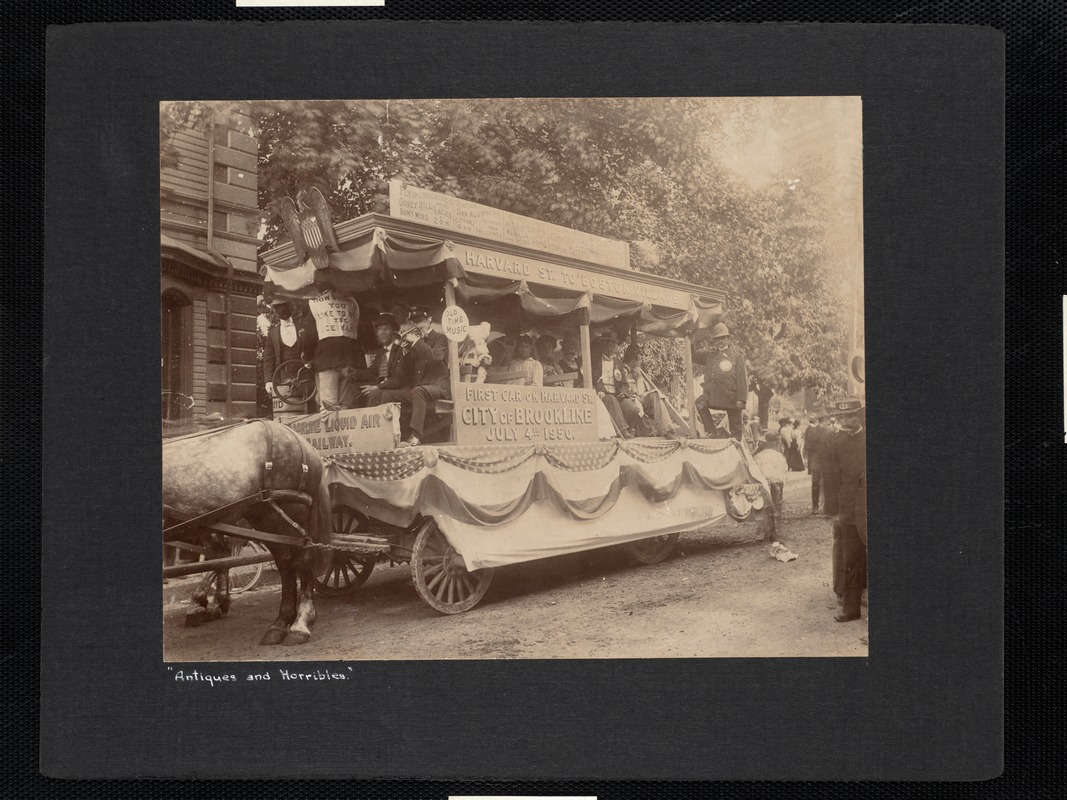 |
Fourth of July Parade, 1899
The float pictured, Opening of the Liquid Air Railway Line, won the prize for best local hit in the annual Fourth of July parade for 1899. It was a burlesque on an imagined future trolley line on Harvard St. powered by the just-developed liquid air. This was undoubtedly inspired by the recent lecture delivered to a huge crowd in town hall, on April 4, by William Peckham, an electrical engineer from New York. He had been advancing new manufacturing methods for liquid air and fantastical claims were being made for its potential (a company was developing an automobile named Liquid Air with the prediction of being able to travel long distances when powered by liquid air.)
The people on the float are playing various roles imagined for the world of 1950. The parade route: begin Harvard Sq., north on Washington St., right on Park St., right on Beacon St., right on Charles St., left on Sewall Ave., right on Kent St., right on Aspinwall Ave., left on Harvard St., continue south on Washington St. to the Village Sq., right on Boylston St., right on Cypress St. to the playground by Davis Ave.
From a series of photos published in The Suburban newspaper, July 8, 1899, pg. 2.
[ref. The Brookline Chronicle, April 8, 1899, pg. 18].
[ref. The Suburban, July 8, 1899, pg. 4]
[Source: Digital Commonwealth]
|
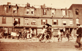 |
Bike Parade, circa 1900, Brookline Village
Looking at the west side of Washington St. across from Station St. This is most likely a Fourth of July parade. The stores pictured were at this location in 1899 and 1900. From left to right:
- #188, James Terry, Shoe Repair (partial)
- #192, Thomas Mahon and Sons, Plumbers
- #194, Flately and Sweeney, Custom Tailors
- #198, John T. Cahill, Provisions
- #200, James B. Hand, House Painter and Decorator
- #208 Washington St., the Chace building, still standing (partial)
[Source: Brookline Preservation Department]
|
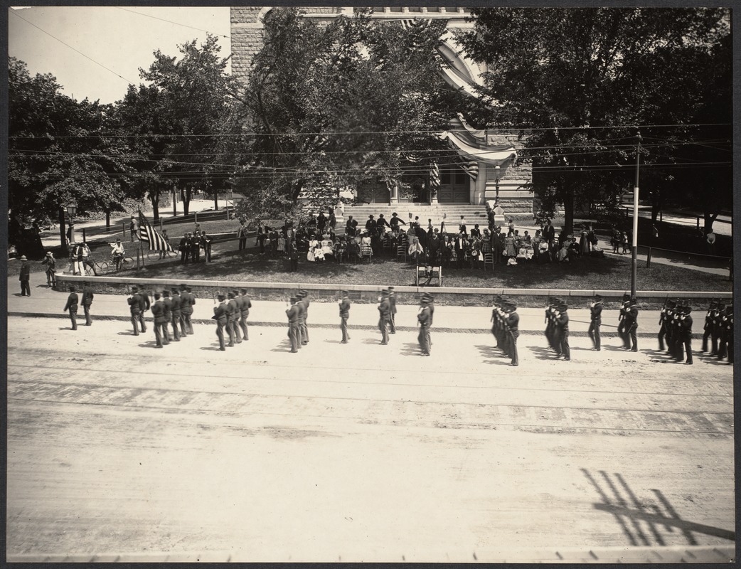 |
Fourth of July Parade, 1899
The procession passes in front of Town Hall.
One of a series of photos taken for the The Suburban newspaper.
[Source: Digital Commonwealth]
|
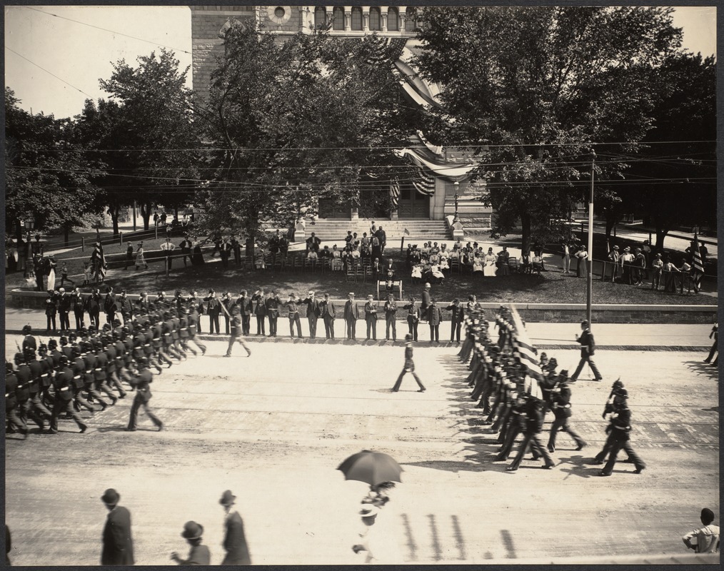 |
Fourth of July Parade, 1899
The procession passes in front of Town Hall.
One of a series of photos taken for the The Suburban newspaper. A cropped version entitled Review of the Troops by the Selectmen in Front of Town Hall appeared on page 2 of the July 8, 1899 issue.
[Source: Digital Commonwealth]
|
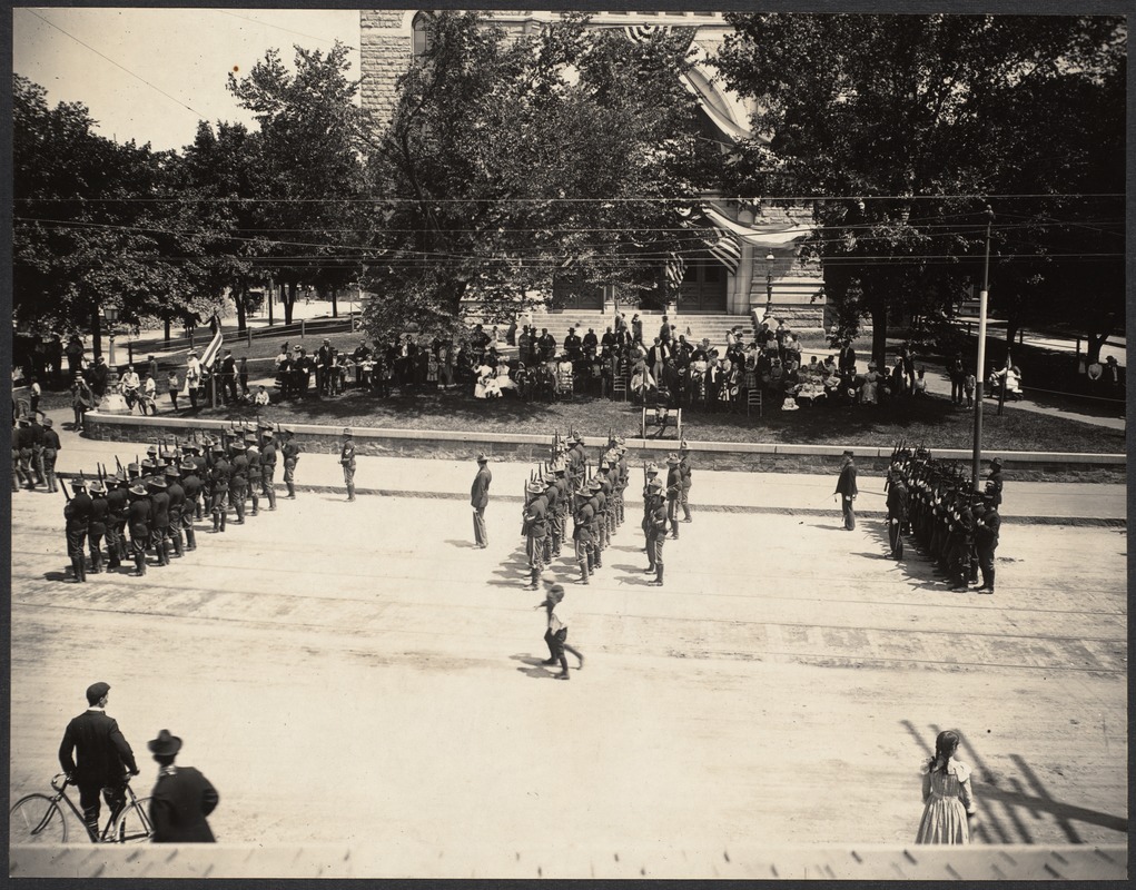 |
Fourth of July Parade, 1899
The procession passes in front of Town Hall.
One of a series of photos taken for The Suburban newspaper.
[Source: Digital Commonwealth]
|
 |
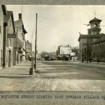
Brookline Village, circa 1910
Washington St., looking west toward Boylston St. From left to right:
- [108 Washington St.] a partial view of Frank Fine, florist
- [34 Walnut St.] J. Edward Kirker, Real Estate (sign on roof)
- [38 Walnut St.] Marks Bergstein, tailor
- [40 Walnut St.] Eagle Hand Laundry
- [Walnut & High] the Union Building which housed the Brookline Friendly Society
- [140 Washington St.] New fire station completed in 1908 and still in use today
- Inbound trolley
- [#166 Washington St.] The Brookline Print sign visible on the Guild Block building
[Source: Joel Shield]
|
 |
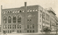
Union Building, Walnut and High Streets
The Union Building, a massive stone structure located at the corner of High and Walnut streets, was erected by the Brookline Friendly Union, a group formed to improve the lives of the poor of Brookline. The building was to be the center for all the charitable activities in Brookline. There were rooms for club work, a hall for dramatic and musical entertainment, a coffee room, a gymnasium, a billiard room, a bowling alley, and a "conversation room in the basement for working men to congregate to discuss the affairs of the nation."
The building was razed in 1961 to make way for public housing as part of the Brookline Redevelopment Authoritys urban renewal project in the area known as The Farm.
[Source: Brookline Preservation Department]
|
 |
Union Building, Walnut and High Streets
The Union Building, a massive stone structure located at the corner of High and Walnut streets, was erected by the Brookline Friendly Union, a group formed to improve the lives of the poor of Brookline. The building was to be the center for all the charitable activities in Brookline. There were rooms for club work, a hall for dramatic and musical entertainment, a coffee room, a gymnasium, a billiard room, a bowling alley, and a "conversation room in the basement for working men to congregate to discuss the affairs of the nation."
The building was razed in 1961 to make way for public housing as part of the Brookline Redevelopment Authoritys urban renewal project in the area known as The Farm.
[Source: Brookline Preservation Department]
|
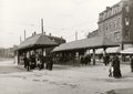 |
Village Transfer Station, circa 1911
On Lower Washington St., recently completed in September, 1909. On the left is Boylston St. looking west. The grocery store of Thomas F. McMahon is visible behind the left platform. The Sagamore Café, which closed in April 1912, and the drug store of T. E. Burns are visible behind the second station.
[Source: MBTA]
|
 |
Station A (Now Station 1), Brookline Village, 1912
Bushes are larger.
|
 |
Village Square
[Source: Digital Commonwealth]
|
 |
Brookline Village, 1920
Looking west on Washington St. toward the start of Boylston St.
Village Square, where Washington Street met today's Route 9, was the commercial center of Brookline from the 1840s until after the Civil War. Most of its commercial and residential buildings were replaced by office buildings during the urban renewal of the 1960s. Pictured here are the still existant 1908 fire station and the transfer stations of the Boston Elevated Railway. The rail route was replaced by a bus line in the 1930s, and the rails were removed for scrap steel during World War II.
|
 |
Brookline Village
|
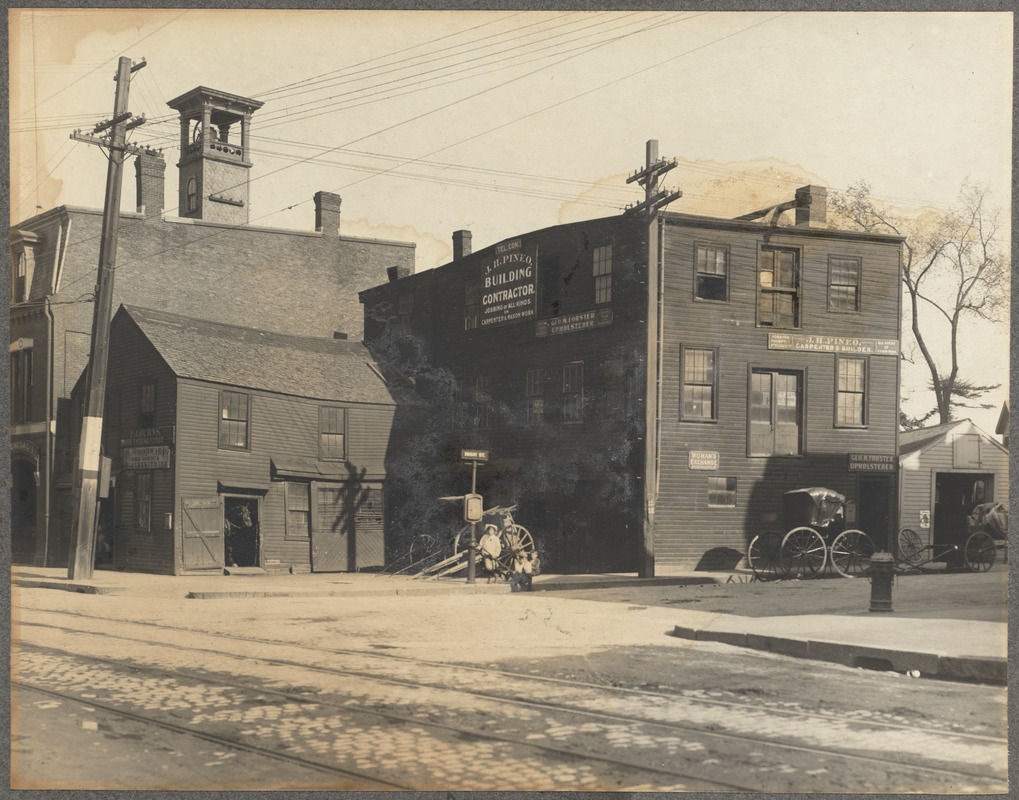 |
High St. Corner, Brookline Village, circa 1905
Standing on today's Rt.9. To the left is the corner of Hose House #1 and Chemical Engine #1. To the right of that, also on Lower Washington St. is P. J. Burns, Horse Shoe Forge. On the upper right, are the High St. businesses of George M. and Thomas K. Forster, Upholsterer and Henry J. Pineo, Carpenter and Builder.
[Source: Digital Commonwealth]
|
 |
High St.
The east side of High St. just south of Walnut St., all buildings demolished. From left to right:
- The Brookline Friendly Society
-
- 16 High St. apartment building
- 18 High St. the Brookline Screen and Shade Co.
- 20 High St. apartment building
[Source: Brookline Preservation Department]
|
 |
Boylston St. Looking East, December 23, 1915
Note in particular the now-halved advertisement for Pure-Clean Quaker Oats. In late 1912, Boylston St. was widened and approximately ten feet of the Guild Building removed. From left to right on that side of the street are seen:
- 21 Boylston St.: Nathaniel L. Walker, carpenter
- 21 Boylston St.: John J. Horgan, horse shoer
- 19 Boylston St.: John S. ODay, stables
- 7 Boylston St.: Martin Geier, hairdresser. The building at 7-11 Boylston was constructed in 1912 and still stands today.
- 160 Washington St.: the Guild Building
[Source: Olmsted]
|
 |
Boylston St., circa 1876
North side of Boylston, numbers 45, 43, 41. In the far distance: on the left is the new town hall, in the middle is the Baptist Church on Harvard St., on the right is the top of Panters building.
From Photographs of Brookline: taken about 1876 / Richard Hills. Call No.: BROOKLINE/Special (CAGE B.R. 974 H6), Brookline Public Library.
[Source: Brookline Preservation Department]
|
|

