|
The Society
Historical Information
Photo & Map Collections
Exploring Brookline
Links
Program Archives
|
Recent Additions
 |
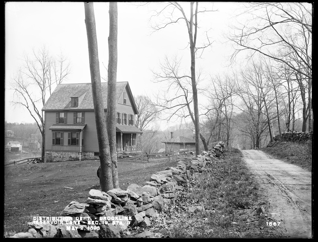
Reservoir Lane, 1898
[Reservoir Lane View 4] Looking south. The house and barn of Charles Webber are on the left and the waste weir, still standing and visible from Reservoir Rd. today, is on the right. In the distance, a wagon is on the road by the white house of Patrick Mooney.
Reservoir Lane is one of the earliest roads in Brookline and was originally a section in the trail used by Native Americans to travel from Roxbury to Nonantum Hill in Newton. In 1905, the lane became todays Reservoir Road, a new section was added on the north end connecting to Middlesex Rd., and only a small length of the lane remains by Middlesex Rd.
In 1892, author Bradford Kingman described the lane as one of the wildest and most picturesque spots, and the land thereabouts such as anyone who had never explored would hardly suppose could be found within the limits of such a town as Brookline, and so near to Boston. The present lane is narrow, rocky, winding, steep, up hill and down vale, bordered with briars and gay with wild flowers, or attractive with berries in their season.
[Source: Digital Commonwealth]
|
 |
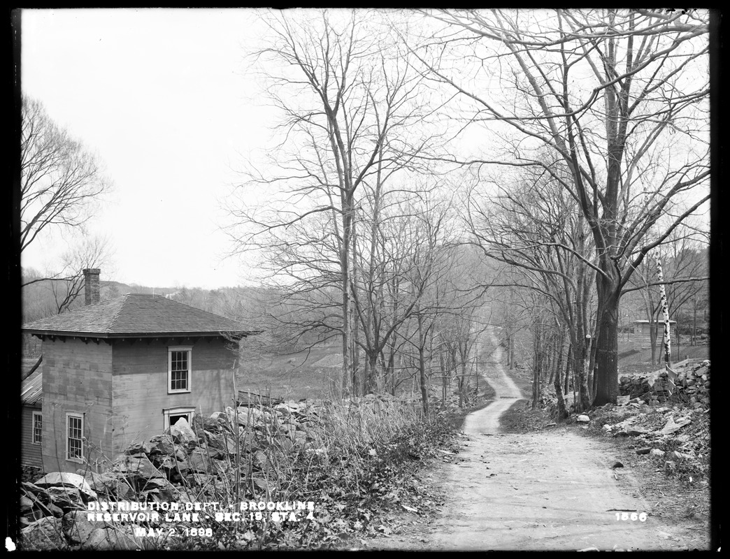
Reservoir Lane, 1898
[Reservoir Lane View 3] Looking east. The buildings on Michael McGradys land are on the left, a brook is on the right.
Reservoir Lane is one of the earliest roads in Brookline and was originally a section in the trail used by Native Americans to travel from Roxbury to Nonantum Hill in Newton. In 1905, the lane became todays Reservoir Road, a new section was added on the north end connecting to Middlesex Rd., and only a small length of the lane remains by Middlesex Rd.
In 1892, author Bradford Kingman described the lane as one of the wildest and most picturesque spots, and the land thereabouts such as anyone who had never explored would hardly suppose could be found within the limits of such a town as Brookline, and so near to Boston. The present lane is narrow, rocky, winding, steep, up hill and down vale, bordered with briars and gay with wild flowers, or attractive with berries in their season.
[Source: Digital Commonwealth]
|
 |
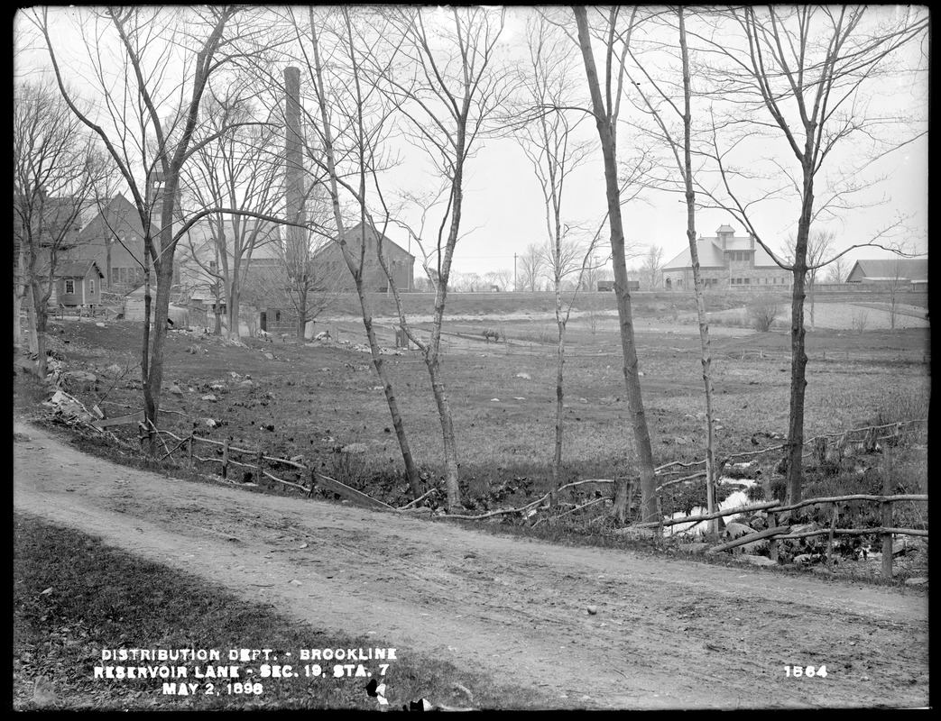
Reservoir Lane, 1898
[Reservoir Lane View 2] On the left is the first house of Michael McGrady soon to be torn down in 1901. On the right Webbers Waste Weir, located on top of the aqueduct that is flowing alongside Reservoir Lane to the Brookline Reservoir on Boylston St. It can be viewed today from Reservoir Road.
Reservoir Lane is one of the earliest roads in Brookline and was originally a section in the trail used by Native Americans to travel from Roxbury to Nonantum Hill in Newton. In 1905, the lane became todays Reservoir Road, a new section was added on the north end connecting to Middlesex Rd., and only a small length of the lane remains by Middlesex Rd.
In 1892, author Bradford Kingman described the lane as one of the wildest and most picturesque spots, and the land thereabouts such as anyone who had never explored would hardly suppose could be found within the limits of such a town as Brookline, and so near to Boston. The present lane is narrow, rocky, winding, steep, up hill and down vale, bordered with briars and gay with wild flowers, or attractive with berries in their season.
[Source: Digital Commonwealth]
|
 |
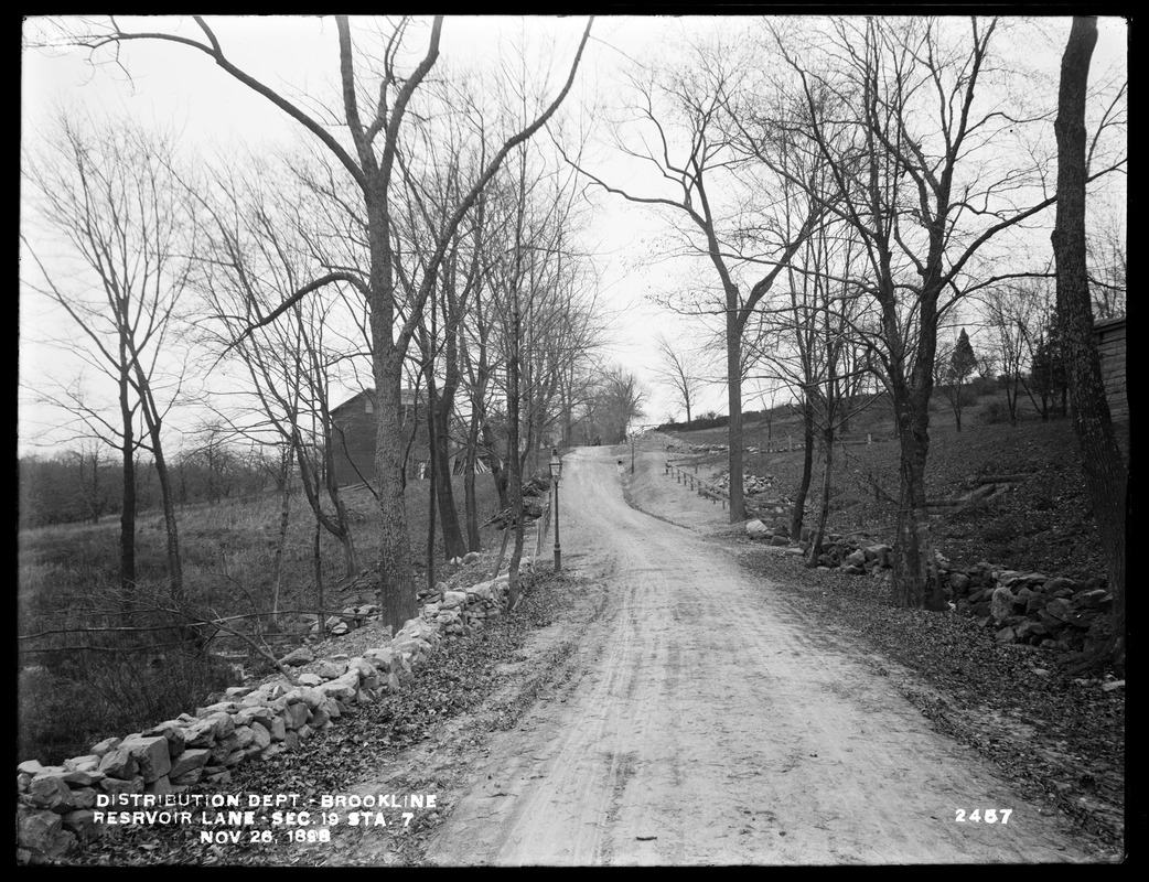
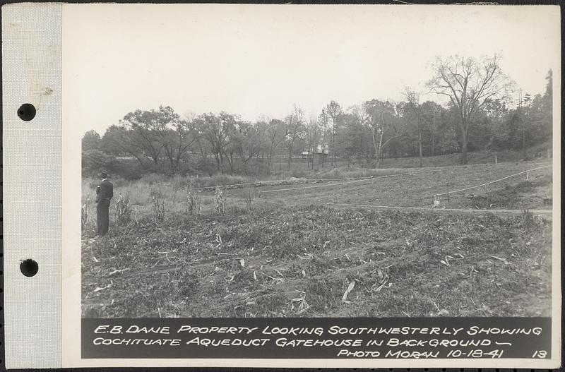
Reservoir Lane, 1898
[Reservoir Lane View1] This view is taken roughly from the railroad tracks (todays D line) behind the Metropolitan Water Works Pumping Station and is the first in line of a sequence of photos of Reservoir Lane as it goes southward to Boylston St.
In the center rear is the first house built by Michael McGrady on his property of 8 acres. He purchased the Learned family land in 1865 and built the house around that time, it was torn down in 1901. Circa 1889-1890 he built the house in the foreground and a barn that is off screen to the left. Both are still standing at 57 Reservoir Lane. After McGradys death in 1912, Ernest Dane bought the land and raised vegetables for his large Chestnut Hill estate at 400 Heath Street.
Reservoir Lane is one of the earliest roads in Brookline and was originally a section in the trail used by Native Americans to travel from Roxbury to Nonantum Hill in Newton. In 1905, the lane became todays Reservoir Road, a new section was added on the north end connecting to Middlesex Rd., and only a small length of the lane remains by Middlesex Rd.
In 1892, author Bradford Kingman described the lane as one of the wildest and most picturesque spots, and the land thereabouts such as anyone who had never explored would hardly suppose could be found within the limits of such a town as Brookline, and so near to Boston. The present lane is narrow, rocky, winding, steep, up hill and down vale, bordered with briars and gay with wild flowers, or attractive with berries in their season.
[Source: Digital Commonwealth]
|
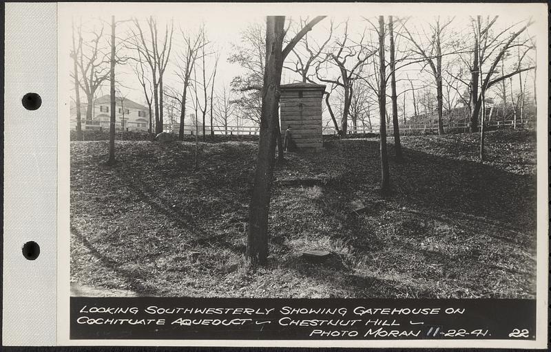 |
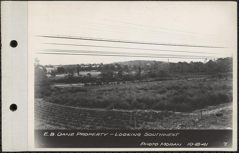
Cleveland Circle Southwest, 1941
Looking southwest from the old Reservoir Lane at the raised aqueduct that runs along Reservoir Rd. The house is 171 Crafts Rd. Visible in front of it is a waste weir of the Cochituate Aqueduct which ran along Reservoir Rd. to the Brookline Reservoir on Boylston St. The waste weir is still standing. The aqueduct was not used after 1951.
[Source: Digital Commonwealth]
|
 |
Cleveland Circle Southwest, 1941
Looking southwest toward Reservoir Rd. from the vicinity of the rear of the Metropolitan Waterworks Museum. The house in the center is 171 Crafts Rd. Visible in front of it is a waste weir of the Cochituate Aqueduct which ran along Reservoir Rd. to the Brookline Reservoir on Boylston St. The waste weir is still standing. The aqueduct was not used after 1951.
[Source: Digital Commonwealth]
|
 |
Cleveland Circle Southwest, 1941
Looking southward at Eliot St. from the vicinity of the rear of the Metropolitan Waterworks Museum. At the far left is 261 Eliot St. To the right a car exiting Willow Crescent onto Eliot St. Further on the right newly-built houses can be viewed on Cleveland Rd. as it descends to Eliot St.
[Source: Digital Commonwealth]
|
 |
Cleveland Circle Southwest, 1941
Viewed from the railroad tracks in the vicinity of the Metropolitan Waterworks Museum. On the left newly-built houses can be viewed on Cleveland Rd. as it descends to Eliot St. Houses on Reservoir Rd. can be seen on the right.
[Source: Digital Commonwealth]
|
 |
Cleveland Circle Southwest, 1941
Viewed from the railroad tracks in the vicinity of the Metropolitan Waterworks Museum. 24 Cleveland Rd. is on the left and the tops of houses on Reservoir Rd. can be seen on the right.
[Source: Digital Commonwealth]
|
 |
Fairmount St. Hill
Looking east at the Fairmount St. hill. The Brookline Reservoir on Boylston St. is on the left.
[Source: Digital Commonwealth]
|
 |
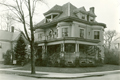
1109 Boylston St.
[Source: Brookline Preservation Department]
|
 |
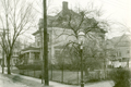
Samuel Philbrick House, 182 Walnut St.
[Source: Brookline Preservation Department]
|
 |
210 Babcock St., Side
[Source: Brookline Preservation Department]
|
 |
210 Babcock St.
Winslow is on the right.
[Source: Brookline Preservation Department]
|
 |
210 Babcock St., Rear
To the right is 204 Babcock St., across the srteet is #209, all still standing.
[Source: Brookline Preservation Department]
|
 |
Boston Elevated Railway Bus, Circa 1927
The Boston Elevated Railway opened a de luxe bus line between Brookline and Boston in 1927. It initially started in Coolidge Corner, that was later extended to Washington Square. The license plate of this bus, stopped in Cleveland Circle, is dated 1927 but it is not clear which route is involved. Beacon St. inbound is off screen to the right. Bostons Sutherland Rd. descends in the middle of the photo.
[Source: Joel Shield]
|
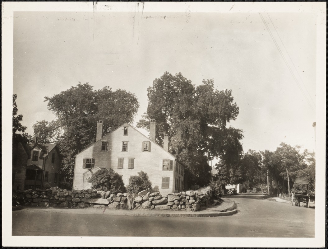 |
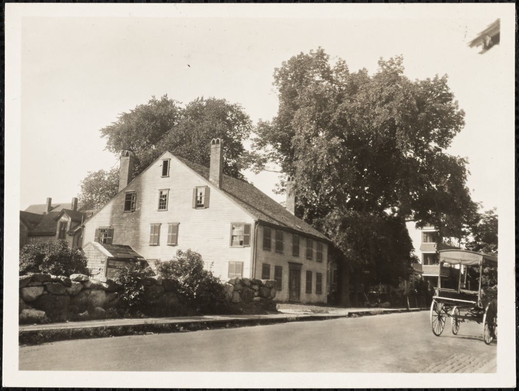
Richard's Tavern, Heath St. near Hammond St.
Northeast corner of Heath and Hammond. Known as the "Old Stage Coach Tavern". Built circa 1760-70. The Worcester Turnpike (Rt. 9) passed behind the house where a tollgate was located.
[Source: Digital Commonwealth]
|
 |
Richard's Tavern, Heath St. near Hammond St.
Northeast corner of Heath and Hammond. Known as the "Old Stage Coach Tavern". Built circa 1760-70. The Worcester Turnpike (Rt. 9) passed behind the house where a tollgate was located.
[Source: Digital Commonwealth]
|
 |
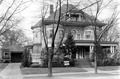
217 Freeman St., 1956
The house was set back from the street. In the distance is 219 Freeman St., still standing.
[Source: Digital Commonwealth]
|
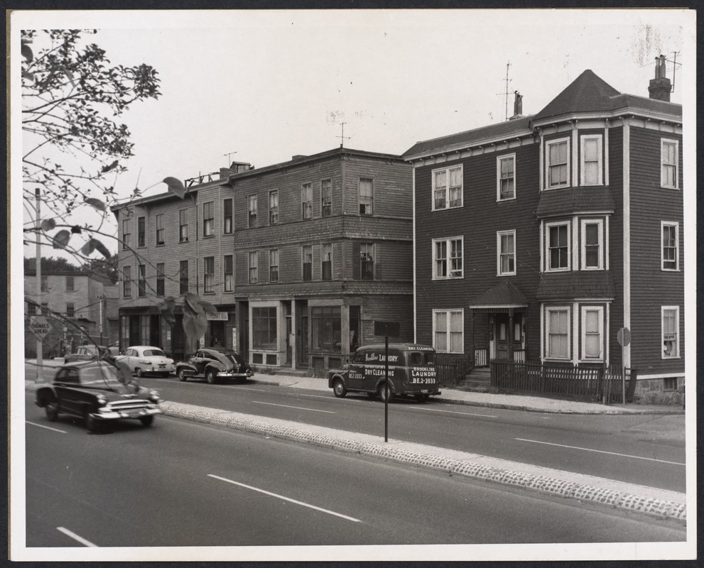 |
Boylston St., 1956
From right to left:
- 253 Boylston St. on the corner of Smyth St.
- 261-263 Boylston St.
- 265-269 Boylston St.
- Gas station at the corner of Cameron St..
[Source: Digital Commonwealth]
|
|

