 |
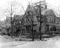
112 High St.
Looking north from Edgehill Rd. On the left is the rear of 112 H,igh St. In the distance, from left to right, are the rear of 92 High St., 82 High St., the outbuilding of 92 High St., all still standing.
[Source: Brookline Preservation Department]
|
 |
39 Irving St., Before 1890
Upland Rd. is to the right of the house followed by a partial view of 43 Upland Rd., both houses are still standing. None of the houses that were constructed in the rear on Upland Rd. beginning in 1890 are present.
[Source: Brookline Preservation Department]
|
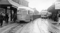 |
First PCC Streetcar, Brookline Village, circa June 1937
Looking west on Lower Washington St. Shown is PCC streetcar 3001, the very first of a line of new PCC streetcars purchased by the Boston Elevated Railway Co. This car was the only car purchased from the St. Louis Car Co., all subsequent cars being purchased from the Pullman Co. In the rear, the ivy-covered fire station is visible. The waiting platforms in the photo were demolished in September 1938.
It is evident from the No Stops destination panel, and the fact that this car never ran on routes going through Brookline, that this is one of the demonstration/training runs conducted following the delivery of the car in May 1937. The car was given the nickname of Queen Mary and began regular service on June 24, 1937, running on routes that did not go underground as it only had doors opening on the right side. This car has been widely reported on by the enthusiast community and there is even a scale model available for purchase.
|
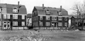 |
High St. Place
From left to right: 7/9/11 High St. Place, 3/5 High St. Place, and rear of 175 High St. as viewed from the yard of the Boston Elevated Railway - todays Margaret E. Robinson playground.
[Source: Brookline Preservation Department]
|
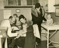 |
"Well Baby" Clinic, Brookline Friendly Society, January 1938
The Brookline Friendly Society was a health and human services agency located at 10 Walter Ave. in the area known as The Farm. This photo appeared on page one of the February 4, 1938 issue of the Brookline Citizen newspaper.
- The physician is Richard Cannon Eley who lived at the time on Glenoe Rd. and was a physician at Bostons Childrens Hospital for 36 years.
- The baby being examined is Richard Flynn, held by his mother, Bridget Delia (Staunton) Flynn. She emigrated from Galway, Ireland in 1929; married Michael Flynn, who also emigrated from Ireland, in 1935; they lived at the time on Boylston Place and had four more children.
- The woman standing at the table is Mildred (Kearney) Ward with her third child, Thomas. She grew up on Pearl St. and lived at the time at 57 Walter Ave. with her husband, Thomas, and their children.
[Source: Brookline Preservation Department]
|
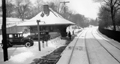 |
Longwood Station, Boston and Albany Railroad, 1930
Looking east. Chapel St. is on the left.
|
 |
Beacon St. as Carlton St.
Looking north
[Source: Digital Commonwealth]
|
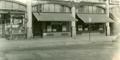 |
Coolidge Corner
- 1316 Beacon St. Howland Wadsworth & Co. - Paints
- 1314 Beacon St. - Waldorf Restaurant
- 1310 Beacon St. - Winchester Sportswear for Women
[Source: Digital Commonwealth]
|
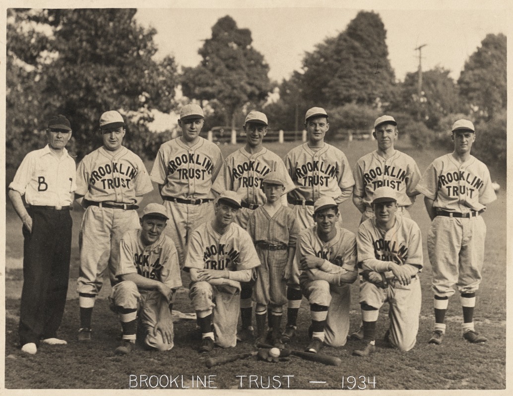 |
Brookline Trust Baseball team, 1934
This photo appeared on page 5 of the June 21, 1934 issue of the Brookline Chronicle.
Front row from left to right:
- Charles Haley, catcher
- Clifford Gittens, second base and manager; auditor at Brookline Trust
- Charles Foster, Jr. - mascot
- Charles Gittens - pitcher
- Thomas Ford short stop; teller at Brookline Trust
Back row from left to right:
- Leonard Rowe coach; chaffeur at Brookline Trust
- James Ferguson left field; teller at Brookline Trust
- R. Larson right field
- Charles Foster center field; bookkeeper at Brookline Trust
- Paul Meade third base; teller at Brookline Trust
- James Donnelly first base; assistant bookkeeper at Brookline Trust
- Arthur Peterson right field; teller at Brookline Trust
[Source: Digital Commonwealth]
|
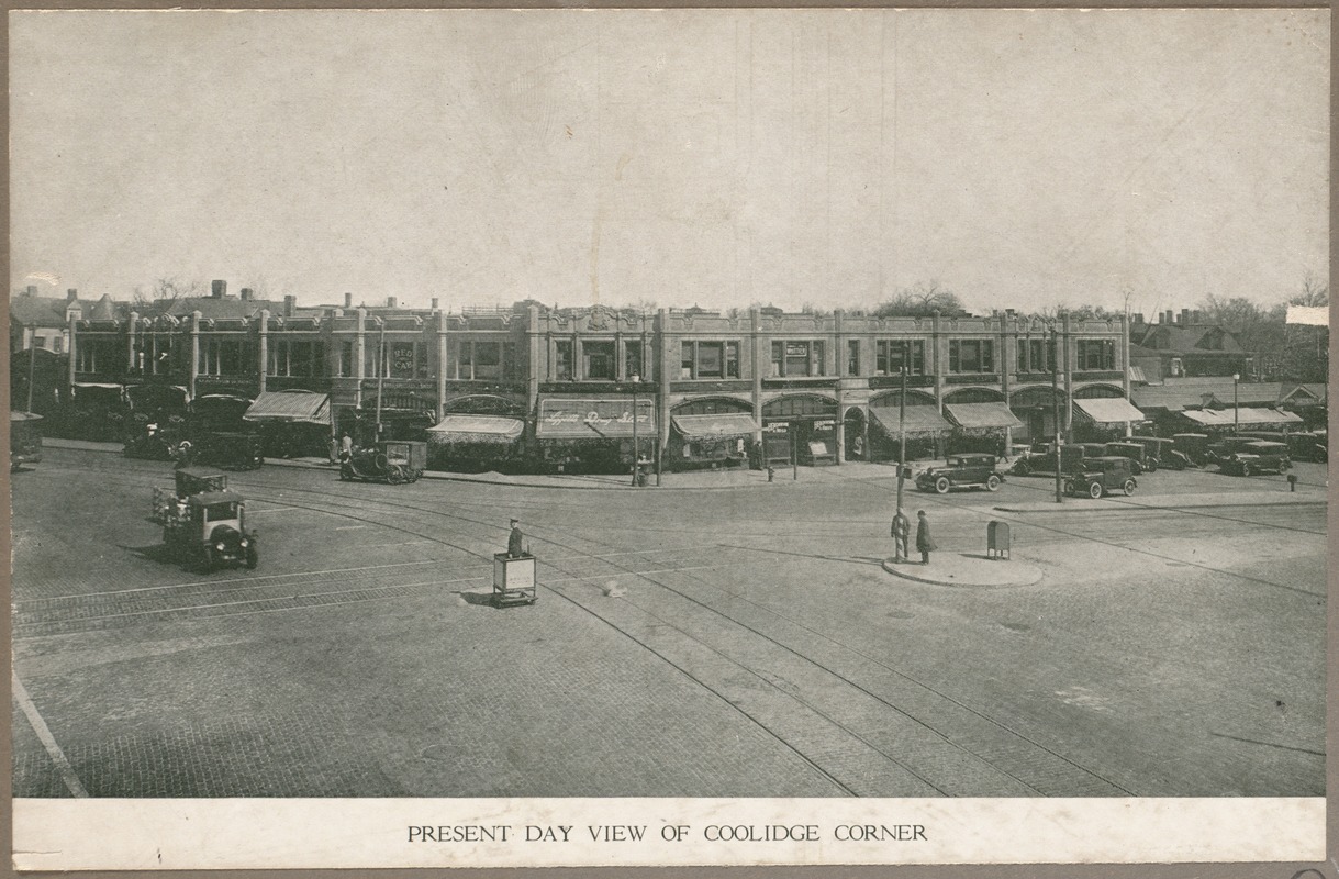 |
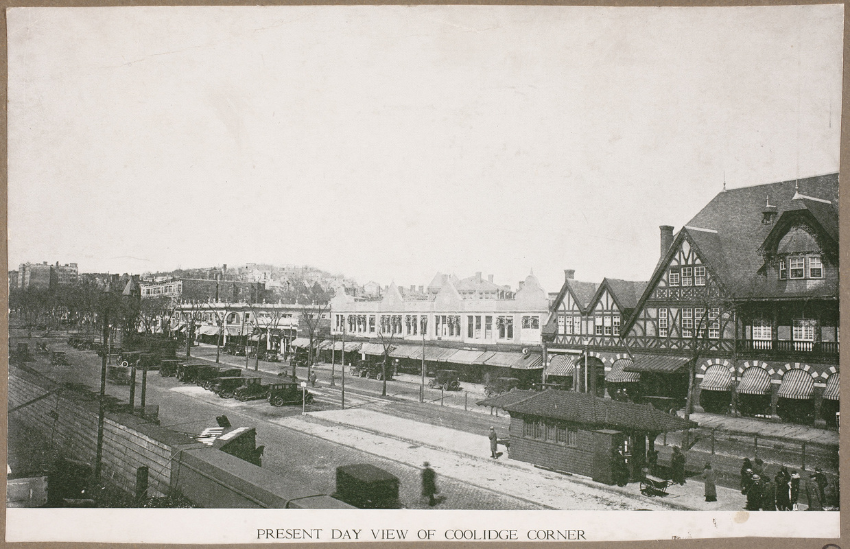
Coolidge Corner, 1926
[Source: Digital Commonwealth]
|
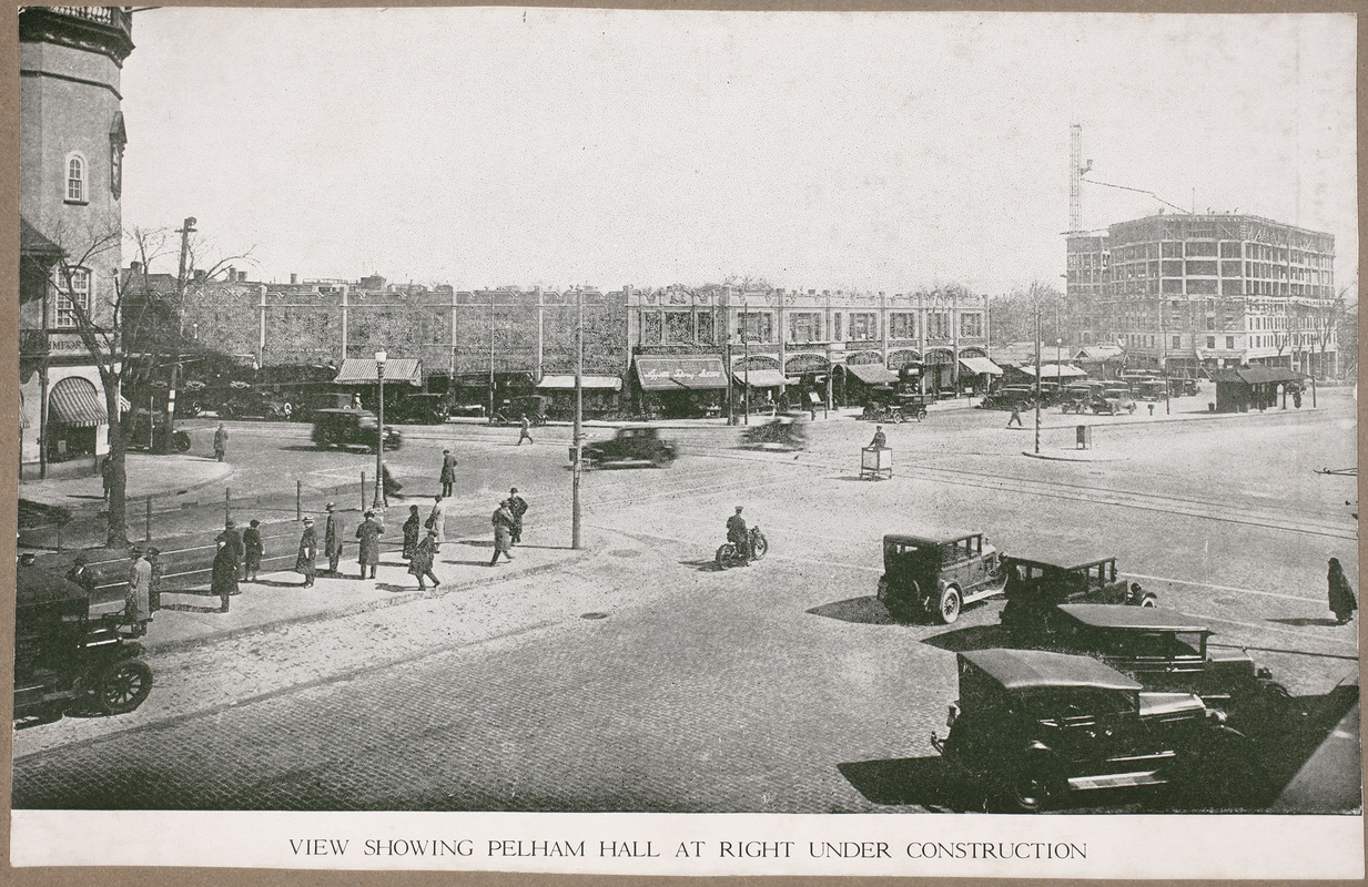 |
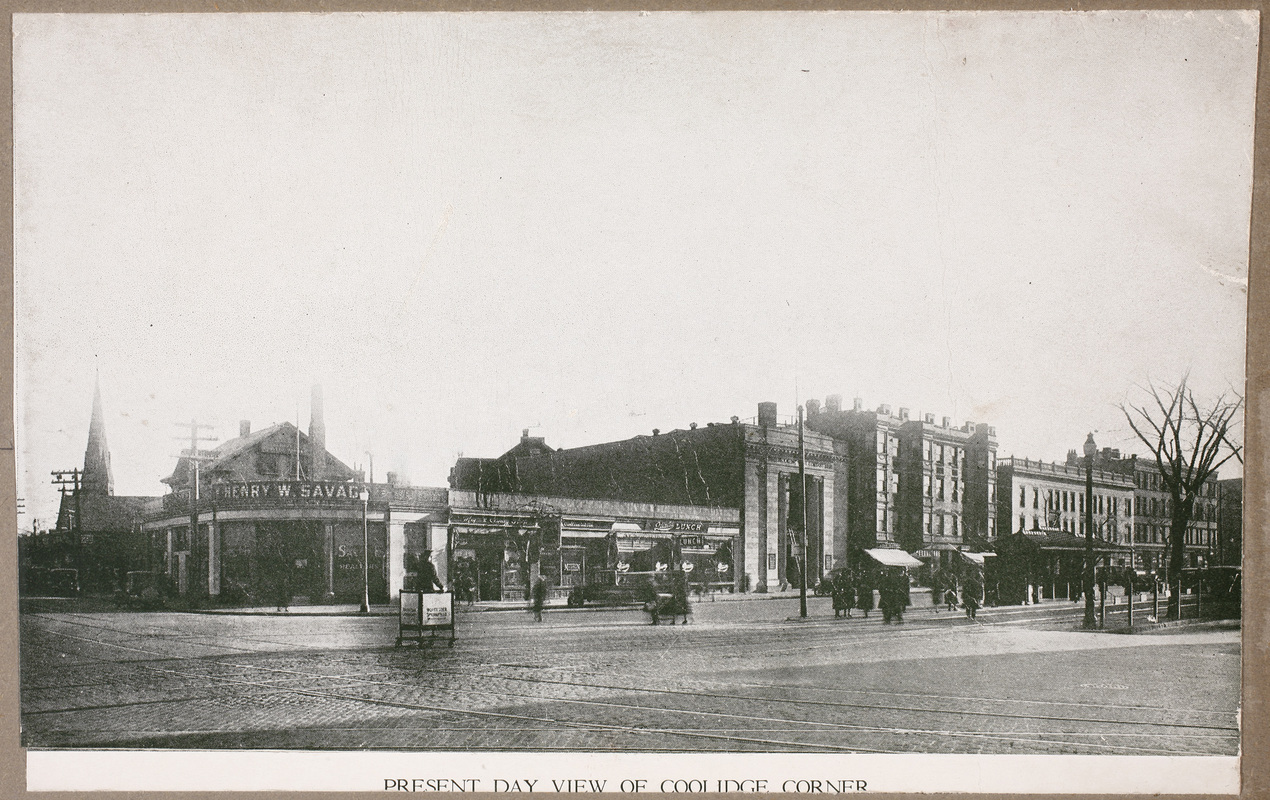
Coolidge Corner, 1926
[Source: Digital Commonwealth]
|
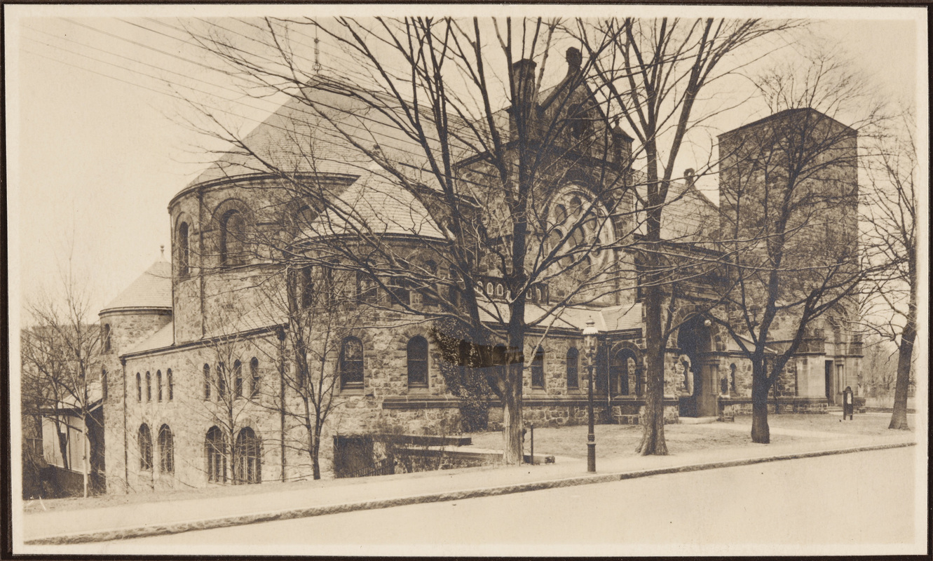 |
St. Mark's Church, Park St.
[Source: Digital Commonwealth]
|
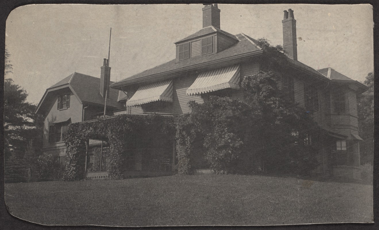 |
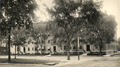
House of Edward Atkinson, Heath Hill
[Source: Digital Commonwealth]
|
 |
Osborne Rd., 1939
Looking east from Naples Rd. at numbers 1, 5, 9
[Source: Brookline Preservation Department]
|
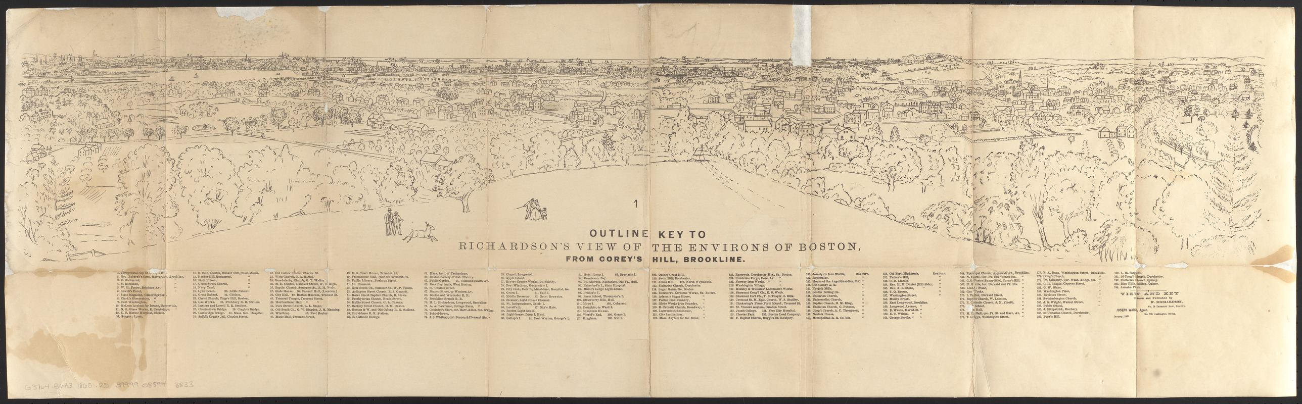 |
Annotations for View From Corey Hill, 1864
[Source: Digital Commonwealth]
|
 |
View From Corey Hill, 1864
[Source: Digital Commonwealth]
|
 |
Coolidge Corner, 1926
[Source: Digital Commonwealth]
|
 |
Coolidge Corner, 1926
[Source: Digital Commonwealth]
|
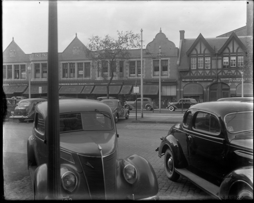 |
Coolidge Corner, 1937
Stores from left to right:
- 1352 Beacon St. Coleman Furniture Co.
- 1350 Beacon St. (Unidentified)
- 1346 Beacon St. Old Corner Bookstore
- 1342-44 Beacon St. Simons Shoe Shop
- 1340 Beacon St. Stone Bros., Mens Furnishings
- 1338 Beacon St. Miss Ayer Shop, Gifts
- 1336 Beacon St. (Unidentified)
- 1334 Beacon St. Lillian E. Kendall, Dry Goods
- 1332 Beacon St. Holmberg and Douglas, Jewelers
[Source: Historic New England]
|
 |
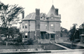
Summit Ave.
Looking southeast. The corner of the roof of #72 Summit Ave. is visible on the right. #69 Summit Ave. is on the left.
[Source: Brookline Preservation Department]
|

