 |
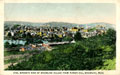
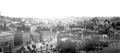
Brookline Village, View From Parker Hill
From Postcard
|
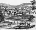 |
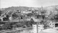
Brookline Village, View From Parker Hill, 1854
From Gleason's Magazine.
|
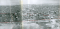 |
The Farm, 1958
Viewed from Parker Hill.
[Source: Brookline Preservation Department]
|
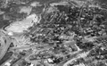 |
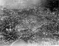
"The Farm", 1958, Piror to Urban Redevelopment
Most of the center of the photo was razed in the early 1960s as part of an urban renewal program. The core area was known as "The Farm".
|
 |
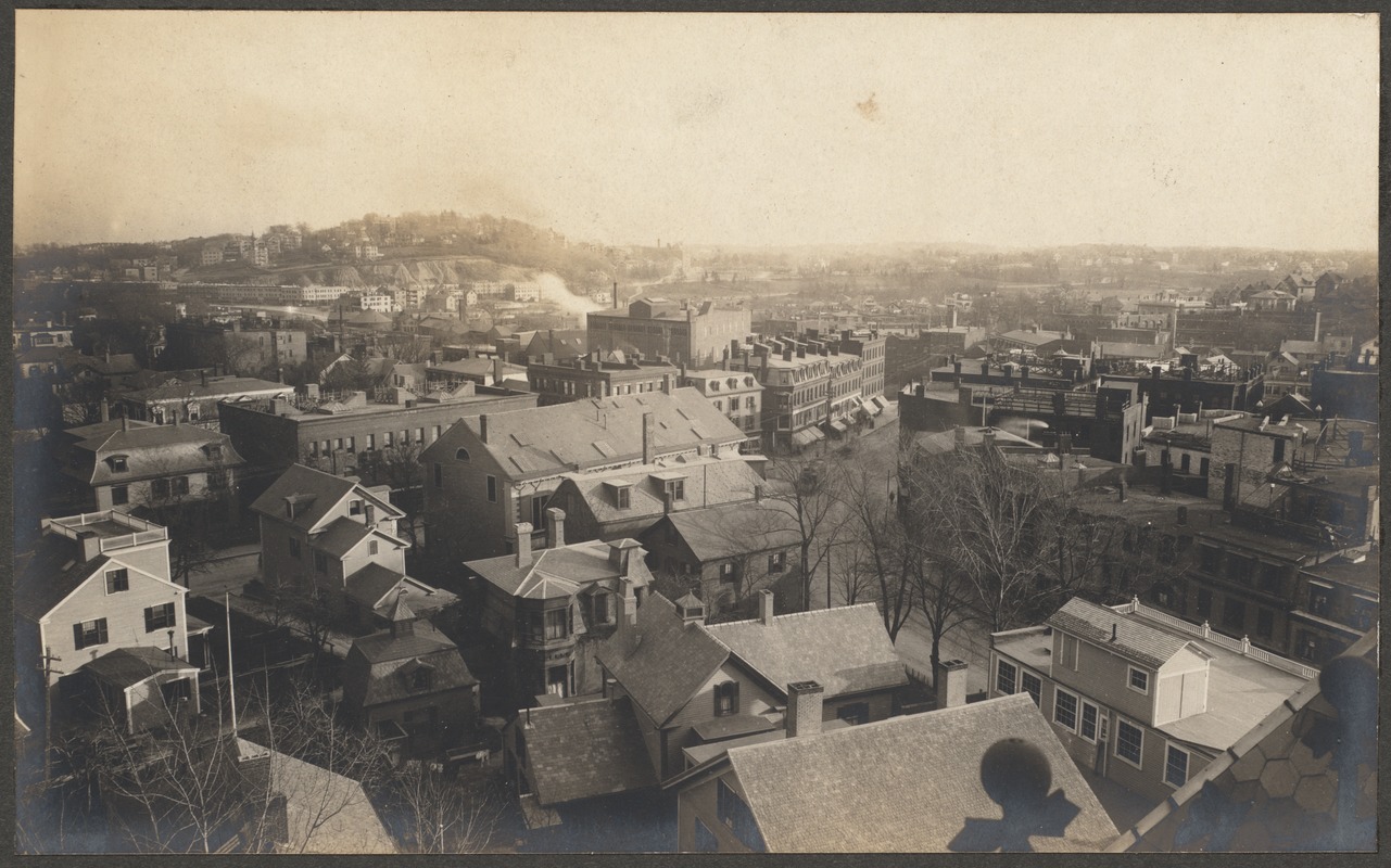
Lower Washington St. at the Boston Line, circa 1909
View From Parker Hill. Brookline Hills in the background. At the extreme left in the center of the photo are the two matching apartment buildings that are located at 165 Pond Ave. (front) and 19 Villa Lane (rear). The large black gasometer tank of the Boston Consolidated Gas Co. is in the middle left and the small white house in front of it is located at 19 Villa Lane.
|
 |
Cypress St. at Boylston Street Area, Aerial View
[Source: National Archives]
|
 |
Green Hill, Aerial View, circa 1958
Looking east on Boylston St. from the corner of Cypress St. (photo, lower left)
FayFoto ID: A91-0915F; URL: http://hdl.handle.net/2047/D20395790
[Source: Northeastern University]
|
 |
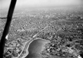
Aerial View, circa 1958
North of Jamaica Pond
FayFoto ID: A91-0915F; URL: http://hdl.handle.net/2047/D20395792
[Source: Northeastern University]
|
 |
Brookline Village, Looking Southward
Looking from Harvard Sq. south on Washington St. viewed from the top of the third Town Hall.
[Source: Brookline Preservation Department]
|
 |
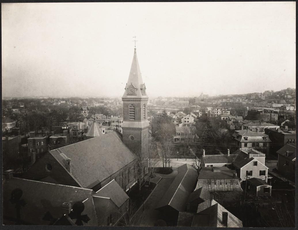
Brookline Village, Looking Southward, circa 1902
One of a series of four photos taken from the top of the third Town Hall. In the far distance is Boston's Parker Hill and, at its foot, the long row of brick apartments along Huntington Ave. In the center of the photo is Harvard Sq. with the awning-covered storefronts on the east side of Washington St. visible to the right.
The 1903 improvements to the National Bank building, center left, are not yet in place.
[Source: Digital Commonwealth]
|
 |
Brookline Village, Looking East, circa 1902
One of a series of four photos taken from the top of the third Town Hall. Harvard St. goes from left to right. In the upper right is Boston's Parker Hill and, at its foot, the long row of brick apartments along Huntington Ave. Center right is the corner of the National Bank building in Harvard Square.
[Source: Digital Commonwealth]
|
 |
Brookline Village, Looking Northward, circa 1902
One of a series of four photos taken from the top of the third Town Hall. The unifying element of this photo is the path of Harvard St. It runs from the 4 oclock position on the right (alongside St. Marys Church) to the 10 oclock position on the left (the brick building at 152-158 Harvard St.) where it curves upwards to the steeple of the Harvard Congregational Church at the top of the photo.
[Source: Digital Commonwealth]
|
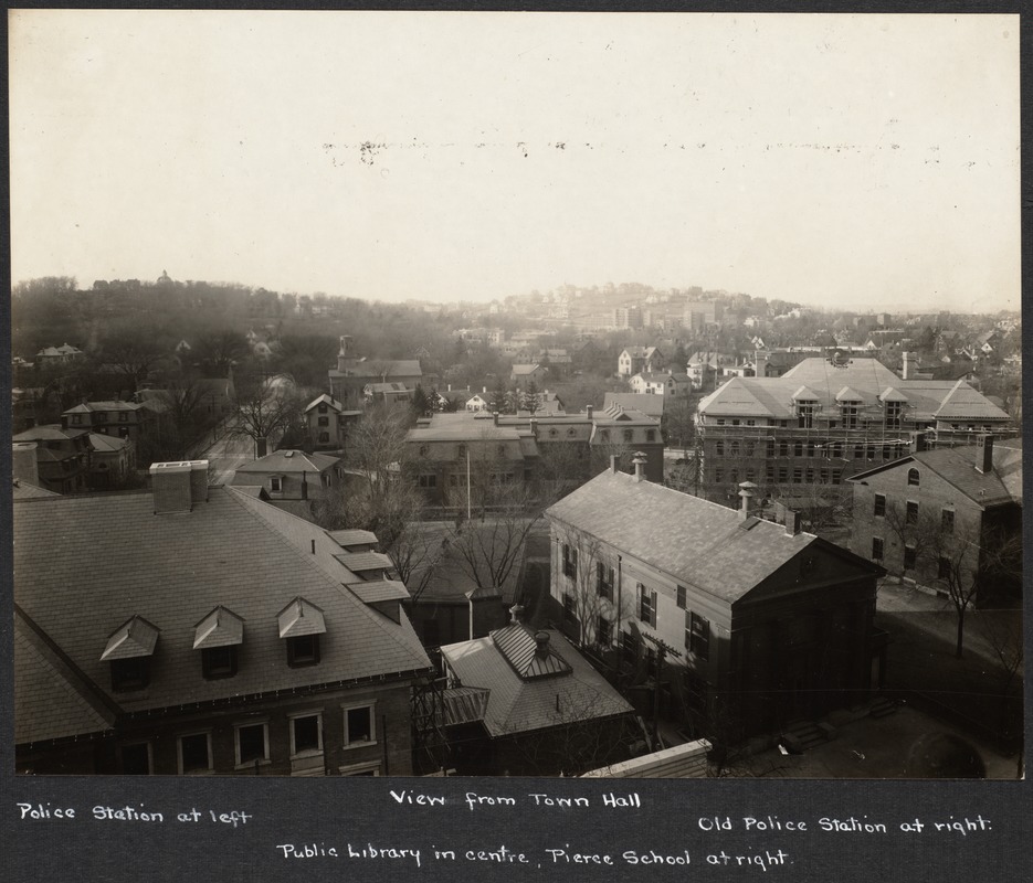 |
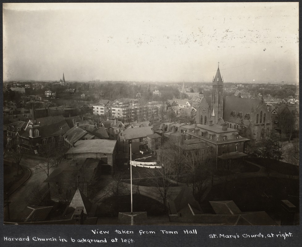
Brookline Village, Looking Northeast, circa 1902
Foreground, left to right, all on Prospect St:
- The southeast corner of the police station and courthouse
- The old 1844 town hall, now the police station
- The southwest corner of the old Pierce Grammar School, built in 1855, sections of which remain as part of the current Pierce Historical Building
Center, left to right:
- Washington St. looking north
- The only known photo of the house at 375 Washington St., southeast corner of Washington St. and School St.
- South side of the library
- Construction of the 1901 replacement Pierce Grammar School being built facing School St. on the site of the old 1856 high school
[Source: Digital Commonwealth]
|
 |
Aerial View, Brookline Village to Beacon St., 1925
High School (photo lower left); Beacon St. (photo left to right)
|
 |
Brookline Village, Aerial View, circa 1930
Looking north.
[Source: Digital Commonwealth]
|
 |
Brookline Village, Aerial View, circa 1958
Looking east on Boylston St. from the corner of Cypress St. (photo, lower left)
FayFoto ID: A91-0915; URL: http://hdl.handle.net/2047/D20395794
[Source: Northeastern University]
|
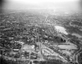 |
Brookline, Aerial View, circa 1958
Chestnut St. runs along the bottom with High St. in the middle going north towards the Village.
FayFoto ID: A91-0915A; URL:http://hdl.handle.net/2047/D20395789
[Source: Northeastern University]
|
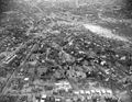 |
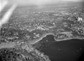
Brookline Village, Aerial View, circa 1958
Looking east toward Brookline Village. In the lower left corner is Walnut St. with Oakland Rd. going to the right toward "The Point" neighborhood.
FayFoto ID: A12-1285; URL:http://hdl.handle.net/2047/D20394881
[Source: Northeastern University]
|
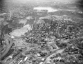 |
Brookline Village, Aerial View, circa 1958
Looking south at Lower Washington St. going from left to right. The core area south of Lower Washington St., known as "The Farm", was razed in the early 1960s as part of an urban renewal program run by the Brookline Redevelopment Authority. The core area north of Lower Washington St. (lower section of the photo), known as "The Marsh", was razed bit by bit from the mid-1960s to the early 1970s as part of The Marsh Urban Renewal Project run by the Authority.
FayFoto ID: A91-0913; URL:http://hdl.handle.net/2047/D20395787
[Source: Northeastern University]
|
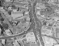 |
Brookline Village, Aerial View
Only a few of the structures remain today, all located in the lower section of the photo.
FayFoto ID: A67-0333; URL:http://hdl.handle.net/2047/D20395346
[Source: Northeastern University]
|

