 |
Lower Washington St. at the Boston Line, circa 1909
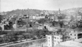
View From Parker Hill. Brookline Hills in the background. At the extreme left in the center of the photo are the two matching apartment buildings that are located at 165 Pond Ave. (front) and 19 Villa Lane (rear). The large black gasometer tank of the Boston Consolidated Gas Co. is in the middle left and the small white house in front of it is located at 19 Villa Lane.
|
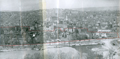 |
The Farm, 1958
Viewed from Parker Hill.
[Source: Brookline Preservation Department]
|
 |
Video: The Farm Prior to Redevelopment, circa 1958
This film was created by the Brookline Redevelopment Authority to promote the replacement of the neighborhood known as The Farm. The film shows both exterior and interior scenes intended as a counterpoint to the new housing units of the Brookline Housing Authority, notably the one on nearby High Street built in 1948-49, designed by Richmond & Goldberg.
[Source: Brookline Preservation Department]
|
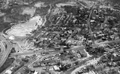 |
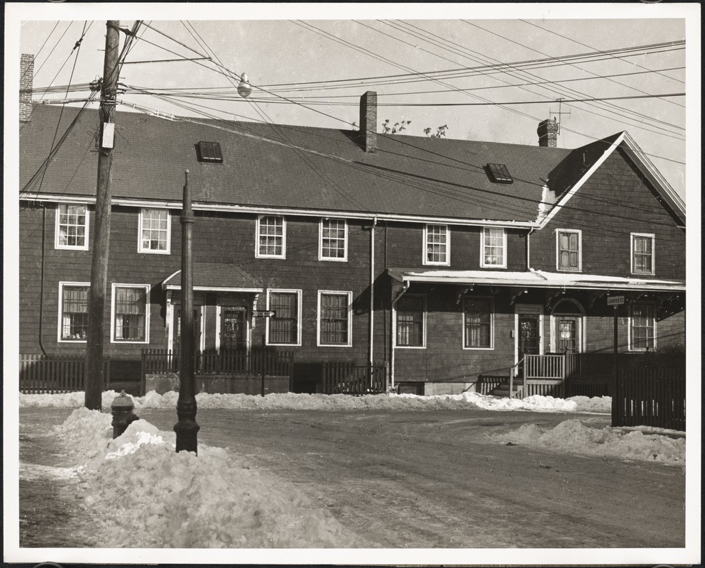
"The Farm", 1958, Piror to Urban Redevelopment
Most of the center of the photo was razed in the early 1960s as part of an urban renewal program. The core area was known as "The Farm".
|
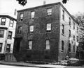 |
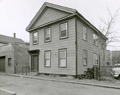
28 Flora St.
Razed for the Brook House complex.
|
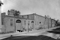 |
Juniper St. Horse Car Stables
Juniper St. looking north toward Morss Ave. The brick structure was the stable for the horses of the West End Street Railway Co. The second floor openings are for hay.
[Source: Leo Sullivan]
|
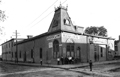 |
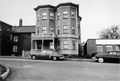
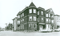
Walnut St. and Morss Ave.
Occupied at the time of this photo by the Brookline Riding Academy at #2 and #4 Walnut St, this building was first erected in 1875 by the Metropolitan Railway Co. to house the horse-drawn cars servicing the Brookline-Roxbury Crossing-Tremont House line. It was closed as a car house in December, 1894, with the move to new electrified routes, and demolished in 1918.
[Source: Leo Sullivan]
|
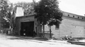 |
Brookline Village Car House of the West End Railway Co.
#2 Walnut St, the car house of the West End Street Railway Co. The building was first erected in 1875 by the Metropolitan Railway Co. to house the horse-drawn cars servicing the Brookline-Roxbury Crossing-Tremont House line. It was closed as a car house in December, 1894, with the move to new electrified routes, and demolished in 1937.
[Source: Leo Sullivan]
|
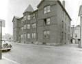 |
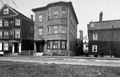
10-12 Morss Ave.
Lower Washington St. is to the left.
[Source: Brookline Preservation Department]
|
 |
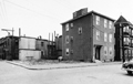
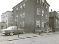
14 - 20 Morss Ave.
Looking north from Juniper St. at the boarding houses of 14, 16, 18, 20 Morss Ave.
[Source: Digital Commonwealth]
|
 |
48 Morss Ave.
Villa Lane going north is on the left. On the right is the vacant lot on the northeast corner of Villa Lane and Morss Ave., formerly 46 Morss Ave, followed by 48 Morss Ave. and a partial view of the side of 185 Pond Ave.
[Source: Brookline Preservation Department]
|
 |
43 Pond Ave.
Looking west, Lower Washington St. is to the right.
[Source: Brookline Preservation Department]
|
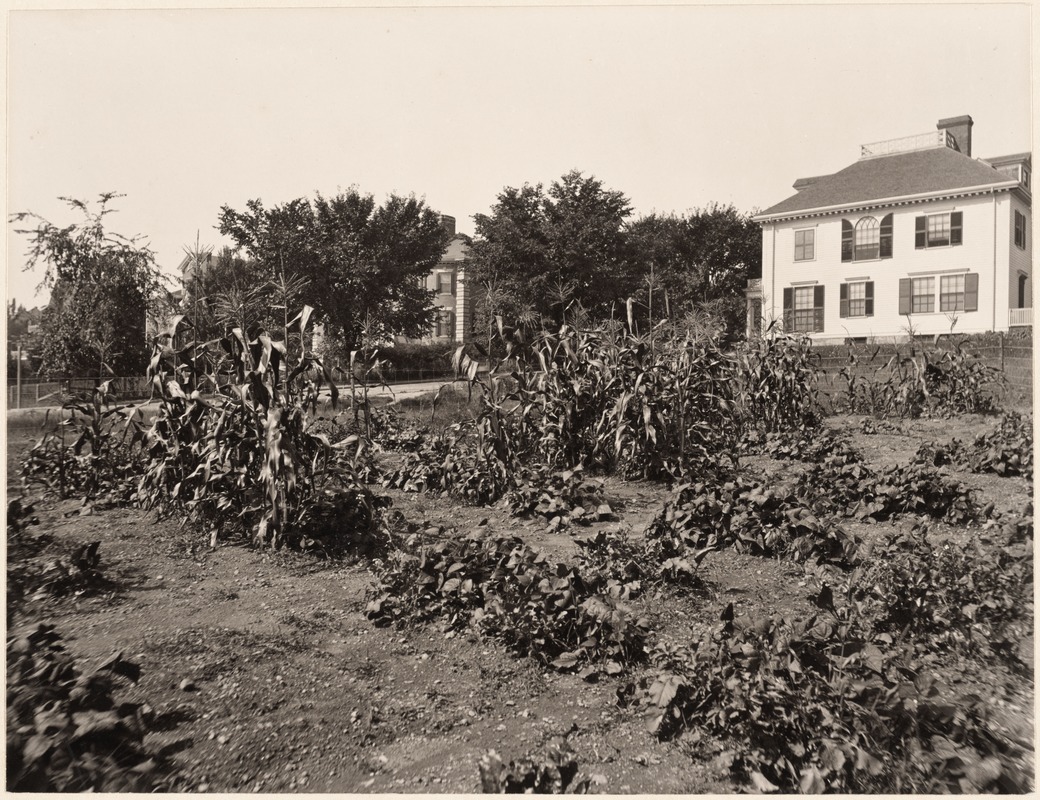 |
Parsons School Gardens, 1903
Looking west toward Allerton St. from the northwest corner with Pond Ave. On the right, the side of 58 Allerton St., later the house of famed singer Roland Hayes, is viewed. On the left is the rear of 4 Hawthorn Rd., both houses are still standing.
The gardens were part of a town-wide program to enhance the learning experience of students. As with the Lincoln and Sewall schools, the gardens were planted on land loaned by private landowners. In this case, the land was loaned by the Brookline Riverdale Land Association.
[Source: Digital Commonwealth]
|
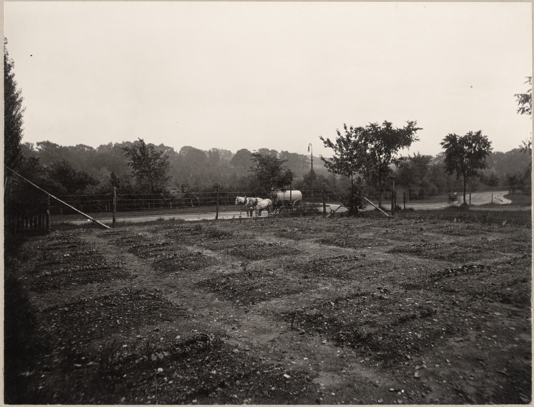 |
Parsons School Gardens, 1903
Looking toward Pond Ave., Allerton St. is on the right. The gardens were part of a town-wide program to enhance the learning experience of students. As with the Lincoln and Sewall schools, the gardens were planted on land loaned by private landowners. In this case, the land was loaned by the Brookline Riverdale Land Association.
In a serendipitous coincidence, the photo includes the only known view of a street-sprinkling wagon being filled with water. The cart was operated by Chester W. Reed who had a contract with the town to water the dirt roads. The water-feeder pole can be viewed by the middle section of the wagon.
[Source: Digital Commonwealth]
|
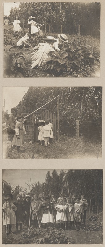 |
Parsons School Gardens, 1903
The Thomas Parsons School garden project involved the third grade students who were supervised by the school principal, Minnie P. Massé. This is one of three experimental school garden projects initiated by the Brookline Education Society in 1903. The gardens were part of a town-wide program to enhance the learning experience of students. As with the Lincoln and Sewall schools, the gardens were planted on land loaned by private landowners. In this case, the land was loaned by the Brookline Riverdale Land Association.
[Source: Digital Commonwealth]
|
 |
Houses Along Pond Ave.
Brookline Village is in the distance in the right half. Morss Ave. is entering Pond Ave. on the left. The large round holding tank of the Brookline Gas Light Co. is visible center right.
[Source: Brookline Preservation Department]
|
 |
Pond Ave.
Left to right: 177, 173, 165
[Source: Brookline Preservation Department]
|
 |
185 and 177 Pond Ave.
Morss Ave. on the left going to Lower Washington St.
[Source: Brookline Preservation Department]
|
 |
19 Villa Lane
[Source: Brookline Preservation Department]
|
 |
22, 26 Villa Lane
[Source: Brookline Preservation Department]
|

