 |
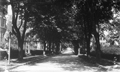
Monmouth St., circa 1910
Looking east from Hawes St.
|
 |
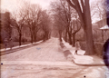
Monmouth St. Looking West, circa 1910
Seen from Carlton St. The George Wales house on the near right was replaced by an apartment buiding in 1924.
|
 |
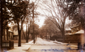
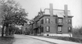
Monmouth St. Looking West, circa 1910
Seen from Carlton St. The George Wales house on the near right was replaced by an apartment buiding in 1924.
|
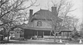 |
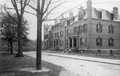
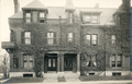
36 Monmouth St.
The house of the John Wales family from circa 1879 until shortly after his death in 1900, no longer standing. Located on the northwest corner of Carlton St. which is just to the right in the photo. One of the two cement posts that bracket the driveway, visible in the photo, remains today. John Wales was the president of the John Wales & Co., a Boston firm that distributed small-form steel products (screws, springs, wire, brackets etc.).
|
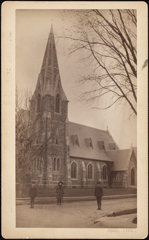 |
Episcopal Church of Our Saviour, Carlton & Monmouth, April 1886
Viewed from Carlton St., Monmouth St. is to the right. The identities of the children are not known. Parenthetically, it is noted that the rector of the church, Reginald Howe, moved his family into the church housing annex around the time of this photo. His daughter was 17 and his son was 11 at the time.
[Source: Digital Commonwealth]
|
 |
Episcopal Church of Our Saviour, Carlton & Monmouth
Carlton to the left, Monmouth going west to the right
|
 |
Monmouth Court, circa 1910
|
 |
Monmouth Court, circa 1910
|
 |
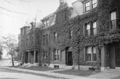
Monmouth Court, West Side
Looking south at numbers 19 - 27.
[Source: Brookline Public Library]
|
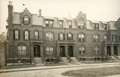 |
Monmouth Court, West Side
Looking south at numbers 19 - 27.
[Source: Brookline Preservation Department]
|
 |
Monmouth Court, East Side
Looking north toward Monmouth St.
[Source: Brookline Public Library]
|
 |
Monmouth St., circa 1910
Looking west from the Chemical Fire Station. On the right, still standing, are 82, 80, 78, 76, 74 Monmouth St.
|
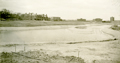 |
Monmouth Court, Rear View, May 7, 1892
Looking from the Boston side toward Monmouth St., photographed as part of Frederick Law Olmsteds Emerald Necklace project. This is an unusual view of a treeless Muddy River. From left to right:
- A partial view of the Carlton St. train stop
- Rear of Monmouth Court West (still standing)
- Rear of Monmouth Court East (still standing)
- Two small gazebo coverings, unidentified
- Partial view of building on Monmouth St., possibly the Longwood School
- Row of brick brownstones on the north side of Beacon St. between St. Marys St. and Park Dr. (still standing)
- Row of brick brownstones on the north side of Beacon St. between Park Dr. and Arundel St. (still standing)
- Row of brick brownstones on the north side of Beacon St. between Miner St. and Mountfort St. (still standing)
- Locomotive heading west on the Boston and Albany tracks, todays D line
[Source: Olmsted]
|
 |
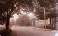
Monmouth St.
Looking east toward St. Mary's St. Numbers 71, 73, 75, 77 are visible.
[Source: Brookline Public Library]
|
 |
75-77 Monmouth St., circa 1910
[Source: Brookline Preservation Department]
|
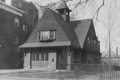 |
Chemical Fire House, Monmouth St.
Part of Hose Company #3. Today, the Brookline Arts Center
[Source: Joel Shield]
|
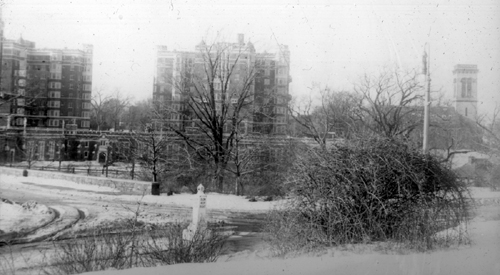 |
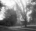
Longwood Towers From the Riverway
|
 |
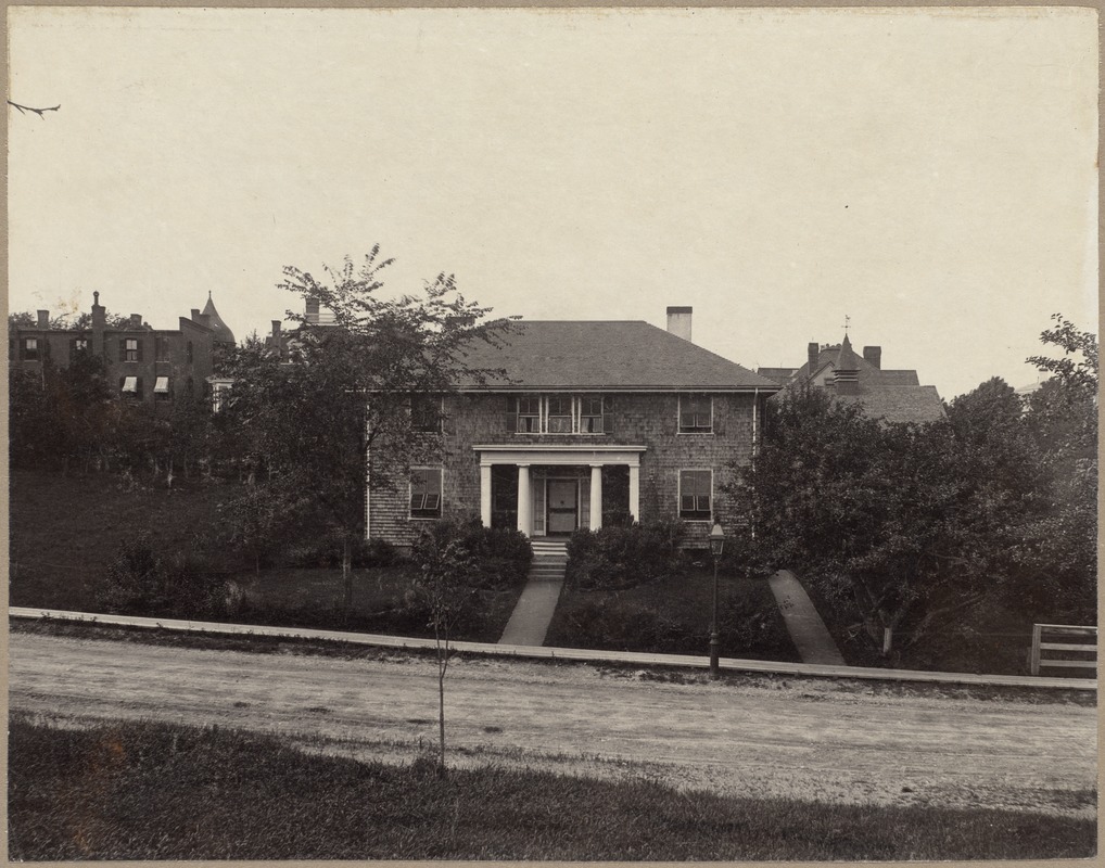
30 Stearns Rd.
House of Alexander Stoddard Jenney
[Source: Digital Commonwealth]
|
 |
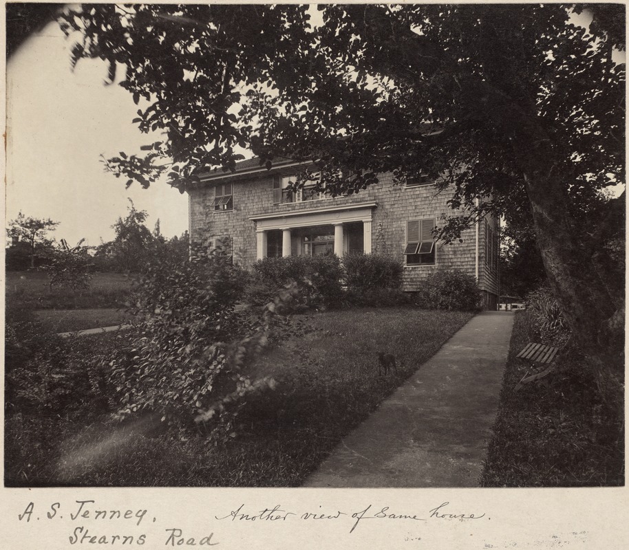
30 Stearns Rd.
House of Alexander Stoddard Jenney. Rear of apartment buildings on Longwood Ave. visible on the left.
[Source: Digital Commonwealth]
|
 |
Longwood Ave. looking west, circa 1909.
197-199 Longwood on left. Driveway from the former Dexter Richard estate right foreground.
|

