|
The Society
Historical Information
Photo & Map Collections
Exploring Brookline
Links
Program Archives
|
Lantern Slides
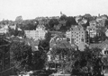 |
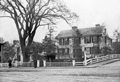
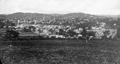
Corey Hill
Looking from Winthrop Rd.,
|
 |
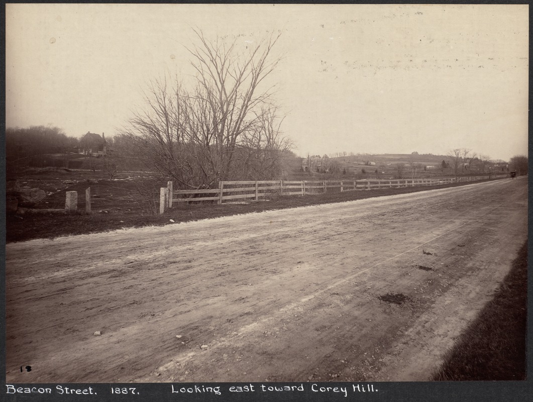
Beacon St., Looking East From Washington St., 1887
In the distance at the top of the hill is the Clark house (formerly the Otis Withington house).
From the 1887 photo series taken just before the widening of Beacon St., most likely by Augustine H. Folsom, a Boston photographer.
[Source: Digital Commonwealth]
|
 |
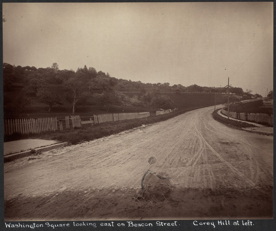
Washington Sq. Looking West on Beacon St., 1887
Winthrop Rd. is along the top of the hill.
From the 1887 photo series taken just before the widening of Beacon St., most likely by Augustine H. Folsom, a Boston photographer.
This photo contains the mystery man, here sitting on the stone fence, who was posed in a number of the 1887 photos.
|
 |
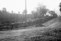
Beacon St. & Winthrop, 1887
Looking east on Beacon St., Winthrop on the right. Washington Square is at the bottom of the hill. In the distance is the Clark house (formerly the Otis Withington house), roughly located at today's Lancaster Terrace. Note gas lamp in center of photo.
From the 1887 photo series taken just before the widening of Beacon St., most likely by Augustine H. Folsom, a Boston photographer.
|
 |
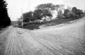
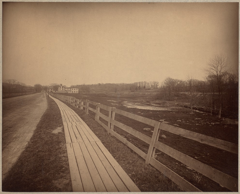
Beacon St. Just West Of Washington Sq.
Looking east, Corey Hill on the left, Washington St. crossing at the bottom of the hill. Eben Jordan mansion, built in 1890, prominent.
|
 |
Beacon St. Looking East From Englewood Ave., 1887
Chamberlain house in the foreground, residence of Susan Y. Chamberlain, widow of Thomas. House of Eugene Knapp in the background on the same side (south). House of Isaac White just visible in the background on the north side of Beacon.
From the 1887 photo series taken just before the widening of Beacon St., most likely by Augustine H. Folsom, a Boston photographer.
[Source: Digital Commonwealth]
|
 |
Beacon St. & Englewood Ave, Reservoir Hotel, 1887
Looking east on Beacon, standing at today's Strathmore Rd. Englewood Ave enters on the left.
From the 1887 photo series taken just before the widening of Beacon St., most likely by Augustine H. Folsom, a Boston photographer.
|
 |
Beacon St. at Englewood Ave., 1887
Looking east on Beacon St. several blocks from Cleveland Circle. Reservoir Hotel is off screen on the right, entrance to Englewood is on the left.
From the 1887 photo series taken just before the widening of Beacon St., most likely by Augustine H. Folsom, a Boston photographer.
|
 |
Beacon Street Looking East from Chestnut Hill Ave., 1887
One of two photos taken from the same spot. Looking east from just east of Cleveland Circle.The Reservoir Hotel is on the right, opposite Englewood Avenue.
From the 1887 photo series taken just before the widening of Beacon St., most likely by Augustine H. Folsom, a Boston photographer.
[Source: Digital Commonwealth]
|
 |
Beacon Street Looking East from Chestnut Hill Ave., 1887
One of two photos taken from the same spot. Looking east from just east of Cleveland Circle. Englewood Ave. enters at the far right.
From the 1887 photo series taken just before the widening of Beacon St., most likely by Augustine H. Folsom, a Boston photographer.
[Source: Digital Commonwealth]
|
 |
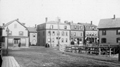
Enos Withington House, 629 Washington St.
Enos Withington was the co-owner of the tannery on Washington St. near Beacon
|
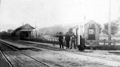 |
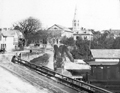
Cypress St. Train Station
Standing on Cypress St. looking west at the station. Tappan St. goes west right behind the station. This precedes the 1891 construction of the bridge over the tracks that still stands today.
|
 |
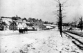
Brookline Village, Washington St. & Davis Ave, early 1860s
Washington St. in the heart of the village, looking northwest, at the corner of Washington Place, today's Davis Ave. Benjamin Davis House, built in 1760, demolished around 1867. Large tree and fences can be viewed in other photos from the 1860s.
|
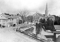 |
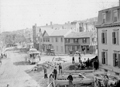
Brookline Village, Looking North on Washington St., 1865
This is one of the two earliest known photos of the Harvard Sq. area of Brookline Village. The business life of the Village was still largely centered along Lower Washington St. From left to right:
- Carriage in front of Kenrick Brothers, stoves and furnaces
- Carriage in front of Marshall Russell, Grocer [unconfirmed]
- Large tree in front of the house of Benjamin Davis
- "Panters Building" at the apex of Washington and Harvard streets. In 1859, John Panter acquired the former Baptist Church building, moved it forward into the apex of the two main thoroughfares, and created storefronts on the first floor.
- Behind the "Panters Building" is the steeple of the newer Baptist Church on Harvard St.
- Coming forward right from the church is the "Rooney Building" which was later raised up one story to accommodate stores underneath and is still standing.
- Foreground right is the train station. This was also the location of the telegraph office (sign visible) and the post office (washed out sign above)
|
 |
Brookline Village, Looking North on Washington St., circa 1865
This is one of the two earliest known photos of the Harvard Sq. area of Brookline Village. The business life of the Village was still largely centered along Lower Washington St. From left to right:
- Carriage in front of Kenrick Brothers, stoves and furnaces
- Carriage in front of Marshall Russell, Grocer [unconfirmed]
- Large tree in front of the house of Benjamin Davis
- "Panters Building" at the apex of Washington and Harvard streets. In 1859, John Panter acquired the former Baptist Church building, moved it forward into the apex of the two main thoroughfares, and created storefronts on the first floor.
- Behind the "Panters Building" is the steeple of the newer Baptist Church on Harvard St.
- Coming forward from the church is the "Rooney Building" which was later raised up one story to accommodate stores underneath and is still standing.
- Foreground right is the train station. This was also the location of the telegraph office (sign visible) and the post office (washed out sign above)
|
 |
Brookline Village, Eastern Border at Huntington Ave, Boston
Looking northwest from Parker Hill.
[Foreground, large angled road] Today's South Huntington Ave. (Boston)
[Center photo from left to right] Boston's Huntington Ave. (formerly Tremont St.) transitioning to Brookline's Washington St.
[Center photo, right side] Houses on Boston's Huntington Ave. (formerly Tremont St.) and Downer St.
[ Center photo, left side] Brooklines Pond Ave. enters lower Washington St
|
 |
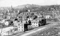
Brookline Village, View From Parker Hill, circa 1874
[Far right to center] Boston's Huntington Ave. (then called Tremont St.); behind it, also running right to left, is Brookline Ave.
[Center-left towards upper left]] Lower Washington St. heads toward Brookline Village. Housing is dense on the north side; the area on the south side known as The Farm, site of today's Brook House, is still predominantly open land.
[Center-left rear] the massive former Town Hall
[Center-right rear] Summit Ave. can be seen going to the top of Corey Hill
|
 |
Houses on Boston Border, Viewed from Brookline
Standing in Brookline on Pond Ave. looking at houses on the northern side of Boston's Huntington Ave (then-named Tremont St.). Transition to Brookline's Washington St. off-photo left. Entrance to Boston's Downer St. is photo center left. Muddy River culvert foreground right.
|
 |
Relocation of the Village Brook, circa 1893
Looking east on lower Washington St. toward Huntington Ave, Boston. Walnut St. feeding in on the right. Note that this is one of two different views taken at the same time.
Tom Condon, Sr. Civil Engineer for Brookline writes:
The work shown is part of the relocation of the outlet of the Village Brook.
(in the pile of lumber in the background you can see a piece of the curved falsework used
to hold the brick arch until the cement mortar set.). Leverett Pond was created from the Muddy River marsh located just south of Washington Street by installing a stop plank manhole (in effect an adjustable height dam) in the new culvert under Washington Street. This stop plank manhole was necessary to hold back the pond since the Charles and therefore the Muddy Rivers were still tidal at that time. Presumably, Alexis French (who was both Olmsted's engineer and the Town Engineer) determined that more flow into this new pond was necessary. To provide this additional flow, the Village Brook which flows alongside what is now the MBTA "D" line was diverted into the culvert shown under construction. The culvert runs east down Washington Street, crosses Walnut Street, runs down Morss Avenue (now discontinued), across Pond Avenue and into Leverett Pond.
|
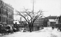 |
Brookline Village, 1885
Washington St. looking south toward the fire station, in the distance, on lower Washington St.; Station St. is to the left; Guild Block building is visible in the rear center.
|
|

