 |
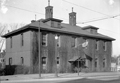
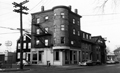
Boylston School
74 Davis St. can be glimsped in the rear.
(ID) 079
(Slide ID) P
[Source: William Robert Murphy Collection]
|
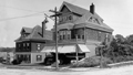 |
Boylston St. at Kennard Rd.
Going east toward Cypress St. is to the left. From right to left:
- The street sign is oddly labeled Clark Road, which is on the other side of Boylston St., instead of Kennard Rd.
- 404 Boylston St. Highly renovated today and now 6 Kennard Rd.
- 402 Boylston St., still standing
(ID) 075
(Slide ID) P 3-2
[Source: William Robert Murphy Collection]
|
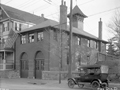 |
Station D, First Location, 796 Boylston St., Appearance Post-1900
Located on the south side of Boylston St. east of Reservoir Rd. It opened in January 1891 and was eventually replaced by the current Station 4 located across the street at 827 Boylston St. To the left is 794 Boylston St., still standing.
This building is the second of two iterations which have presented some identification challenges. First, the fire house that was built two years later, in 1893, on Devotion St. had a virtually identical front façade and doors and the two have been conflated in publication. Second, photos after 1900 show a very different-looking building. But a closer look reveals that its the same building with several new feet added at the bottom and totally different doors added. This was because Boylston St. was lowered six feet for the trolley installation in 1900.
(ID) 042
(Slide ID) P 25-24
[Source: William Robert Murphy Collection]
|
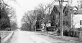 |
Outer Boylston St. (Speculative)
This is probably outer Boylston St. looking east
(ID) 090
(Slide ID) P 102-19
[Source: William Robert Murphy Collection]
|
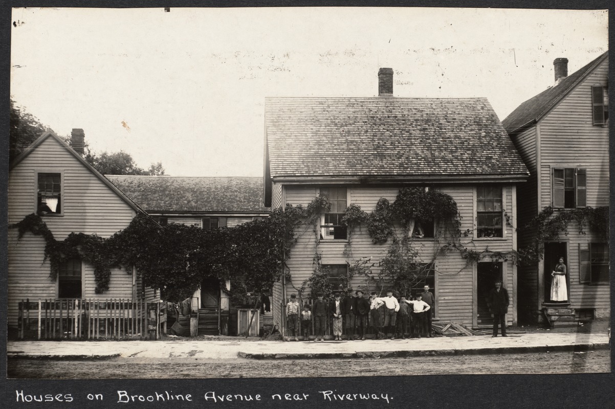 |
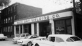
81-89 Brookline Ave.
From left to right are numbers 89, 87 (rear), 85, 81. There was a newspaper reference in 1909 to a nuisance problem at these addresses and they were torn down circa 1910.
[Source: Digital Commonwealth]
|
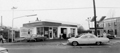 |
Citgo Station, 615 Brookline Ave., January 1966
Looking northwest. Just off screen on the right is the Robert Winthrop School building which still stands. On the right is the Town of Brookline building in the pipe yard on the section of Pearl St. that was eliminated.
From a notebook of property-appraisal photos taken in 1965 and early 1966 for The Marsh Urban Renewal Project run by the Brookline Redevelopment Authority. Only a few scattered peripheral structures remain today.
|
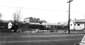 |
Brookline Ave., January 1966
Looking northwest from 646 Brookline Ave. On the right is a partial view of the gas station at 615 Brookline Ave. To its left had been apartment buildings that were razed two years earlier.
From a notebook of property-appraisal photos taken in 1965 and early 1966 for The Marsh Urban Renewal Project run by the Brookline Redevelopment Authority. Only a few scattered peripheral structures remain today.
|
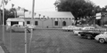 |
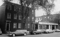
636 Brookline Ave., 1965
Looking south on Brookline Ave. to the right. Building still standing in 2025, one of the very few not removed during the urban renewal project of the 1970s.
From a notebook of property-appraisal photos taken in 1965 and early 1966 for The Marsh Urban Renewal Project run by the Brookline Redevelopment Authority. Only a few scattered peripheral structures remain today.
|
 |
Brookline Ave., January 1966
Looking northeast on Brookline Ave. with Emerald St., todays Pearl St., on the left. From left to right are 657, 651, and 647/645 Brookline Ave.
From a notebook of property-appraisal photos taken in 1965 and early 1966 for The Marsh Urban Renewal Project run by the Brookline Redevelopment Authority. Only a few scattered peripheral structures remain today.
|
 |
666/670 and 676/678 Brookline Ave., January 1966
On the left is the apartment building at 666/670 Brookline Ave. On the right is 676/678 Brookline Ave., a building still standing in 2025, one of the very few not removed during the urban renewal project of the 1970s.
From a notebook of property-appraisal photos taken in 1965 and early 1966 for The Marsh Urban Renewal Project run by the Brookline Redevelopment Authority. Only a few scattered peripheral structures remain today.
|
 |
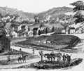
Punch Bowl Tavern
Located on the north side of todays Lower Washington St. at approximately Pearl St. Walnut St. is viewed on the left. This painting is good depiction of early Brookline before the Village became a commercial center. The tavern was a meeting place for British soldiers before the Revolutionary War and when Boylston St., then the Worcester Turnpike, was created in 1806, it became a stage coach stop. The tavern was torn down in 1833 and its timbers were purportedly used in the construction of several houses on White Place.
The painting is by Richard W. Rourke and it was formerly in the collection of the First National Bank: of Boston.
|
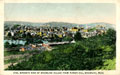 |
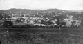
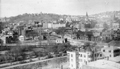
Brookline Village, View From Parker Hill
From Postcard
|
 |
Brookline Village, View From Parker Hill, 1854
From Gleason's Magazine.
|
 |
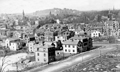
Brookline Village, View From Parker Hill, circa 1874
[Far right to center] Boston's Huntington Ave. (then called Tremont St.); behind it, also running right to left, is Brookline Ave.
[Center-left towards upper left]] Lower Washington St. heads toward Brookline Village. Housing is dense on the north side; the area on the south side known as The Farm, site of today's Brook House, is still predominantly open land.
[Center-left rear] the massive former Town Hall
[Center-right rear] Summit Ave. can be seen going to the top of Corey Hill
|
 |
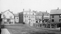
Brookline Village, Eastern Border at Huntington Ave, Boston
Looking northwest from Parker Hill.
[Foreground, large angled road] Today's South Huntington Ave. (Boston)
[Center photo from left to right] Boston's Huntington Ave. (formerly Tremont St.) transitioning to Brookline's Washington St.
[Center photo, right side] Houses on Boston's Huntington Ave. (formerly Tremont St.) and Downer St.
[ Center photo, left side] Brooklines Pond Ave. enters lower Washington St
|
 |
Houses on Boston Border, Viewed from Brookline
Standing in Brookline on Pond Ave. looking at houses on the northern side of Boston's Huntington Ave (then-named Tremont St.). Transition to Brookline's Washington St. off-photo left. Entrance to Boston's Downer St. is photo center left. Muddy River culvert foreground right.
|
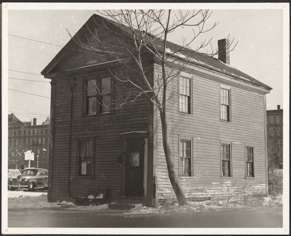 |
624 Brookline Ave.
The house at 624 Brookline Ave., roughly across from the Robert Winthrop School and initially numbered 39 then 103 and finally 624, was essentially the home of members of the Bingham family for its entire existence. The Binghams, Irish immigrants, moved in circa 1880. By the 1940s two unmarried children remained. John Bingham died in 1958 and Elizabeth Esther Bingham died in 1959 at the age of eighty.
The apartment buildings on the Riverway in Boston can be viewed in the rear. The town ordered the demolition of the house in 1961 and, in the coming decade, would demolish the entire neighborhood known as The Marsh.
[Source: Digital Commonwealth]
|
 |
Lower Washington St. at the Boston Line, circa 1909
View From Parker Hill. Brookline Hills in the background. At the extreme left in the center of the photo are the two matching apartment buildings that are located at 165 Pond Ave. (front) and 19 Villa Lane (rear). The large black gasometer tank of the Boston Consolidated Gas Co. is in the middle left and the small white house in front of it is located at 19 Villa Lane.
|
 |
Pond Ave.
Leverett Pond. Rear, right to left: Washington St. goes from the Boston border over the visible stone bridge toward Brookline Village. Left: 7 houses along Pond Ave bisected by Morss Ave., all replaced by the Brook House apartments.
[Source: Smithsonian]
|

