 |
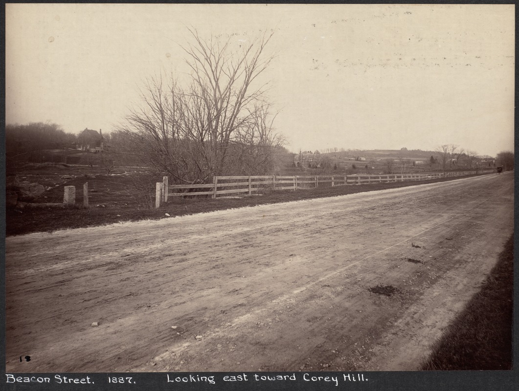
Beacon Street Looking East from Chestnut Hill Ave., 1887
One of two photos taken from the same spot. Looking east from just east of Cleveland Circle.The Reservoir Hotel is on the right, opposite Englewood Avenue.
From the 1887 photo series taken just before the widening of Beacon St., most likely by Augustine H. Folsom, a Boston photographer.
[Source: Digital Commonwealth]
|
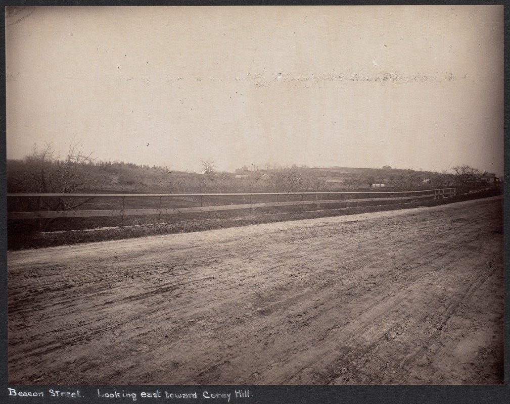 |
Beacon Street Looking East near Chestnut Hill Ave., 1887
Englewood Avenue enters on the left in the far distance.
From the 1887 photo series taken just before the widening of Beacon St., most likely by Augustine H. Folsom, a Boston photographer.
[Source: Digital Commonwealth]
|
 |
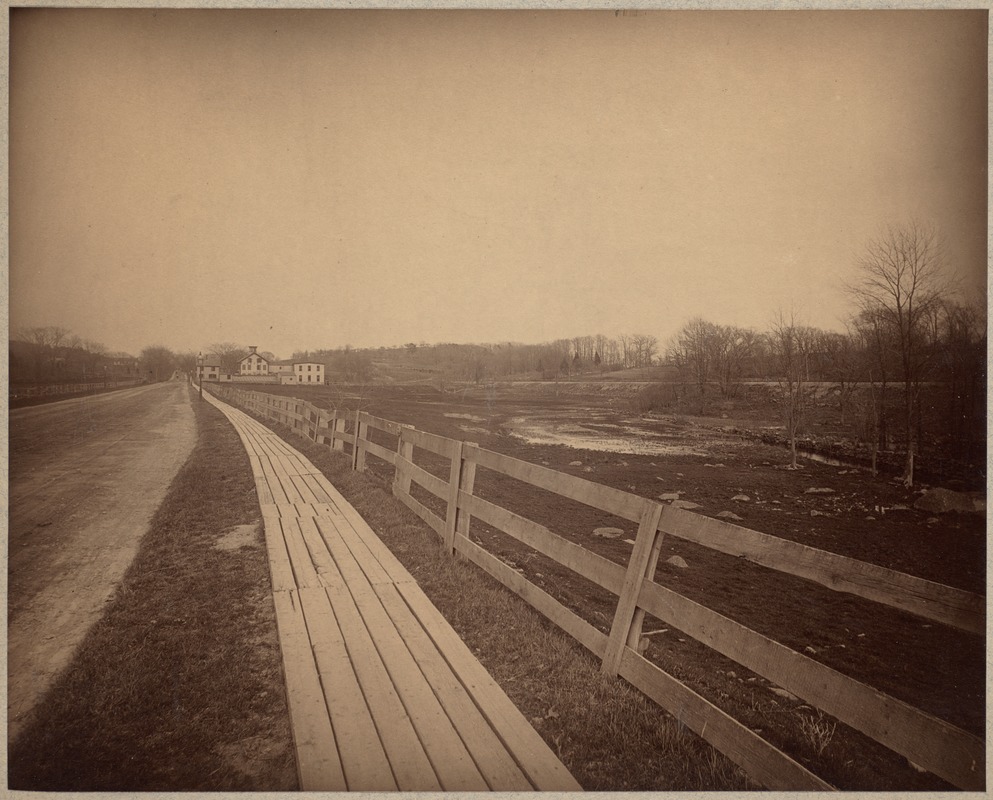
Beacon Street Looking East from Chestnut Hill Ave., 1887
One of two photos taken from the same spot. Looking east from just east of Cleveland Circle. Englewood Ave. enters at the far right.
From the 1887 photo series taken just before the widening of Beacon St., most likely by Augustine H. Folsom, a Boston photographer.
[Source: Digital Commonwealth]
|
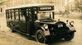 |
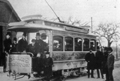
Boston Elevated Railway Bus, Circa 1927
The Boston Elevated Railway opened a de luxe bus line between Brookline and Boston in 1927. It initially started in Coolidge Corner, that was later extended to Washington Square. The license plate of this bus, stopped in Cleveland Circle, is dated 1927 but it is not clear which route is involved. Beacon St. inbound is off screen to the right. Bostons Sutherland Rd. descends in the middle of the photo.
[Source: Joel Shield]
|
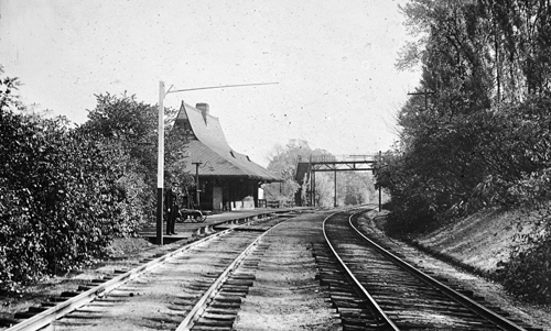 |
Reservoir Station, Boston and Albany Railroad
[Source: Iowa State]
|
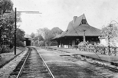 |
Reservoir Station, Boston and Albany Railroad
[Source: Iowa State]
|
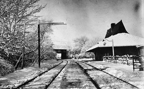 |
Reservoir Station, Boston and Albany Railroad
[Source: Iowa State]
|
 |
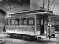
Early Beacon St. Trolley Car
Shown in front of the Oak Square, Brighton car barn. This car was the first to run on Henry Whitney's groundbreaking streetcar line which started service in 1889. It was used on two routes: Beacon Street from Coolidge Corner to the Chestnut Hill Reservoir and from the Allston powerhouse to the car barn in Oak Square.
|
 |
Early Electric Trolley Car
This car was the first model to run on Henry Whitney's groundbreaking streetcar line which started service in 1889 as part of the widening of Beacon Street.
|
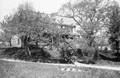 |
Enos Withington House, 629 Washington St.
Enos Withington was the co-owner of the tannery on Washington St. near Beacon
|
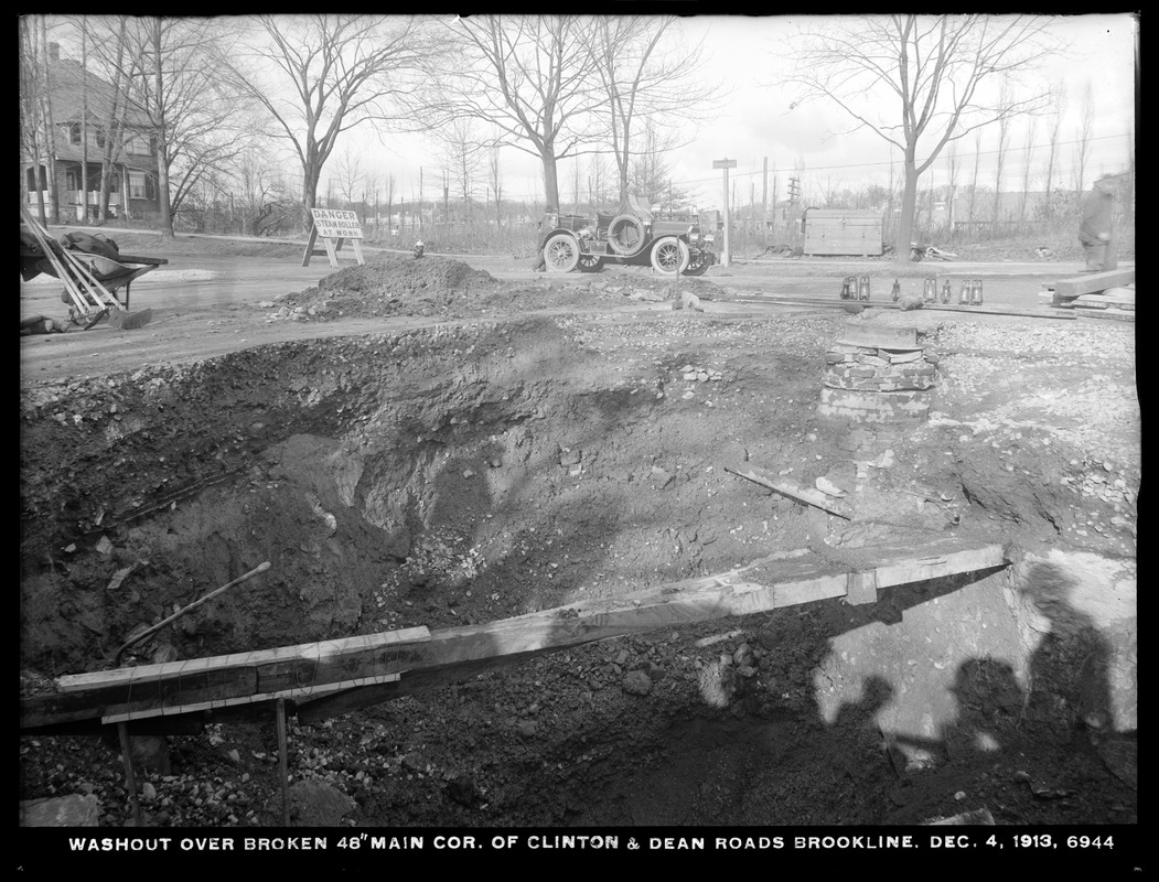 |
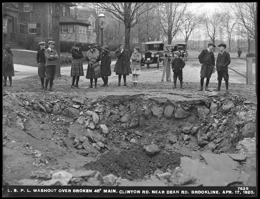
Clinton and Dean Rds., 1913
Looking northwest toward Beacon St. 233 Clinton Rd. is on the left. In the early morning hours of December 5, 1913 (the date imprinted on the photo is inaccurate), a large water main burst here flooding the neighborhood and damaging homes.
In the center of the photo is the car of fire chief George H. Johnson. It is a Knox Model R Chiefs Car that was delivered to the town in August, 1909. It could seat the chief and his driver up front, two firefighters in the back, and carried light equipment like a lantern, axe, and extinguisher. It was capable of traveling at speeds up to 50 mph and was a dramatic change from the horses that were used just a few years earlier.
[Source: Digital Commonwealth]
|
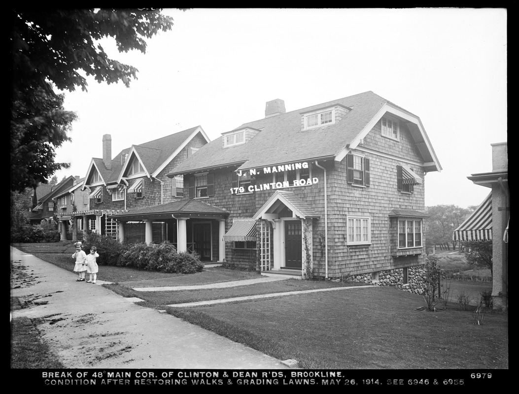 |
Clinton Rd., 1914
The house in the foreground with the label was that of Joseph Nelson Manning and family. Daughter, Charlotte, was 3 ¾ years old at the time of the photo which perfectly matches the little girl standing in front. The younger boy is unidentified.
[Source: Digital Commonwealth]
|
 |
Clinton Rd., 1920
Looking west on Clinton Rd. Dean Rd. crosses from left to right. Foreground left is 204 Clinton Rd. followed by 78 Dean Rd., then a small corner of 73 Dean Rd., and 233 Clinton Rd. obscured in the distance. The lead car has an MDC license plate.
[Source: Digital Commonwealth]
|
 |
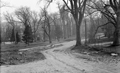
Cypress St. Train Station
Standing on Cypress St. looking west at the station. Tappan St. goes west right behind the station. This precedes the 1891 construction of the bridge over the tracks that still stands today.
|
 |
Brookline Hills Station, 1907
|
 |
Locomotive of the Boston and Albany Railroad, circa 1910
Heading east at the Brookline Hills Station. The Manual Training School is behind the station The High School is on the right..
|
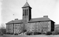 |
High School
(ID) 121
(Slide ID) P-25-18
[Source: William Robert Murphy Collection]
|
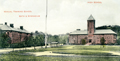 |
High School, Manual Training School, Bath House
|
 |
Blake Estate Construction, April 30, 1927
The vantage point is from the Blake Estate on the hill above the high school. Stanton Rd. is coming in from the left. In the distance from left to right:
- 80 Greenough St. barely visible through the trees
- Manual Training School barely visible through the trees
- Outbuildings on the Blake Estate, no longer standing but roughly located on the east side of todays Lowell Rd.
- High School
(ID) 106
(Slide ID) P-69-23
[Source: William Robert Murphy Collection]
|
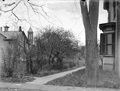 |
Blake Estate
Standing in the Blake Estate looking across the rear of estate outbuildings and the high school to houses on Tappan St.
(ID) 107
(Slide ID) P-6-8
[Source: William Robert Murphy Collection]
|

