Walking Tour: Coolidge Corner West, The Sharp and Griggs Farms
Courtesy, Brookline Preservation Commission
This is a custom reproduction, by permission of the the Brookline Preservation Commission (originally "Historical Commission"), of the second tour, entitled "The Sharp and Griggs Farms", that appeared in their 1982 publication
A Guide To North Brookline: Five Walking Tours. This
[tour map] shows the route and the indexed locations on this page. The Commission operates as part of the Town of Brookline and has a number of publications on the history of Brookline which they have generously made available to us.
See also:
This tour explores areas which were once farmlands belonging to several prominent Brookline families and their descendants. A walk along Marion Street leads through land which constituted a small part of the Robert Sharp estate, used as farmland as early as 1693. Between 1650 and 1798, six successive generations of Robert Sharps owned this farm; when the sixth Robert Sharp died without heirs in 1798, his holdings were inherited by his siblings. Eventually forty-one acres of Sharp's holdings were passed on to his niece, Hannah Clark Jones, and her husband. They built a house in 1806 between what are now Foster and Vernon Streets, not far away from the Sharp farmhouse; both houses have been demolished.
The Jones property was subdivided for residential use in 1844, and Marion Street, Vernon Street, and Park Street (then called Harvard Place) were laid out. It is interesting to note that Alexander Wadsworth, who worked on the design for the Mount Auburn Cemetery in Cambridge in 1831, planned this subdivision. He also laid out Linden Street and Linden Place during the same year. In both instances a park was included in his designs. Park Street was probably named for this park, now called St. Mark's Square, a planned, open space in a residential neighborhood. It was owned privately until 1898 at which time the town's Parks Commission accepted it as a gift from the heirs of Marshal Stearns.
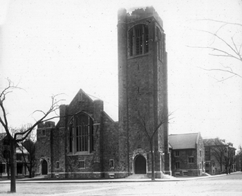
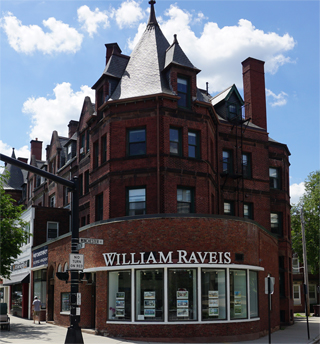
Harvard Congregational Church
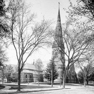
The tour begins at the United Parish Church, located at the corner of Harvard and Marion Streets. Now the home of three merged congregations, this building first housed the Evangelical (or Orthodox) Congregational Church, founded in Brookline in 1844. Meeting first in a private home, the congregation later bought land on the corner of Washington and School Streets and built the Bethany Building. In 1873 after outgrowing that facility, it purchased land on the corner of Harvard and Marion Streets for thirty cents per square foot and hired Edward Tuckerman Potter to design a new church. Shepley, Rutan and Coolidge were the architects of the chapel and auditorium which were added in 1889. In 1931 a disastrous fire destroyed all but two walls and the tower of the church, but during the following year the congregation rebuilt the structure, using much of the original floor plan.

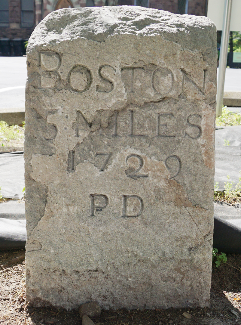
Mile Marker
Variegated stonework, irregular massing, decorative stone bands, and polychromatic arches are some of the features which contribute to the High Victorian Gothic flavor of this building. Brownstone, marble, granite, and Pennsylvania verde antigue, a limestone which turns copper green through oxidation, have been used in the construction of the exterior walls and steeple.
Before proceeding up Marion Street, note the 1729 milestone in front of the church on Harvard Street, showing a distance of five miles to Boston. One of a series of stones marking the route from Boston to Cambridge, it was placed by Paul Dudley, a naturalist and a justice of the Massachusetts Supreme Court.

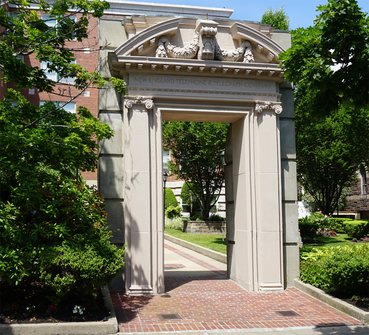
Preserved Arch of New England Telephone Co.
At #20 Marion Street, on the left-hand side of the street, we come to one of the older houses in the area, having been built in 1879 by a Boston merchant, George Greene [
Editor's note: no longer standing]. Across the street are the offices of the New England Telephone Company
[3] [
Editor's note: no longer standing but the original entrance arch remains]. Designed in 1916 by the well-known architect, R. Clipston Sturgis, who also designed the main branch of the Brookline Public Library, this structure is the third home of the telephone company. Beginning in a little room in the Joyce Building in Brookline Village, where the Town's first telephone exchange was founded in 1880 by Charles Holtzer, the telephone company moved into a brick building on Aspinwall Avenue in 1901. Although another building was erected on Aspinwall Avenue to accommodate the company's increased business, in 1916 the Munroe Goodspeed estate on Marion Street was purchased, the houses demolished, and the present building constructed. The adjacent telephone building was erected in 1963. Before walking on, note the bell motifs used in the exterior decorative detailing.
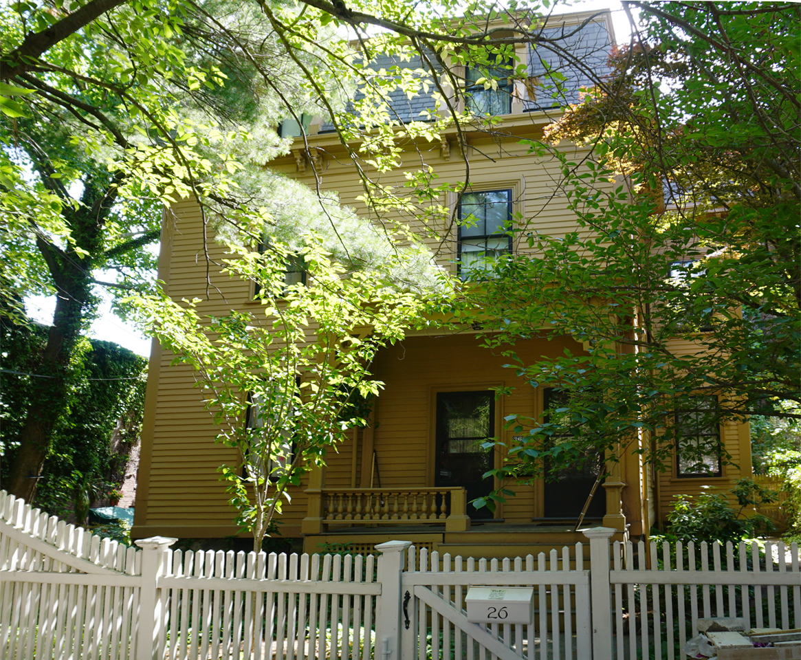
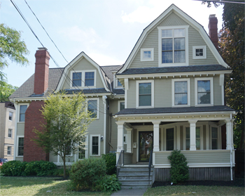
44 Marion Street
In the design of #44 Marion Street we see a fine example of the Queen Anne Style, illustrated by the asymmetrical massing, turrets, variety of building materials such as brick, decorative shingles, and wooden clapboards, and many windows of varying shapes and sizes. The tall decorated chimney is another typical architectural feature of this style.
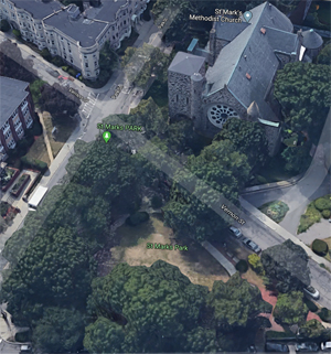
St. Mark's Square & St. Mark's Methodist Church
courtesy Google Maps
At the intersection of Park and Marion Streets is St. Mark's Square. The green, open space provides an attractive setting for the large Romanesque Revival style church
[6] which once belonged to the congregation of St. Mark's Methodist Church, formed in Brookline in 1873. First holding meetings in the Bethany Building, the town hall, and a chapel built on the corner of Washington and Cypress Streets, the members later purchased 25,000 square feet of land at the corner of Vernon and Park Streets and laid the building's cornerstone in 1892. The church was dedicated in 1896; the cost of construction was $160,000.
Built of Brighton ledge stone with Nova Scotia sandstone trim, St.Mark's was designed by George Clough, architect of the Suffolk County Courthouse in Boston. Among its more outstanding features are the tower, arcaded porch, and monumental rose window. Original plans called for the construction of an additional carillon tower above the existing tower, but because it was discovered that the building rested on fillea land, the construction of the carillon was not undertaken.
By the 1970's, the congregation of St. Mark's had merged with those of the Baptist and Congregational churches of Brookline; efforts by the neighborhood and town agencies, particularly the Historical Commission, prevented the demolition of this National Register property, now converted to condominiums.
Baptist Church
Interestingly, the site of the Baptist Church is nearby, at the intersection of Park, Webster, and Beacon Streets. The building, demolished during the 1960's, had been designed by Julius Schweinfurth in 1907 (
[see Tour 1]). It was the fourth home of a congregation which formed in 1828, led by members of the Corey, Coolidge, and Griggs families. A chapel built at the corner of Washington and Harvard Streets soon proved insufficient for the growing congregation, and so a church was constructed on this site, while the chapel was moved and converted to a parsonage. In 1858 a new church was built at the corner of Pierce and Harvard Streets, now the location of the Presbyterian Church. Among the better-known ministers was William Shailer who performed baptisms in the Charles River in 1837. Shailer's predecessor had used the Muddy River, while some of his successors took advantage of nearby Jamaica Pond.
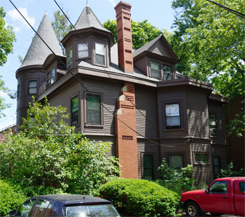
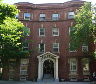
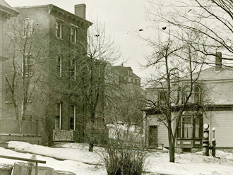
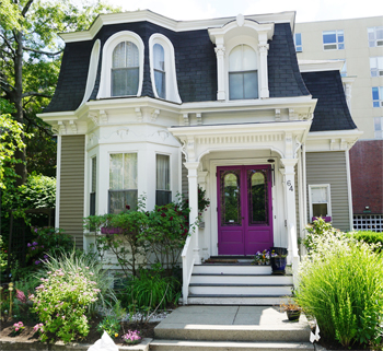
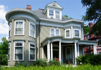
105 Marion Street In Original Location, 1887
Source: Digital Commonwealth
The home of one of the church's deacons, Austin Benton, can be seen at #105 Marion Street. This house, the oldest on the street, was built in 1861-62 in the Mansard style with a bell cast pediment and imbricated slate roof. Among its more attractive details are the symmetrical facade, double brackets, and Palladian window over the gracefully arched doorway. The house has been moved twice, but its present location is near the original site. Benton was a Town assessor and selectman and a Representative to the Great and General Court in 1871- 72. He was remembered by one of his fellow deacons as "a little disposed to look on the dark side, but always ready to do his part, even when he thought his brethren a little too ready to advance." [
Editor's Note: Directly across from 105 Marion St. is Mason Path which leads to Grigg's Park. A quick side trip is recommended.] Although the Baptist church is no longer standing, its bell
[8], cast in a Boston foundry, has been placed in the plaza of #1369 Beacon Street, at the church's former site.
The next part of the tour includes the Winchester and Centre Streets neighborhood. The land through which these two streets were laid out was part of one of the largest farms in eighteenth century Brookline. John Baptist Church Winchester, for whose family Winchester Bell Street was named, was the son of an English immigrant who owned land in what we now call South Brookline. By the mid-eighteenth century, Winchester descendants owned a farm in North Brookline which stretched from the west side of Harvard Street towards Washington Street, encompassing Corey Hill, and north as far as the Brighton line.

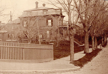
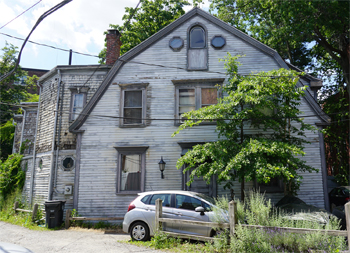
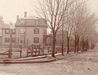
Farm of Thomas Griggs
By 1786 Nathan Winchester, representing the fourth generation of that family to live in Brookline, had sold some of the land to Thomas Griggs, a member of another well-known family. The Griggses held on to much of their property until 1906, although Deacon Thomas Griggs, the grandson of the first owner, had indicated his intention to sell at least some of the property as early as 1856 by having the land platted and roads laid out. It was Deacon Griggs who purchased additional land in this area to expand the family's holdings to over one hundred acres of farmland and orchards. [
Editor's Note: Just to the right of Mason Path is the approximate point of view of this photo of the farm of Thomas Griggs.]
The Griggs family, whose relations also owned land in Brookline Village and around Washington Square, was one of several families involved in the development of North Brookline and Coolidge Corner. The family leaves its mark on North Brookline today not only through some of the houses which they built but also through the names of three of the streets on this tour. Fuller Street was named for Harriet Fuller, wife of Deacon Thomas Griggs; Williams Street was named for Margaret Williams, wife of Thomas Griggs and paternal grandmother of Deacon Thomas Griggs; and Shailer Street was named for Hezekiah Shailer, a schoolmaster, brother of William Shailer (the Baptist preacher) and husband of Mary Jane Griggs, a daughter of Deacon Thomas.
In terms of development, the section of Winchester Street between Beacon and Fuller Streets remained open land until the early 1870's at which time William J. Griggs, then owner of the land, sold off some house lots which were soon developed. Some of those earlier houses still stand, but the larger portion of Winchester Street was built up during the 1920's and 1930's. Before the street was fully developed, the Brookline Toboggan Club had a little building on the upper part of Winchester Street. From the roof of that building, coasters cut across the farms towards Beacon Street. However, as one former resident recalled in the 1953 Proceedings of the Brookline Historical Society, "When building began, coasting had to cease."
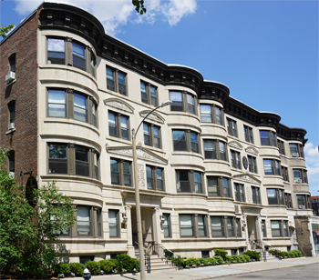
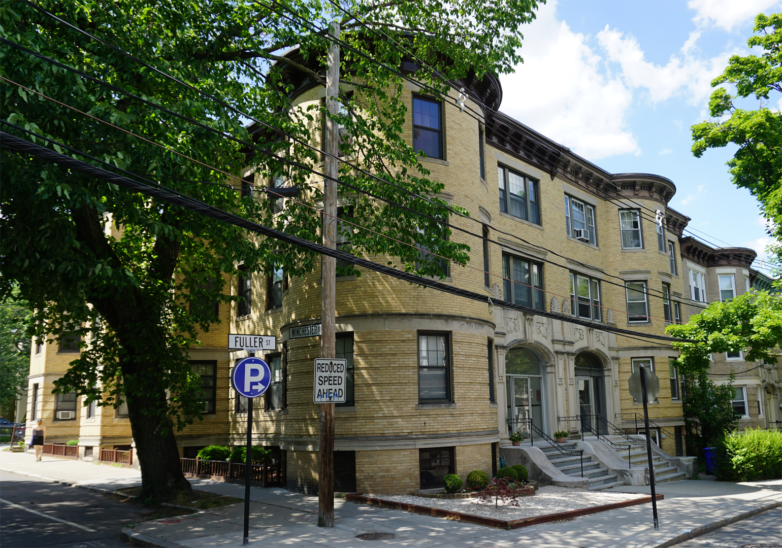
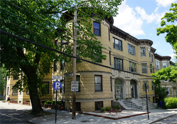
The Richelieu and The Winchester
On the northeast corner of Beacon and Winchester Streets are a series of buildings, each constructed as an eight family apartment house (9). The Windsor, Wrexham, Tamworth, and Wedgemoir at #1378-1392A Beacon Street as well as The Richelieu and The Winchester at #1-5 Winchester Street were all designed by W. H. Andrews in 1902-03 and were built by Peleg Briggs Wadsworth, a real estate developer . Andrews designed these brick and limestone buildings using a number of architectural elements found in the designs of other Beacon Street buildings dating from the late nineteenth and early twentieth centuries: rounded bay windows alternating with flat facades; projecting cornices with brackets and dentils; and center entrances.
Northwest corner of Beacon Street
On the northwest corner of Beacon Street is a block of attached townhouses (10), designed in 1890 by Shepley, Rutan and Coolidge, successors to the architectural firm of H. H. Richardson. George Shepley, who married H. H. Richardson's daughter, and Charles Rutan both lived in Brookline; their firm designed the Seamans Building at #256 Washington Street, the First Parish Church at #400 Walnut Street, and the Leyden Church (now Chinese Christian Church) at #1841 Beacon Street.
Like Richter Terrace at #1751-63 Beacon Street, this brick and limestone block was designed in the Chateauesque style. Its massing and roof lines complement those of the S. S. Pierce Building at the corner of Beacon and Harvard Streets and with its towers, gables, and dormers create a lively silhouette. Of particular interest is the building's date inscribed in the gable peak, surmounted by a lion holding a shield. Unfortunately, two of the original townhouses have been demolished, and the first floors and in some cases the second floors of the remaining units have been extensively altered.
20 Winchester St.
As we begin to walk down Winchester Street, note the three brick apartment houses at #s 16,20, and 24. Built between 1898 and 1904, each building has handsome decorative details, such as the scrolled brackets under the first floor bay of #16; the brick cornice, egg and dart molding, and garlands of #20; and the panel brick work, round arch windows with wooden tracery, and column capitals with carved faces of #24. This group of buildings, although not identical, is of similar apartments at attractive and street. size and scale and with the row of #30-42 Winchester Street, creates an attractive and uniform facade on this section of the street.
14 Winchester Street
Before proceeding up the street, look between #16 and #20 and note a stable, now #14 Winchester Street (12), built in 1895 to accommodate four horses owned by Marshall Pollard who lived at #1396 Beacon Street. Used in later years as a garage and now as a residence, this wooden building reflects the influence of the Colonial Revival style in its type of roof, exterior wall fabric, and such details as the leaded glass oval window as well as the dentils underneath the window cornices. The cupola adds an appropriate touch.
26 Winchester St. 1887
Source: Digital Commonwealth
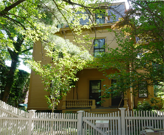
26 Winchester St. Today
[13] Another building partially hidden from view is #26 Winchester Street, the front of which can be seen from the driveway which runs between #24 and #30. This house was built in 1871-72 by Elbridge Wason, a wholesale grocer from Boston, who lived at the corner of Harvard Street and Alton Place and built this house for income purposes. After her husband's death, Mary Wason built the townhouses at #1394-1408 Beacon Street.
Originally fronting on the street, #26 Winchester was moved back from its lot in the early 1900's. It is a Mansard style house, readily identifiable not only by the mansard roof but also by the corner pilasters and paired brackets under deep set eaves. The shed dormers, almost straight line of the roof, and geometric treatment of mass are typical of the mansards built at this time. A similar house, also dating from the 1870's, can be seen on nearby Atherton Road.
Across the street and several houses down is #43 Winchester Street (14), one of several houses built by William J. Griggs for rental income purposes. This simple two-and one-half story home dates from 1887-88 and still retains its original shingled exterior.
Corey Hill Garage & Gas Pump, 1915
Source: National Park Service, Frederick Law Olmsted National Historic Site
54 Winchester St.
Section on the Right: Old Corey Hill Garage
Private stables were a very common feature on Winchester Street during the second half of the nineteenth and early years of the twentieth centuries; we have just seen one surviving example at #14 Winchester Street. However, boarding stables were somewhat unusual. The Griggs family owned a wooden stable near #100 Winchester Street which probably housed, among other vehicles, the omnibuses and horses used on the transportation route between Coolidge Corner and Longwood Avenue. Although this building has been demolished, another one, part of which was built as a boarding stable, remains at #54-56 (15) Winchester Street. In 1896, responding to the growth of the surrounding neighborhood, Charles F. Lord and Jefferson Bradbury built a large brick stable in shape of an L. Boarding horses and renting out horses and carriages, their business met with such success that by 1907 the building had been expanded to its present size. By 1913, the original part was still used as a stable, but the new addition had become known as the Corey Hill Garage, thus accommodating two modes of transportation. By 1927 the entire building was used for automobiles, and today it is being converted into residential condominiums.
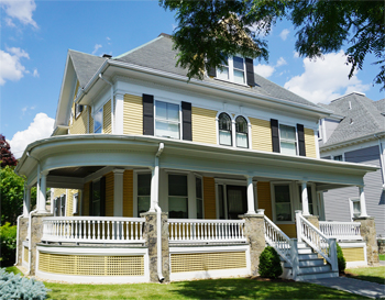
64 Winchester St.
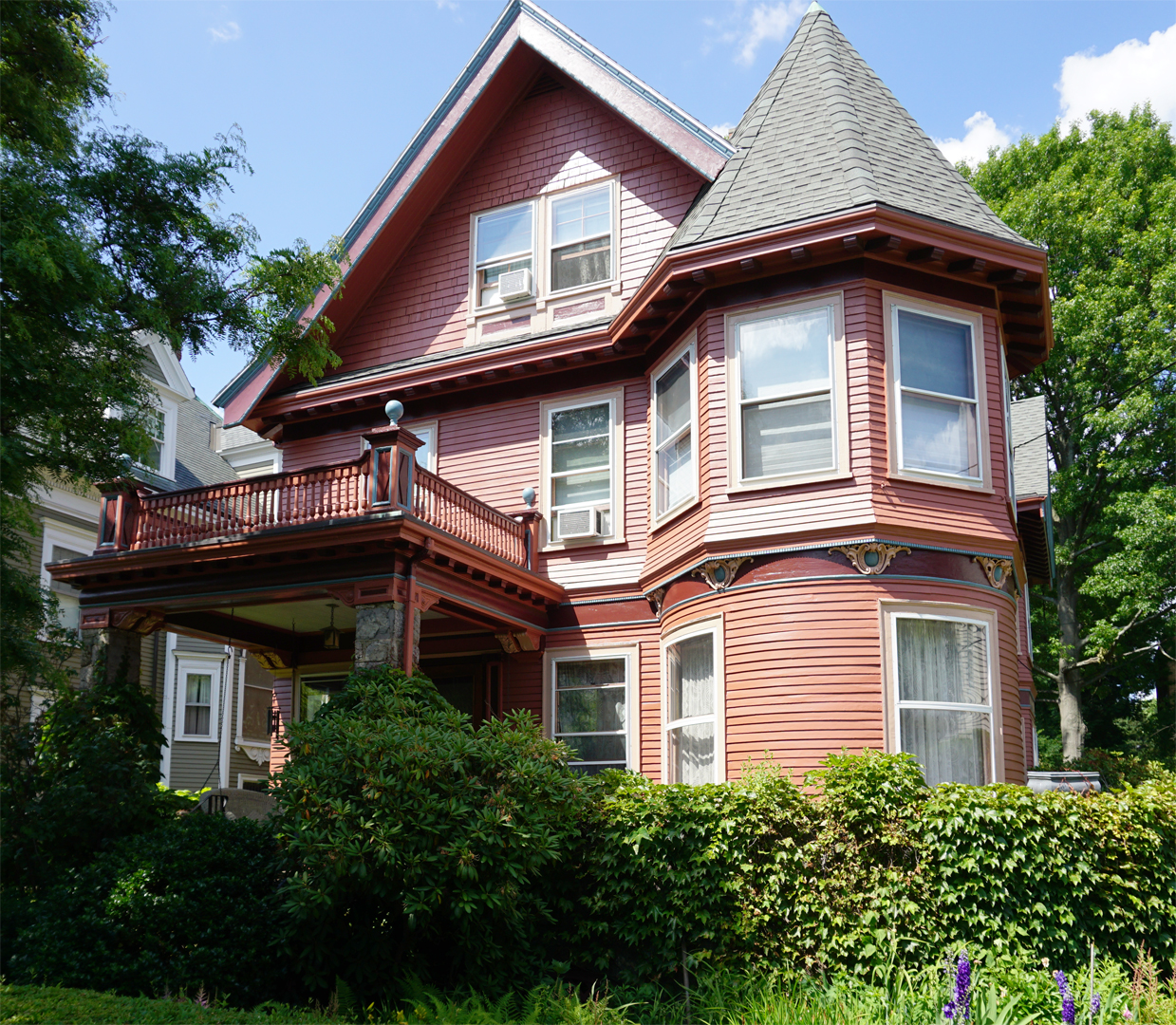
With #64 Winchester Street we come to a more ornate Mansard-style house. It too was built in 1871, but features a far more complex and animated treatment of the facade, thus anticipating the exuberance and vigor of the Queen Anne style. The curved window frames in the dormers, paired brackets under the cornice, paneled frieze board, and carved porch posts make this house one of the more architecturally and visually exciting ones on the street. The first owner of this house, the Reverend John Orrack, lived here for over thirty years. He was editor of the Advent Herald, a religious newspaper published weekly by the American Millenial Association, with a yearly subscription costing a mere $2.00.
Next door is another relatively old house for this street; #74-76 Winchester Street (17) was built as two attached single-family houses in 1886 by Deland Sheplie, president of Deland Sheplie and Company, purveyors of bonnet frames. Two of Sheplie's early tenants worked in Brookline; one ran a grocery store near the railroad station at Longwood, while the other was superintendent of the Brookline Post Office. Number 74 still retains some of its original architectural features, such as decorative shingles, window trim, and detail around the first-floor bay.

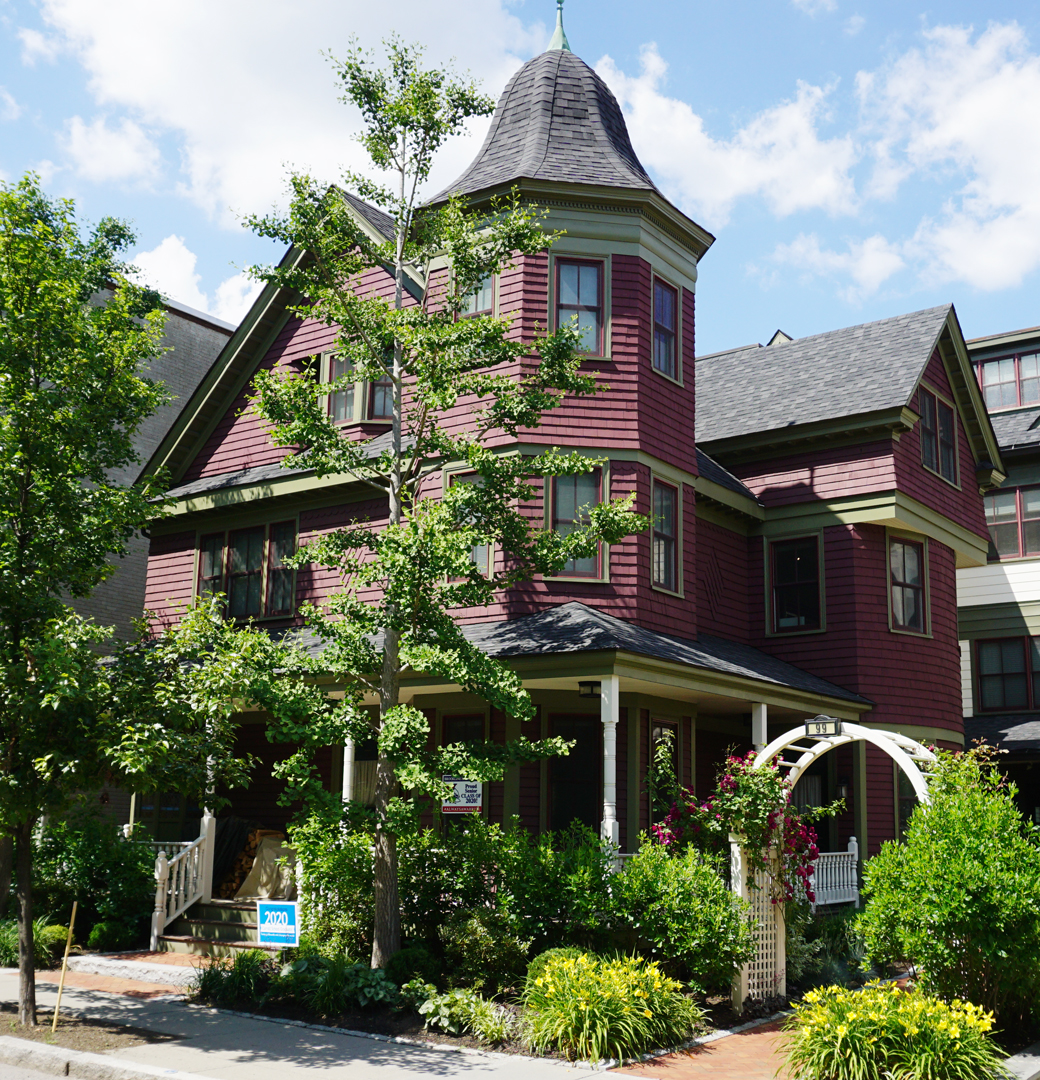
99 Winchester Street
At #99 Winchester Street is a fine example of a house whose design incorporates elements of both the Queen Anne and Shingle Styles. Here are the asymmetrical massing, three story turreted bay , overhangs, and turned porch balusters which typify the Queen Anne style, yet the shingle exterior, use of saw tooth and scalloped shingles along the string courses, and curving wall of the third floor gable on the front facade all indicate the influence of the Shingle Style. A nearly identical house was built on the adjoining lot; it was torn down in 1975.
Fuller St.
Continuing up the street and turning right on to Fuller Street, note the row of apartments on the left. The rounded bays, dentils, brackets, and projecting cornices, seen so often in the design of other Brookline apartments, are also found here. However, stylized details at the entrance distinguish this building from many others.
129 Centre Street
During the 1890's, Centre Street began to develop into a residential neighborhood. Today it is greatly changed from its original appearance; late nineteenth and early twentieth century houses are now mixed with parking lots, built during the 1950's and 1960's, and townhouses and apartments, built during the 1970's.
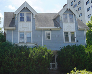
[20] At the corner of Fuller and Centre Streets is #129 Centre, one of several Colonial Revival type houses built in the area at the turn of the century. This 1898 house features a hip roof, dentil frieze, egg and dart molding, corner boards, a Palladian-type stained glass window, and an exaggerated swan's neck pediment on top of the gable dormer. Next door is a house dating from 1896. Although #123 Centre Street (21) 'lacks some of the decorative details of #129, it is similar in size and scale.
108 Centre Street
The house at #108 Centre Street was designed by Julius Schweinfurth, well known Brookline architect. Schweinfurth was fluent in the Queen Anne as well as the Medieval Revival styles as illustrated by the house at #103 Sewall Avenue (see Tour 1) and by this structure. The wide decorative bargeboards and drop pendants, indicative of the Medieval Revival style, are found in the gables of this house, but the vertical emphasis, shingle pattern variations, fanciful spandrel-like panels, and panel brick chimney are common characteristics of the Queen Anne style.
62 Centre Street
Further along on Centre Street is #62, built and first owned by the heirs of William J. Griggs. This 1907 house was designed by the firm of Freeman and Funk, architects of the fire station at #140 Washington Street in the Village. They used several Shingle Style elements in the design of this house, including the gambrel gable with gable end pent, shingled brackets, slightly flared eaves, and minimal overhangs.
61 Centre Street
Right across the street is a fine example of the Colonial Revival style. Built between 1900 and 1902, #61 Centre Street, the work of W. C. Collett, is especially noteworthy for its Palladian windows and classical details as seen in the front porch. Collett was also the architect of several blocks of commercial buildings in Washington Square. When viewed as a group, this house and its neighbors at #62, #53, and #51 Centre Street create a picture of the street during its early twentieth century growth.

53 Centre Street
Obed F. Smith, architect of a number of homes in Brookline between 1883 and 1905, designed #53 Centre Street in 1904. Like many of his later designs, this house exhibits complex massing as well as a number of other characteristics of the Queen Anne style: turreted bay, polygonal windows, and panel brick chimneys. Smith also has incorporated classical elements: modillions, wide board string course with dentils, and ionic pilasters. Its Medieval Revival style elements, wedge end bargeboards and finials, should be compared with Schweinfurth's design at #108 Centre Street. The wrap-around porch is particularly well executed in the plan for this house.
[26] Across the street is a second house designed by Freeman and Funk, built in 1906 by the Griggs heirs. Similar to #62 Centre Street in scale as well as the design of its Wellman Street facade, #50 Centre Street exhibits characteristics of the Medieval Revival style, considered by some to be the final phase in the development of the Queen Anne style. Among these elements are wide bargeboards with wedge shaped ends, canted horizontal beams, drop pendants, and hooded entrances.

30-34 Centre Street
Numbers 30-34 Centre Street were designed in 1893 as attached townhouses by the architectural firm of Kendall and Stevens. George Taylor, a partner of Taylor Brothers, a real estate firm, built these houses on speculation. Probably owing to the Depression of 1893, the buildings were not all sold until 1897. Interestingly, George Taylor's office at 8 Oliver Street in Boston was in the same building as that of the architects.
Note the handsome brickwork in the design of these houses, particularly the string courses, zipper brickwork in projecting bays, and patterns over many of the windows. The wrought iron railings are a handsome addition to the overall appearance of the building.
51 Centre Street
This tour ends at #51 Centre Street, the oldest house in the immediate area. It was first owned and occupied by William J. Griggs, market gardener, financial investor in the Coolidge and Brother store, Selectman, member of the Water Board, Overseer of the Police, and heir to much of the Griggs family's holdings in North Brookline during the second half of the nineteenth century. In addition to raising produce for the Boston markets, Griggs also owned a dairy at 330 Harvard Street which boasted of "Pure, fresh milk from tested cows".
This house originally stood at #334 Harvard Street but was moved to the rear of that house lot, its present location, in 1919. It is a large but simple structure, and at the time of its construction (c. 1858), it was one of the few buildings in this area, then consisting of acre after acre of fertile farmland. As Helen Cartwright McCleary, a former resident, reminisced about her early childhood in this area, "Why the owners of these flourishing truck farms were referred to as 'land-poor' always puzzled [me] ... to [my] eyes, these splendid farms seemed wealth untold!"