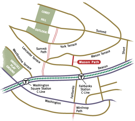
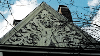
 Looking down from the top, Mason Path resembles a maze. Descending the steep southern slope of Corey Hill, the route switches back and forth, with the maze-like effect accentuated by the double iron handrails following every twist and turn. Beginning next to a stunning Queen Anne Victorian on Mason Terrace, the path provides a steep and quick passage down to Lancaster Terrace, coming out alongside the towering 1550 Beacon Street. There is a pedestrian crosswalk across Beacon Street at Lancaster Terrace, leading to the Fairbanks T stop. In this way, Mason Path gives convenient access to Beacon Street and the T for Corey Hill residents.
The terracing on Corey Hill is dramatic, and a very different approach to building on a hill than that employed on Aspinwall Hill. There, roadways were cut at gentle grades, following lengthy and circuitous routes, swinging back and forth, slowly rising and falling. In contrast, the Corey Hill roadways follow terraces sliced into the hillside.
at 41 Mason Terrace. Mason path begins
next to and runs beside this house.
The town accepted Mason Path on October 30, 1894. By this time, landowners Henry M. Whitney and William H. Allen had already constructed the path following the property line between their lands. Both gave 1,333 square feet of land to the town for the path. Mason Path is 177.69 feet long, making it the shortest path on Corey Hill. Despite the recent loss of a prominent tree that the path had circumvented (all that is left of the tree in the photograph is a foot-tall stump), there are still plenty of trees to provide a leafy canopy in the summer months. There are ornamental bushes, terrace gardens, and containers spilling over with annuals to soften the concrete and asphalt path during the warm weather months. Even in winter, the many gray branches and remaining evergreens convey a woodsy feel. As you approach the bottom of the path, the massive gray structure of 1550 Beacon fills your field of vision and dominates the streetscape conspicuously.
Mason Path was planned as an integral part of the overall development of Corey Hill. The outstanding view of Boston and the surrounding landscape from the top of this 260 foot hill has always been a significant feature, prompting the creation of a town park, Corey Hill Outlook, in 1900. Once known as "The Great Hill," it derives its current name from Timothy Corey, who settled on the hill in the 1760s. His descendents went on to establish a dairy farm amid the wooded groves, pastures, and working farms that once dotted the landscape. The widening of Beacon Street and the subsequent introduction of transit in the mid-19th century made the hill a desirable location for single- and multi-family homes, as well as institutions taking advantage of the light and air available on the hilltop.