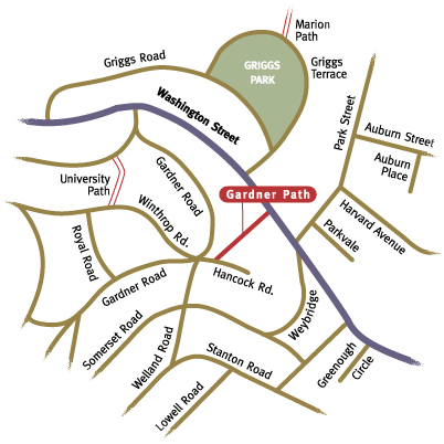
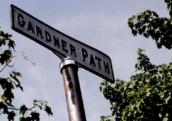
 As one of seven paths on Aspinwall Hill, Gardner Path provides a link to Washington Street, serving as one of the lower "spokes" of paths arrayed around the hill. Gardner Path is both the oldest (it was accepted by the town in 1886) and the most modern looking of all the paths. In 1972 the path and stairs were rebuilt using a material called duraslab, which allowed the steps to be built with a single central riser, giving the steps a floating look. The path's flat surfaces consist of squares of yellowish/brown concrete, which are now somewhat uneven, the effects of years of freezing and thawing earth. Aluminum handrails replaced what were most likely cast iron rails. The new handrails are styled in a continuous loop, with slightly rounded corners, in keeping with the modern "streamlined" styling popular in the '60s and '70s, thereby giving Gardner Path's appearance a strong link to this era.
Beginning next to 10 Hancock Road (a short, dead-end street) the entrance to Gardner Path is a little hard to find, and is in fact very near the somewhat chaotic intersection of Gardner, Winthrop, Welland, and Hancock Roads.
The trees soften the path's hard edges and the sounds of birdsong and the occasional dropping branch or seed mingle with the sound of passing cars that drifts up from Washington Street. The transition from the quiet Aspinwall Hill neighborhood to the busy roadway is a dramatic contrast. The path reaches Washington Street near the intersection of Park Street.
An integral part of the path system on Aspinwall Hill, the 323 foot long Gardner Path can be seen on an 1885 plan made by the Aspinwall Hill Land Company, indicating that it was probably already in existence at the time. The only other path on this plan was Rawson Path, then called Sullivan Path. E.W. Bowditch, who incorporated the circuitous roadway system that F.L. Olmsted had previously designed for the Land Company, made the final development plan for Aspinwall Hill. The path lies on the outer boundary of the Aspinwall Hill Land Company's property, abutting land owned by the heirs of George B. Blake that would later be developed as Blake Park. When the town voted to accept the path as a public way in 1886 they paid the company $253.13 for land damages.