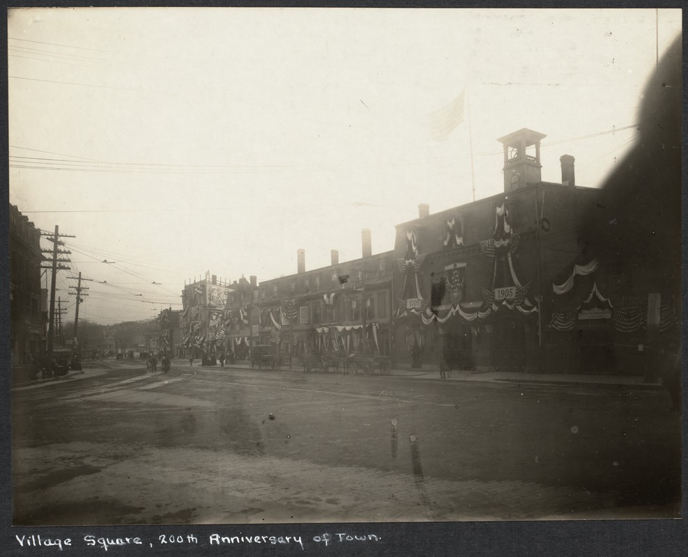
Streets of Brookline


Prev - Zoom - Next
Relocation of the Village Brook, circa 1893
Lower Washington St. going toward Boston angling to the left rear. Note that this is one of two different views taken at the same time. From right to left, looking at the south side of Washington St.:
  • Sing Lee, laundry, #136
  • John Barthelmes, hairdresser, #134
  • Frank T. Fay, newsdealer, cigars and tobacco, #128
  • William Frawley, custom shoemaker (note picture of boot on sign), #126
  • Luigi Barba (aka Louis Barbour and Louis Barber), fruit, #126
On the left of the photo is the awning of Thomas S. Brown & Co., provisions, at #145 Washington St.

Tom Condon, Sr. Civil Engineer for Brookline writes:
The work shown is part of the relocation of the outlet of the Village Brook. …(in the pile of lumber in the background you can see a piece of the curved falsework used to hold the brick arch until the cement mortar set.). Leverett Pond was created from the Muddy River marsh located just south of Washington Street by installing a stop plank manhole (in effect an adjustable height dam) in the new culvert under Washington Street. This stop plank manhole was necessary to hold back the pond since the Charles and therefore the Muddy Rivers were still tidal at that time. Presumably, Alexis French (who was both Olmsted's engineer and the Town Engineer) determined that more flow into this new pond was necessary. To provide this additional flow, the Village Brook which flows alongside what is now the MBTA "D" line was diverted into the culvert shown under construction. The culvert runs east down Washington Street, crosses Walnut Street, runs down Morss Avenue (now discontinued), across Pond Avenue and into Leverett Pond.

[Courtesy of the Digital Commonwealth (CC BY-NC-ND). From the Brookline Photograph Collection published by the Public Library of Brookline]