Photo Collection
| ⇐ Prev | - Zoom - | Next⇒ |
 | ||
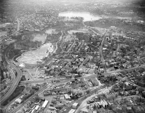
| Brookline Village, Aerial View, circa 1958 | ||
|
Looking south at Lower Washington St. going from left to right. The core area south of Lower Washington St., known as "The Farm", was razed in the early 1960s as part of an urban renewal program run by the Brookline Redevelopment Authority. The core area north of Lower Washington St. (lower section of the photo), known as "The Marsh", was razed bit by bit from the mid-1960s to the early 1970s as part of “The Marsh Urban Renewal Project” run by the Authority.
FayFoto ID: A91-0913; URL:http://hdl.handle.net/2047/D20395787 Courtesy, Northeastern University Archives and Special Collections Department. From the FayFoto Boston photographs collection (M221) acquired as part of FayFoto Boston's corporate acquisition of Lenscraft Photo in 1971. | ||