The Other Side of Corey Hill

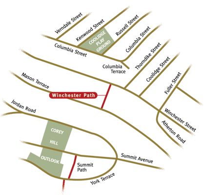
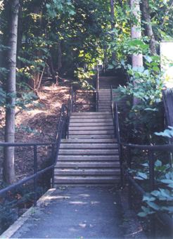
Climbing up the northeast slope of Corey Hill, Winchester Path carries you past side yards and through a forested sanctuary. Connecting Mason Terrace and Winchester Street, Winchester Path provides quick access up and down Corey Hill, aiding travel to Beacon Street and Coolidge Corner for area residents. Climbing steeply, the path is almost all steps. The deep back yards of homes perched on the hillside form a woodsy enclave, quickly transporting the walker to a hushed world of scampering chipmunks and singing birds. In wintertime, it is not uncommon to see rabbit and bird tracks in the snowy carpet below the trees. In summer, the green canopy creates a cool and quiet retreat from the street.

Part of Corey Hill's path system which includes Summit Path and Mason Path, Winchester Path was accepted by the town on June 15th, 1926, even though development of the terraced roadways and homes on Corey Hill began several decades before this date. The view from atop the 260 foot high hill, which was known as "The Great Hill" during the early settlement of Brookline, has always been an attraction for town residents. Early development of the hill was dominated by Eben Jordan's estate, Stonehurst, which was built in 1890 on the south slope. Other estates followed, and eventually more single family and apartment buildings were built on the terraced hillside.
One of the longer paths, Winchester Path is 310.48 feet in length. Concrete steps make up most of the path today, however the path and stairs were originally made of wood. Iron handrails border the path on both sides. A walk on the path today reacquaints the pedestrian with a hint of the landscape of the hill before it was fully developed, and the steepness of the hill is made manifest.