Walnut Path by Linda Olson Pehlke
Linda Olson Pehlke is an author and urban planner living in Brookline. Her book, Exploring the Paths of Brookline, is available at Brookline Booksmith and other locations. The series "In Step: Brookline's Paths" was published in Our Town Brookline magazine in 2005 and appears here with the permission of its publisher and the author.
s
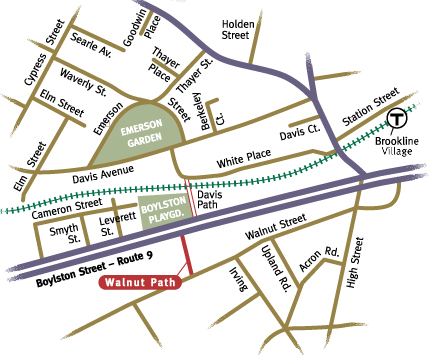
Traveling Walnut Path is an experience of dramatic contrast. Linking Walnut Street with Boylston Street, the path carries you from the world of early Brookline to the present day, beginning, as it does, near the heart of colonial Brookline, and ending beside four lanes of careening traffic! Walnut Path is probably the oldest of Brookline's paths, and was once known as "Cat Alley." To make things more confusing, today's Davis Path was at first called Walnut Path.
Accepted and constructed by the town in 1890, Walnut Path is 226 feet long. Land damages in the amount of $500 were paid to the estate of Edward S. Philbrick (son of Samuel Philbrick), and construction costs were also $500. Walnut Street, laid out in 1658 and called the old Sherburne Road, was the main street in the early settlement days of Muddy River. It is narrow and tree lined; and just down the street to the west lies the historic town green, around which was built the first "town hall," and upon which the militia gathered to march to the revolutionary war battle at Lexington. Many of the homes lining Walnut Street date from the early to mid 19th century.

Home of Samuel Philbrick
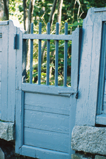
The path's entrance is marked with a 1937 cast aluminum sign. On the right-hand side, a stone wall, worn with age, surrounds a colonial-style house built in 1800. A majestic European Beech, at least 100 years old, graces its front yard. For the protection of pedestrians, a raised crosswalk has been built across Walnut Street where the path begins, slowing through traffic.
Fortunately for those on foot, there is an activated crossing with a traffic light about 50 feet to the west that makes it possible to get to the other side of Boylston Street, and gives access to Boylston Playground. Once across, the foot traveler can continue on into the Emerson Park neighborhood via Davis Path, which takes you up and over the T tracks.
© 2010 Linda Olson Pehlke. All rights reserved. No part of this article may be reproduced in any form without prior written permission from the author.
Map by Robert Pehlke. Photographs by Linda Olson Pehlke