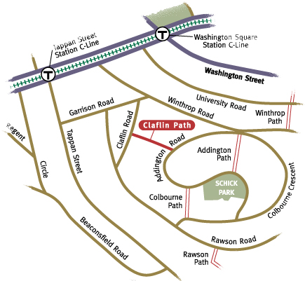
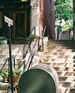
 Claflin Path climbs up the western slope of Aspinwall Hill, squeezing itself between densely built townhouse buildings. Marked with a 1937 cast aluminum sign, the path begins as a set of concrete steps, bordered with substantial iron handrails that further demarcate the path's entrance. Before you start your journey, take a moment to appreciate the ambiance of Claflin Road. You can't help but notice the old sycamore trees that line the road in a majestic procession, providing much welcomed shade that softens the streetscape. At eye level, the interesting, patterned bark encircles the massive trucks, which loom large in the intimate space. The three story brick row houses create a uniform street façade, while curved bays, intricate corbels, and unique door and window surrounds create rhythm and visual interest. On the uphill side, front stairs provide a convenient place for flowerpots and for sitting, making it easy to chat with neighbors and passersby. Many of the sloping front lawns sprout flowers or grass, adding additional softness to the walkway. Heavy lily blooms bob on their slender stems at the path's entrance. The overall effect on the street is of pleasing human scale and calm.

One of the youngest paths, Claflin Path was constructed by the town in 1922, and required an appropriation of $4,150 to pay for land damages and construction cost. This was unusual; most of the paths did not require the payment of land damages or construction costs.
Connecting Claflin and Addington Roads, its 311-foot length is narrow (8 feet), steep, and urban in feel. Beyond the first set of steps, Claflin Path passes between the tall buildings, and then alongside the porches and balconies perched on their backs. Hardy trees struggle for a foothold on the remaining small patches of earth; and in so doing, shade the stairs. Continuing on, the path bends to the right and climbs a longer set of stairs, eventually reaching an open, 20-foot wide section leading out to the S-shaped Addington Road. Here, the path is lined with three two-family homes that use Claflin Path as their address. The widened path also gives auto access to a parking area and an alley that runs behind Colbourne Crescent, Addington, Claflin, and Rawson Roads.