Streets of Brookline
| ⇐ Prev | - Zoom - | Next⇒ |
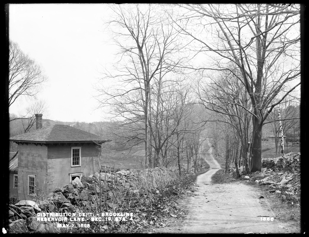 | ||
| Reservoir Lane, 1898 | ||
|
[Reservoir Lane View 2] On the left is the first house of Michael McGrady soon to be torn down in 1901. On the right Webber’s Waste Weir, located on top of the aqueduct that is flowing alongside Reservoir Lane to the Brookline Reservoir on Boylston St. It can be viewed today from Reservoir Road.
Reservoir Lane is one of the earliest roads in Brookline and was originally a section in the trail used by Native Americans to travel from Roxbury to Nonantum Hill in Newton. In 1905, the lane became today’s Reservoir Road, a new section was added on the north end connecting to Middlesex Rd., and only a small length of the lane remains by Middlesex Rd. In 1892, author Bradford Kingman described the lane as “one of the wildest and most picturesque spots, and the land thereabouts such as anyone who had never explored would hardly suppose could be found within the limits of such a town as Brookline, and so near to Boston. The present lane is narrow, rocky, winding, steep, up hill and down vale, bordered with briars and gay with wild flowers, or attractive with berries in their season.” [Courtesy of the Digital Commonwealth (CC BY-NC-ND). From the Metropolitan District Commission, Water Division, Metropolitan Water Works Photograph Collection, 1876-1930] | ||