 |
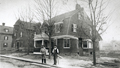
Aspinwall Ave., circa 1888
The south side of Aspinwall Ave. with Toxteth St. just to the right. From left to right:
- [#193] Partial view
- [#189]
- [#183] The wooden plank over the front steps, presumably for the carpenters, and the for-sale sign indicate that the house is just being finished. It was sold in September, 1888
- [#179] An empty plot, the house will be built in 1891
- An out building is visible on Brook St.
[Source: Brookline Preservation Department]
|
 |
Carlton St. at Monmouth St., circa 1910
Lookng north from Monmouth St. The apartment building at 40 Carlton St. on the northwest corner has not yet been erected (1924).
|
 |
Hawes St., circa 1910
Looking south. Monmouth St. coming in on the left followed by the George Wightman mansion (b. 1904) at 43 Hawes St.. 48 Hawes St. (b. 1913) visible on the right. Both still standing.
|
 |
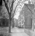
Sewall Ave.
Looking west on Sewall Ave. from St Paul St. None of the houses on the left side remain. On the right, from right to left, all on Sewall Ave:
- #82, no longer standing
- #76 with the unique entrance, still standing
- #70 is barely differentiated from #76, it is still standing
- #64, no longer standing
- Charles St. enters, not visible
- White house
- Second Unitarian Society Parish House
[Source: Brookline Public Library]
|
 |
Corner, Sewall Ave. and Charles St.
From left to right:
- Rear, 50 Sewall Ave., behind the Parish House. The building there today has an identical footprint but any connection is not known.
- Second Unitarian Society Parish House, 11 Charles St., built 1916, still standing
- (center rear) 3 Charles St., built circa 1916, , no longer standing
- 64 Sewall Ave., no longer standing
[Source: Digital Commonwealth]
|
 |
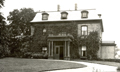
29 Colchester St., 1910
Built in 1903-04 by Edward Boit, and designed by Peabody & Stearns
[Source: Smithsonian]
|
 |
Colchester St. Looking West toward Kent St.
In the distance is 312 Kent St., no longer standing.
|
 |
119 Colchester St., 1888
Formerly numbered 115, home of Harrison Gardner. Kent St. looking north, to the left. House still standing.
|
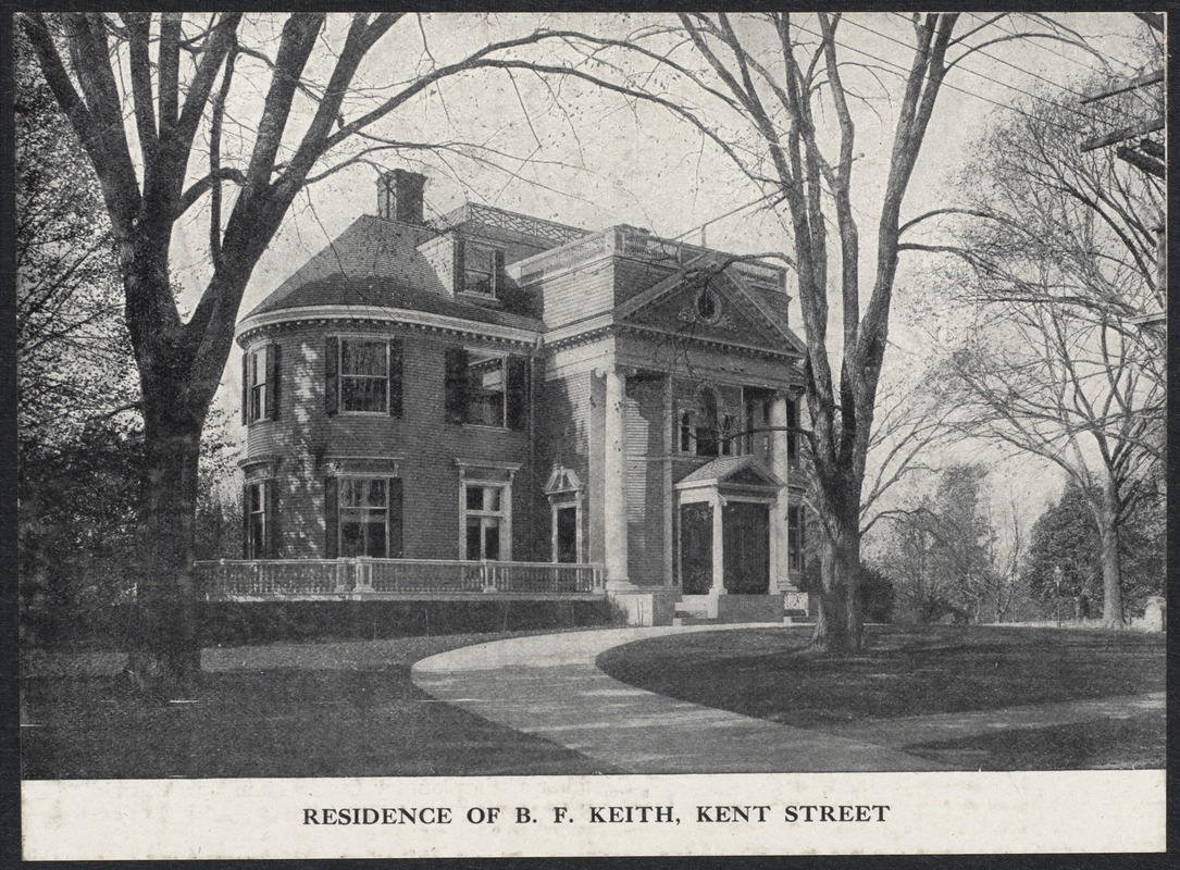 |
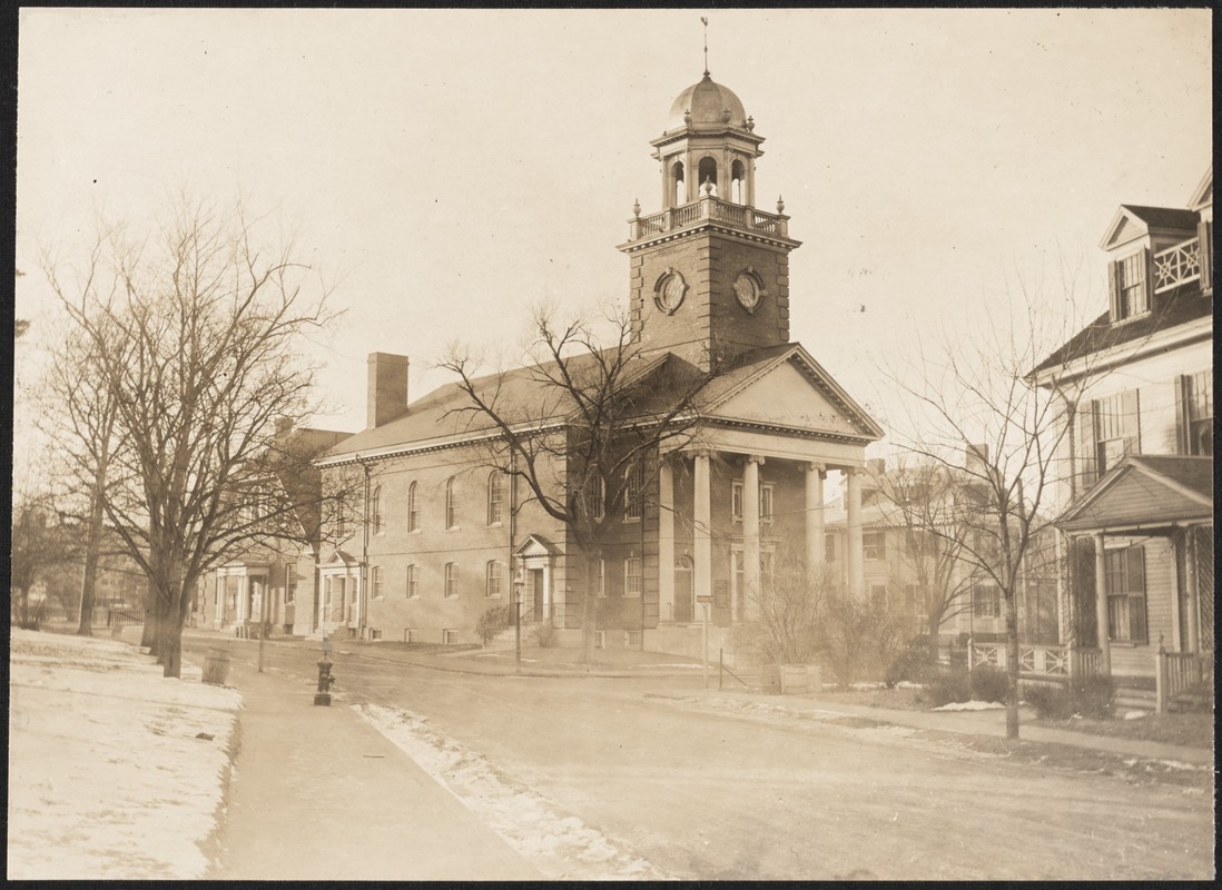
312 Kent St.
Home of Benjamin Keith, demolished in1938.
[Source: Digital Commonwealth]
|
 |
357 Kent St., 1933
The house, no longer standing, was built in 1860 for David Sears III, the son of David Sears who owned much of the Longwood area. It was demolished by 1940 and replaced by todays Chatham Circle subdivision. Photo by Henry A. Varney, Brookline town engineer.
[Source: Brookline Preservation Department]
|
 |
60 Beech (formerly Dudley St.) Rd., 1888
House of William H. Lincoln. Kent St. is off-photo to the right.
|
 |
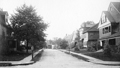
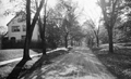
Beech Rd.
Looking east from Kent St. In the foreground is the house of William H. Lincoln at 60 Beech Rd. followed by 48 Beech Rd., neither are still standing. The third house, 42 Beech Rd., is still standing.
[Source: Brookline Public Library]
|
 |
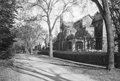
Beech Rd.
Looking west from Hawes St. #26 Beech Rd. is on the left, still standing.
[Source: Brookline Public Library]
|
 |
6 Hawes St., November, 1910
Built in 1864 for David Sears; was remodeled and expanded in 1906 by Clarence H. Blackall for Nathaniel Amster, a mining expert
[Source: Smithsonian]
|
 |
16 Hawes St., November, 1910
Designed by architects P. B. Howard and Charles E. Patch; built in 1906 for Clara and H. A. Gowing. All houses in the photo still stand. 1090-1100 Beacon St. is in the far distance.
[Source: Smithsonian]
|
 |
10 Hawes Pl., November, 1910
The George Quincy House, built in 1909, on the corner of Hawes Place and Borland Street.
[Source: Smithsonian]
|
 |
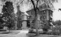
26 Beech Rd., 1910
Designed in 1907 by Hartwell, Richardson & Driver for Joseph Gahm.
[Source: Smithsonian]
|
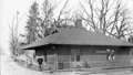 |
Chapel Station, Carlton & Colchester St.
Flag station for the Boston and Albany Railroad and pedestrian crossing; the southern end of Carlton St. is on the left; note same man as in the Longwood Station photo and the other man at the left hand corner of the building
|
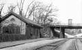 |
Longwood Flag Station, Boston and Albany Railroad
By the Longwood Ave overpass, looking east; Sears Chapel in the background; note same man as in the Chapel Station photo
|
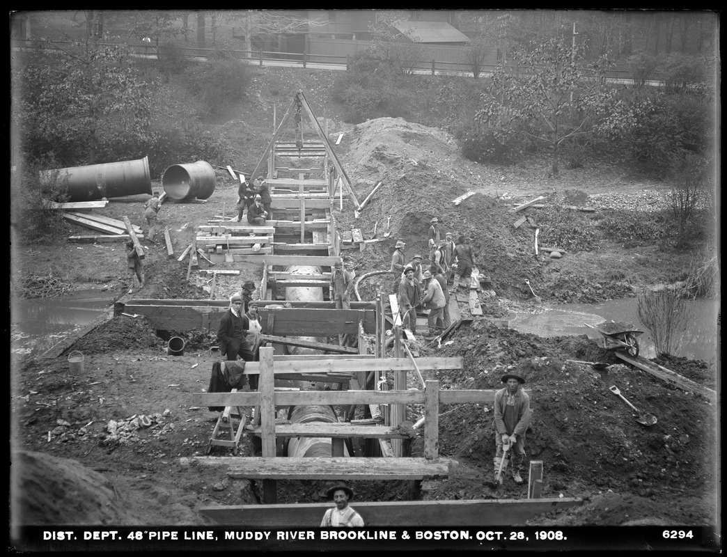 |
Muddy River Project, October 28, 1908
Looking north toward Chapel St. from the Muddy River just east of the Longwood Ave. bridge. In the foreground is the carriage house of the Richards estate, location of the present-day Longwood Towers. In the upper left corner is the rear of the house at 287 Kent St., still standing.
[Source: Digital Commonwealth]
|

